1 km away
Dawson-Pitamakan Loop
A lengthy but epic hike over two passes.
Difficult Hiking
- Distance
- 28 km
- Ascent
- 1.1 km
- Descent
- 1.1 km
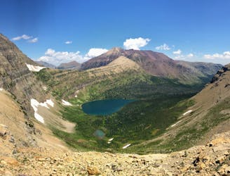
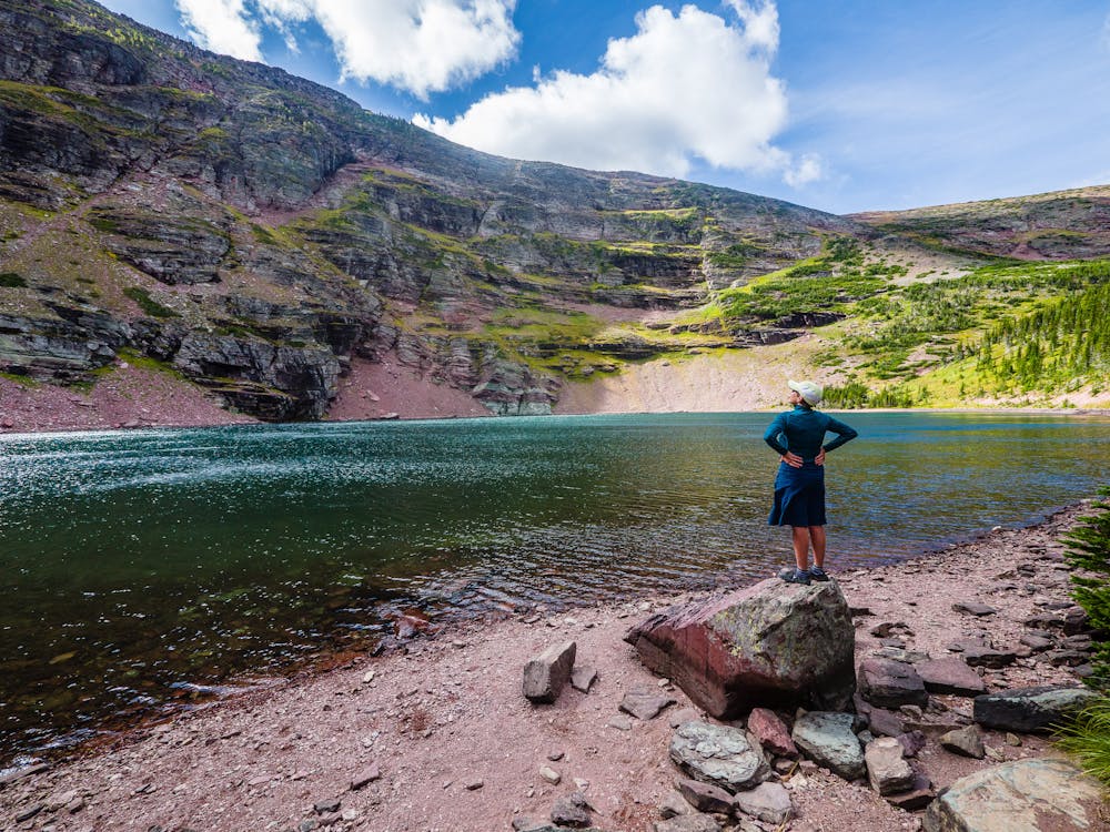
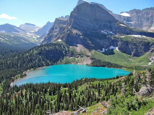
An aptly named glacial lake.
Hiking Moderate
Cobalt Lake is located in the Two Medicine Region of Glacier National Park and is accessed from the south end of Two Medicine Lake.
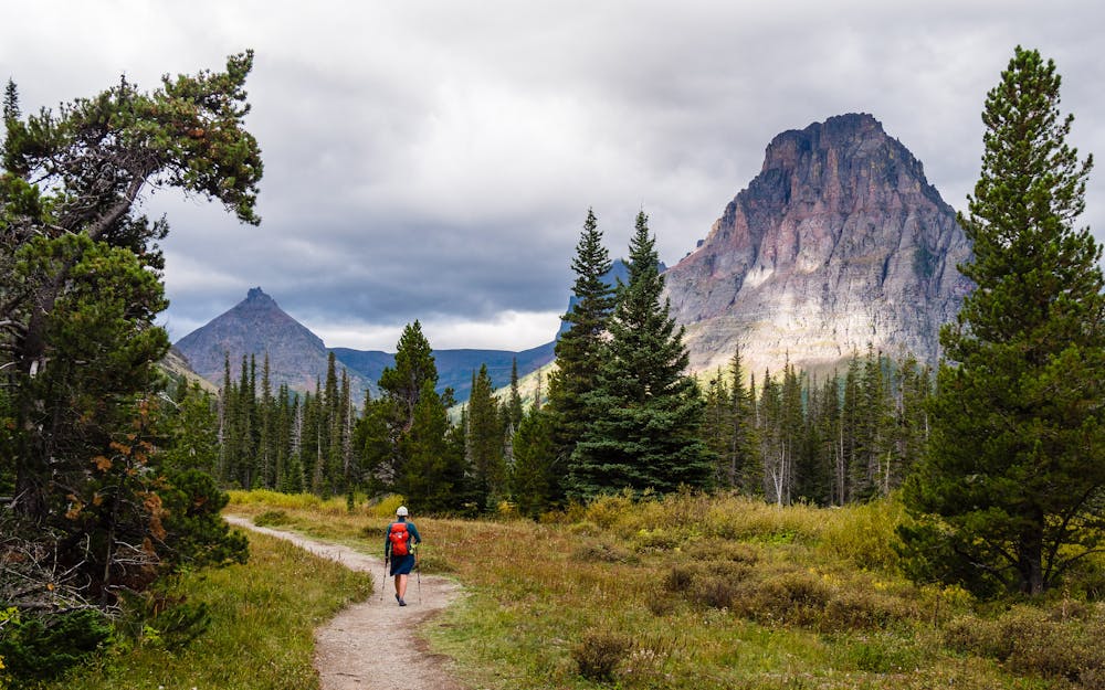
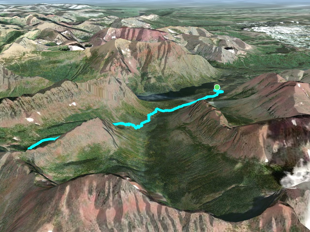
The 12.7-mile out-and-back hike to Cobalt Lake and Rockwell Falls is a good option on the way to the St. Mary or Many Glacier Regions or on the drive down the east side of the park. Since it doesn't climb above treeline, it is also a good choice on a less-than-perfect weather day.
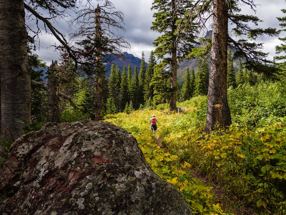
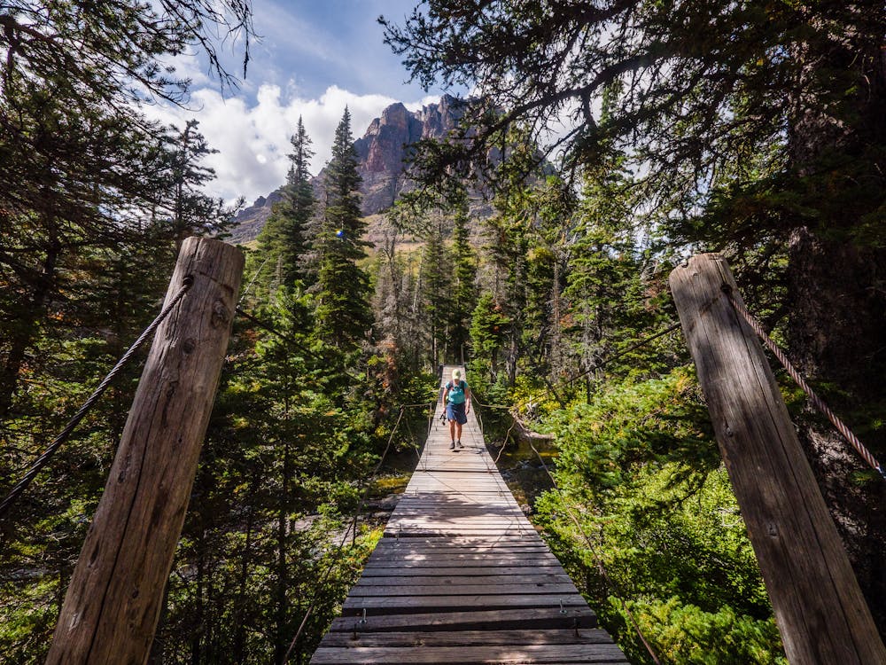
Launching from the south shore of Two Medicine Lake, the trail reveals its mellow nature immediately. The beginning of this hike is primarily a lovely stroll through woods, meadows, and past beaver ponds to a suspension bridge crossing of Paradise Creek. The sign on the bridge says, "Load limit: 1 person at a time," which is good advice to avoid bouncing another person off the bridge!
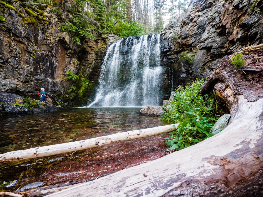
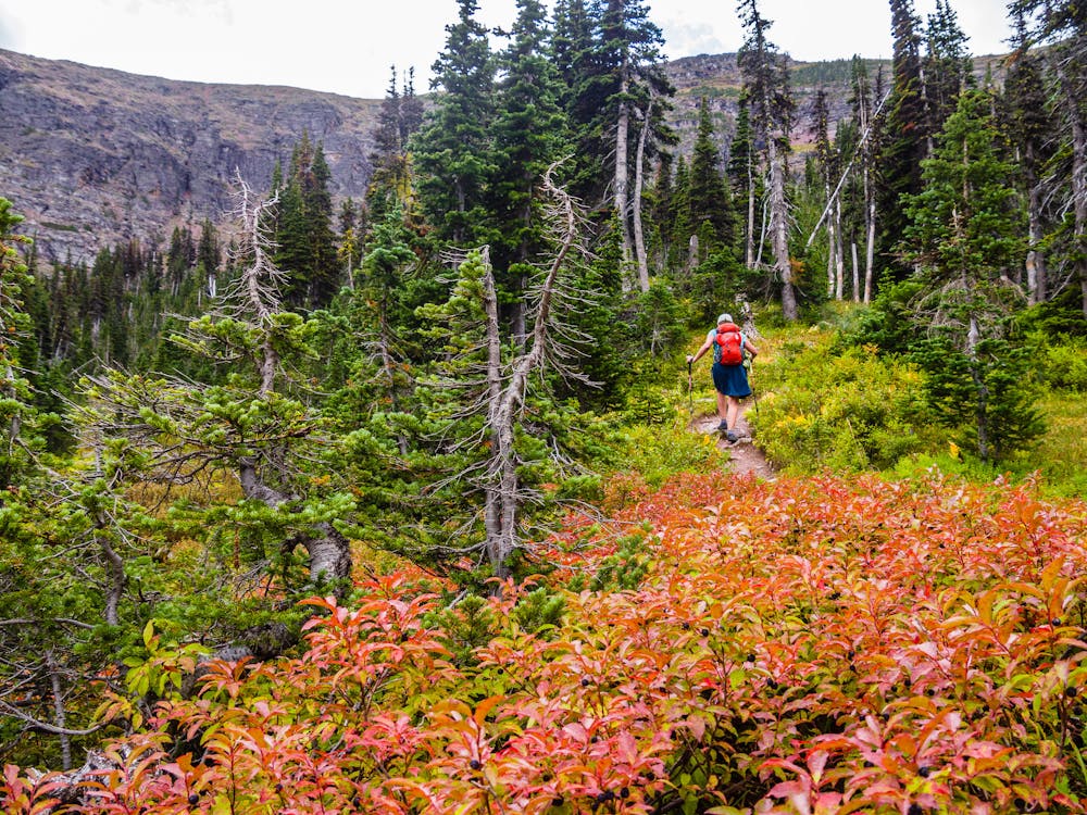
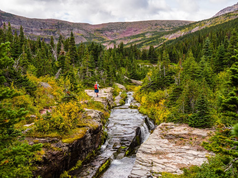
As the trail winds around the base of Sinopah Mountain, it crosses fields of low, lush brush, which is subtly colored in the fall. About 3.5 miles in, the trail intersects with an optional spur to Rockwell Falls. Be sure to make the worthy side trip on the way up or visit the falls on the return trip. The spur trail is quite short and delivers hikers directly to the base of a roaring waterfall.
Continuing gently upward, at one point the trail splits to the left for humans and to the right for horses. The human option utilizes a stretch of slab rock alongside a loudly burbling creek, then meanders into woods and back out in the open for ever-changing views.
Just before Cobalt Lake bursts into view, the wind can sometimes be heard roaring over the high rock walls above the lake. When the wind is howling and the cloud cover is dense, the eponymous cobalt color may be elusive, but when calm prevails, it is stunning. Regardless, the journey is rewarding, and the descent provides an array of gorgeous views.
Moderate
Hiking along trails with some uneven terrain and small hills. Small rocks and roots may be present.

The path is on completely flat land and potential injury is limited to falling over.

Away from help but easily accessed.
1 km away
A lengthy but epic hike over two passes.
Difficult Hiking
11 routes · Hiking