31 m away
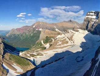
Siyeh Pass
An amazing point-to-point trek over and above a stunning pass.
Difficult Hiking
- Distance
- 16 km
- Ascent
- 698 m
- Descent
- 1.1 km
A relatively uncrowded trail that provides fantastic views.
Hiking Difficult

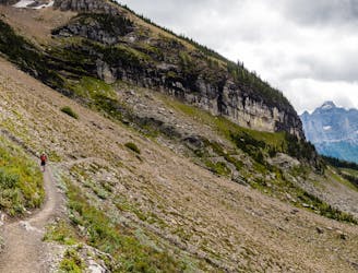
Piegan Pass is another great day hike in the park, yet it isn't as strenuous as some of the others. It likely falls between the moderate and difficult range.
The Piegan Pass Trail begins from the Siyeh Bend trailhead, which is just a few miles from Logan Pass. As the name implies, this trailhead is also shared with the Siyeh Pass trail.
Despite being near Logan Pass, this route will have fewer people than most of the other day hikes in the area. Another plus is that the total roundtrip is under ten miles, and you still get to hike over a pass and get fantastic views. You could also begin this hike from the Many Glacier valley, but starting there would add a good bit of mileage.
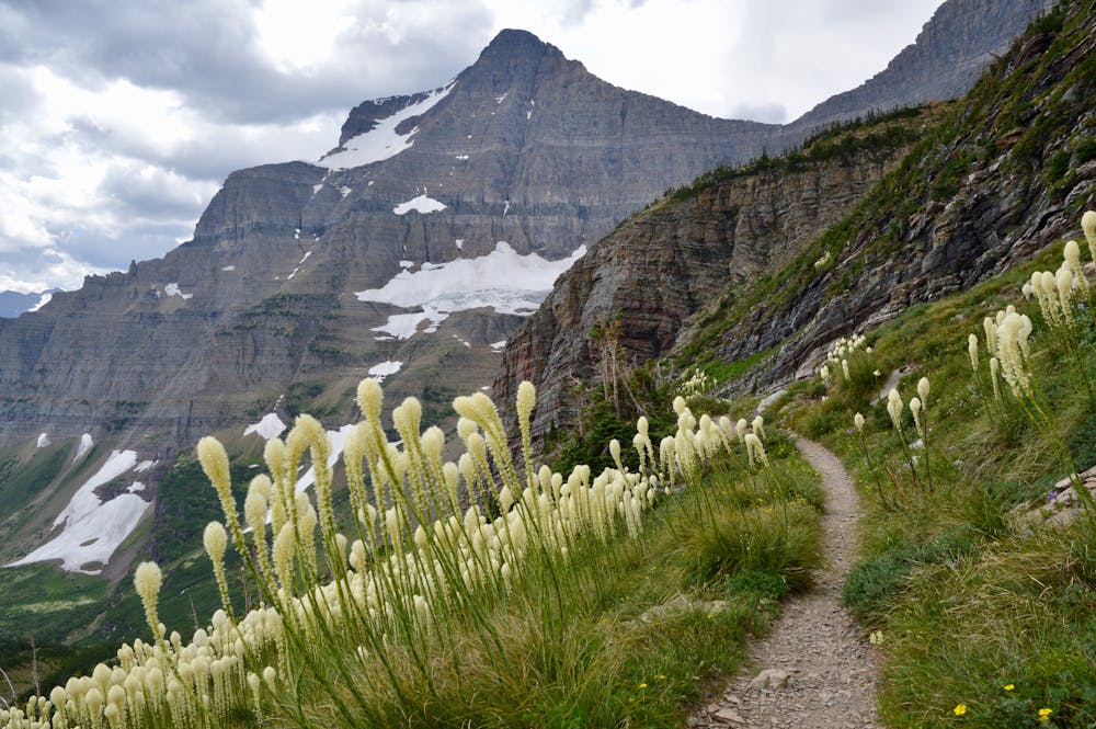
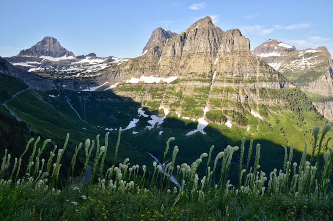
The hike begins in a spruce forest, and you will go through the forest for the first few miles. The route features multiple landscapes as you eventually depart the forest to get into the open. Once the trail opens up, the junction for the Siyeh Pass trail appears. Not far from the junction is Preston Park, which is a gorgeous wildflower meadow—definitely worth a visit.
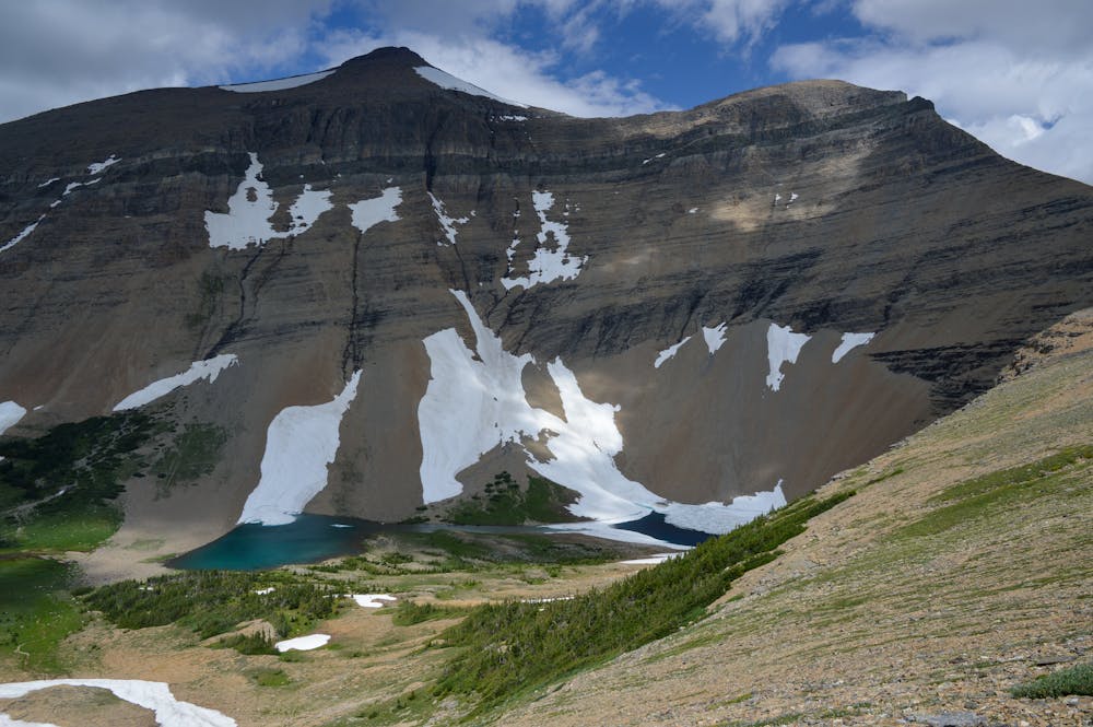
Once above the tree-line, the trail is pretty straightforward. Make your way gently uphill and take in the surroundings. Spectacular views abound in this section. Mountain goats are frequently seen in this area, too. Another plus is the view of Piegan Glacier across the valley!
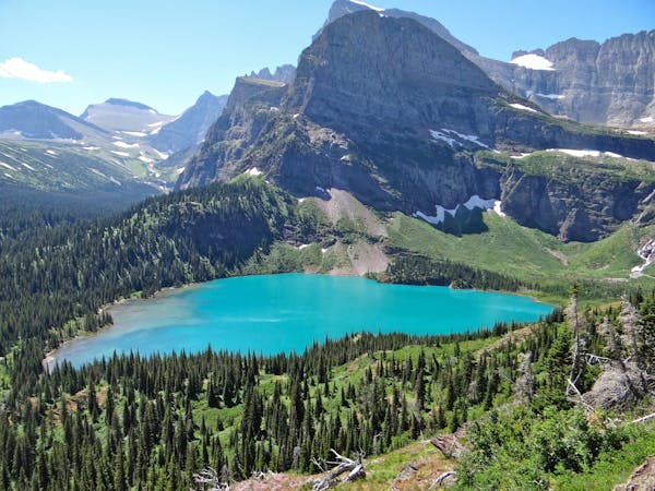
The pass features a beautiful view down into the Many Glacier valley. You could descend a bit to get a feel for the other side of the pass if you'd like. Once ready, retrace your steps back to the Siyeh Bend trailhead. For an even longer day hike, you could tack on Siyeh Pass on your way back since the pass isn't too much further from the junction.
All in all, Piegan Pass is less visited than most other hikes in the park, yet still provides glorious views. The elevation gain and mileage make it an excellent option for a day hike in Glacier!
Difficult
Hiking trails where obstacles such as rocks or roots are prevalent. Some obstacles can require care to step over or around. At times, the trail can be worn and eroded. The grade of the trail is generally quite steep, and can often lead to strenuous hiking.

The trail contains some obstacles such as outcroppings and rock which could cause injury.
Away from help but easily accessed.
31 m away
An amazing point-to-point trek over and above a stunning pass.
Difficult Hiking
3.8 km away
Simply put: One of the best day hikes in the world.
Difficult Hiking
3.8 km away
An iconic Glacier National Park trek.
Difficult Hiking
3.8 km away
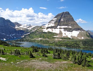
Easygoing hike to beautiful Hidden Lake.
Moderate Hiking
5.9 km away
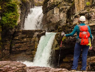
Three gorgeous waterfalls within a 5-mile loop.
Easy Hiking
11 routes · Hiking
6 routes · Hiking

25 routes · Alpine Climbing · Hiking
5 routes · Alpine Climbing · Hiking

63 routes · Alpine Climbing · Hiking