5 routes · Hiking
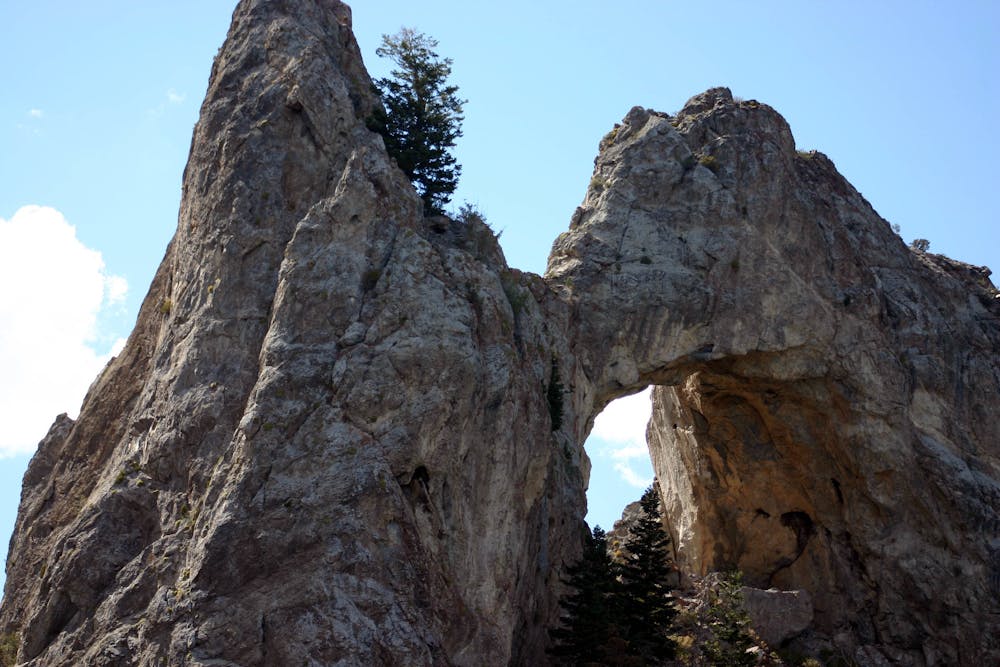
A six-story arch carved enigmatically of limestone, hidden in a remote corner of Great Basin National Park.
Hiking Difficult

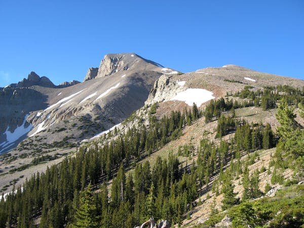
This giant natural arch protruding from a mountainside lies deep in the backcountry of Great Basin National Park and is not reached via any park entrance gate. It’s found by driving a remote 4WD road, then hiking a rugged trail. The drive and most of the hike are actually within Humbolt-Taiyobe National Forest, and the trail crosses into the park unannounced, shortly before reaching the arch.
The first part of the adventure is driving Lexington Creek Road, which is unimproved and washed out in places. Depending on your vehicle and on the road conditions, you may be able to shorten the hike from what’s mapped here. The road gets progressively worse higher in the canyon, and essentially blends into the wash after a while. Simply drive as far as you can, then park and start walking. Pay attention to navigation to know when to leave the wash for the trail.
The trail switchbacks up a hillside through a burned area, granting elevated views down the canyon of Lexington Creek. The trail then straightens and traverses into a narrower, steeper gorge. Stone crags jut out from the slope both above and below. From a clifftop overlook, you can see the arch across the canyon. You’ll then follow the trail as it moves past the arch, drops steeply down, crosses the wash, and takes tight switchbacks up the opposite side to reach the base of the formation. Lexington Arch is unique because it’s formed of limestone rather than sandstone that’s more typical of arches elsewhere in the Southwest. With a bit of scrambling, you can actually stand in the “window” beneath the limestone span and inspect the geology up close.
Sources: https://www.nps.gov/grba/planyourvisit/lexington-arch.htm https://www.nps.gov/grba/planyourvisit/upload/Lexington%20Arch.pdf
Difficult
Hiking trails where obstacles such as rocks or roots are prevalent. Some obstacles can require care to step over or around. At times, the trail can be worn and eroded. The grade of the trail is generally quite steep, and can often lead to strenuous hiking.

The trail contains some obstacles such as outcroppings and rock which could cause injury.

Little chance of being seen or helped in case of an accident.
5 routes · Hiking