1.8 km away
Mary Jane Falls
One of the top waterfall hikes near Las Vegas.
Moderate Hiking
- Distance
- 3.5 km
- Ascent
- 277 m
- Descent
- 277 m
A long day in the mountains to gain the summit of one of the most prominent peaks in the USA!
Hiking Severe

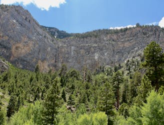
Mount Charleston rises dramatically above the Southern Nevada landscape, soaring to a height of 11,918 feet above sea level, with a staggering 8,259 feet of prominence. Even though it doesn't break 12,000 feet, this incredible mountain ranks as the 8th most prominent mountain in the USA!
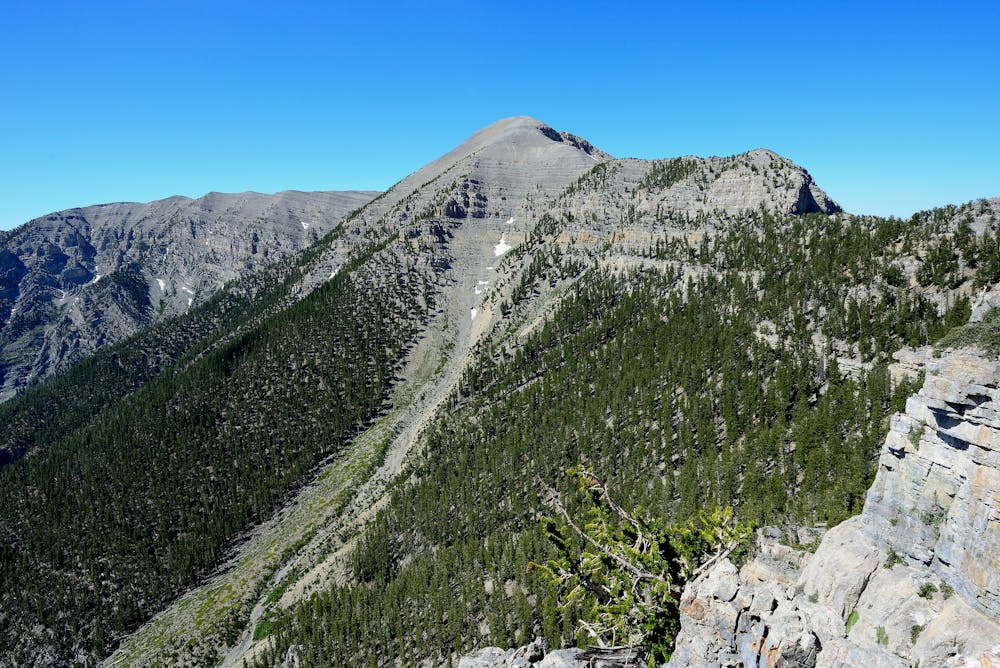
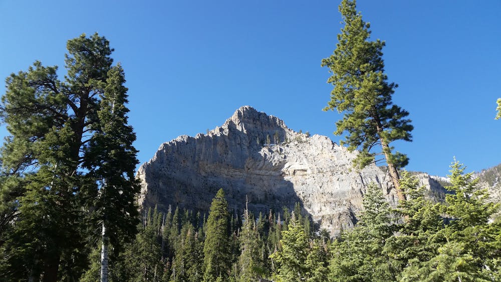
The environment on Mount Charleston couldn't be more different from nearby Las Vegas. "Less than an hour’s drive from Las Vegas, it provides desert dwellers with a dramatic change of scenery (big trees and alpine meadows) and a taste of strenuous high-altitude hiking," writes Redsplashman23 on SummitPost.org. Even the beginning of the hike is already in an alpine environment, and as you ascend the mountain, you'll break out above treeline and traverse a vaulted, mostly treeless ridge to reach the summit.
The 8.5-mile hike to the summit is strenuous and gains over a vertical mile in elevation, making this a truly challenging summit hike. The bulk of the elevation gain takes place in the first few miles via a steep, switchbacked, rocky trail that ascends directly up the mountainside. Once on top of the ridge below Griffith Peak, you'll continue to climb—just more gradually—following the ridge to the summit of Mount Charleston, aka Charleston Peak.
If you are uncertain whether or not you can tackle such a distance, then this hike isn't for you. But if you're willing to tackle the challenge and gain the summit, you'll be rewarded with stunning views of the region, including the town of Pahrump, and endless desert valleys and mountain ridges.
Severe
Hiking challenging trails where simple scrambling, with the occasional use of the hands, is a distinct possibility. The trails are often filled with all manner of obstacles both small and large, and the hills are very steep. Obstacles and challenges are often unexpected and can be unpredictable.

The trail contains some obstacles such as outcroppings and rock which could cause injury.

In the high mountains or remote conditions, all individuals must be completely autonomous in every situation.
1.8 km away
One of the top waterfall hikes near Las Vegas.
Moderate Hiking

8 routes · Hiking