7.8 km away
Appalachian Trail: Pinkham Notch to Grafton Notch
A beautiful segment of the AT, summiting the final 4,000-footers in New Hampshire before heading into Maine.
Severe Hiking
- Distance
- 72 km
- Ascent
- 5.1 km
- Descent
- 5.2 km
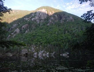
Pleasant loop off NH-16 with great views of Mount Washington
Hiking Difficult

This is a popular hiking route which is generally considered to be difficult. It's very remote, it features high exposure and is typically done between March and December. From a low point of 382 m to the maximum altitude of 1000 m, the route covers 9.9 km, 663 vertical metres of ascent and 665 vertical metres of descent.
Beautiful day hike in the Imp woods. The trail has a beautiful look out towards the presidential range. There are some sections that are difficult to cross but overall not too bad.
Difficult
Hiking trails where obstacles such as rocks or roots are prevalent. Some obstacles can require care to step over or around. At times, the trail can be worn and eroded. The grade of the trail is generally quite steep, and can often lead to strenuous hiking.

Some trail sections have exposed ledges or steep ascents/descents where falling could cause serious injury.
Little chance of being seen or helped in case of an accident.
7.8 km away
A beautiful segment of the AT, summiting the final 4,000-footers in New Hampshire before heading into Maine.
Severe Hiking
7.9 km away
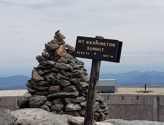
One of the greatest hikes in White Mountains of New Hampshire.
Severe Hiking

58 routes · Hiking

10 routes · Hiking