11 routes · Trail Running
An epic point-to-point tour of the Presidential Range in the White Mountains.
Trail Running Severe

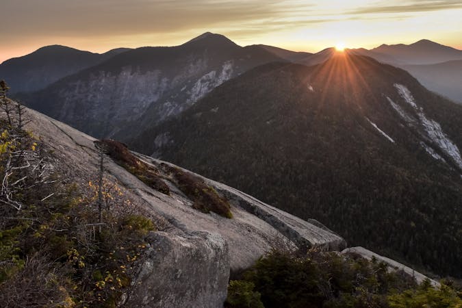
The Presidential Traverse is the single most epic way to experience the White Mountains of New Hampshire—including the highest point in New England, Mount Washington. Mostly above the treeline, this traverse offers stunning high mountain views while summiting all of the peaks in the Presidential Range. Whether you're hoping to thru-hike, fast-pack, or run, this is an incredibly challenging undertaking that should not be done alone.
While hikers typically tackle the route in 2 - 3 days, experienced runners should have no problem finishing during daylight hours. In fact, according to fastestknowntime.com, a sub-4 hour attempt has even been documented, though many runners aim for the 4 to 6-hour window.
While ambitious hikers attempt this year-round, runners should plan their trip in the summer months, according to NewEngland.com. Afternoon thunderstorms are always a possibility and should not be underestimated since much of the route lies in the treeless alpine zone.
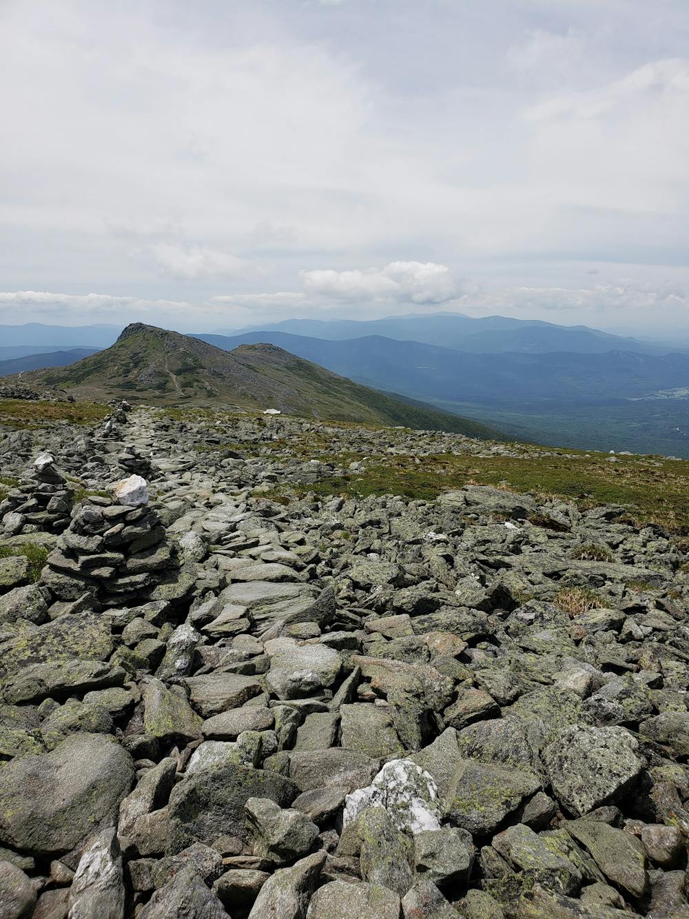
Most runners choose a north-to-south direction, beginning with the long steady ascent up to Mt. Madison. In contrast to other iconic thru-hikes, there is no "official" way to reach the summit. Valley Way is chosen by many, but requires an out-and-back to the first summit of the range. Alternatively, the path depicted here leads off of Valley Way and onto Watson Path to create a more aesthetically pleasing route. From here, you'll follow the Gulfside Trail to the next two peaks: Adams and Jefferson.
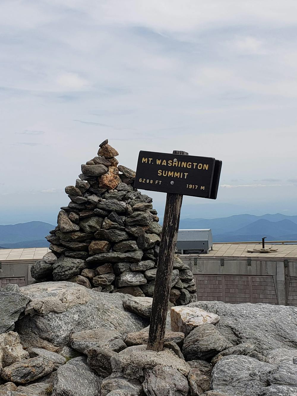
Ahead, the route summits Mount Clay before making the final push to Mount Washington, the highest peak in the northeast at nearly 6,300' above sea level. Its high summit is also known for its infamously bad weather. High winds and clouds are common year-round, though summer afternoons often offer clear 360-degree views from the summit. Closed in the winter months, a concession stand and water make it a great opportunity to resupply for the peaks ahead.
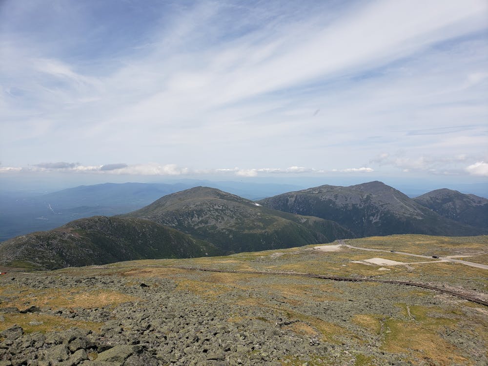
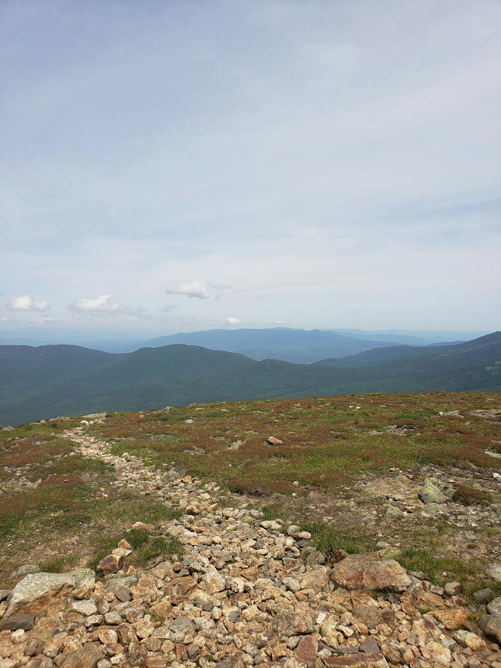
Descending through a field of scree, the route follows the Crawford Path for the next portion. Just below the summit, you'll reach the Lake of the Clouds Hut, a beautiful high mountain lake and a popular stop for weary Appalachian Trail thru-hikers. Monroe, Franklin, and Eisenhower lie ahead. Follow the short loop trails off Crawford Path to their summits.
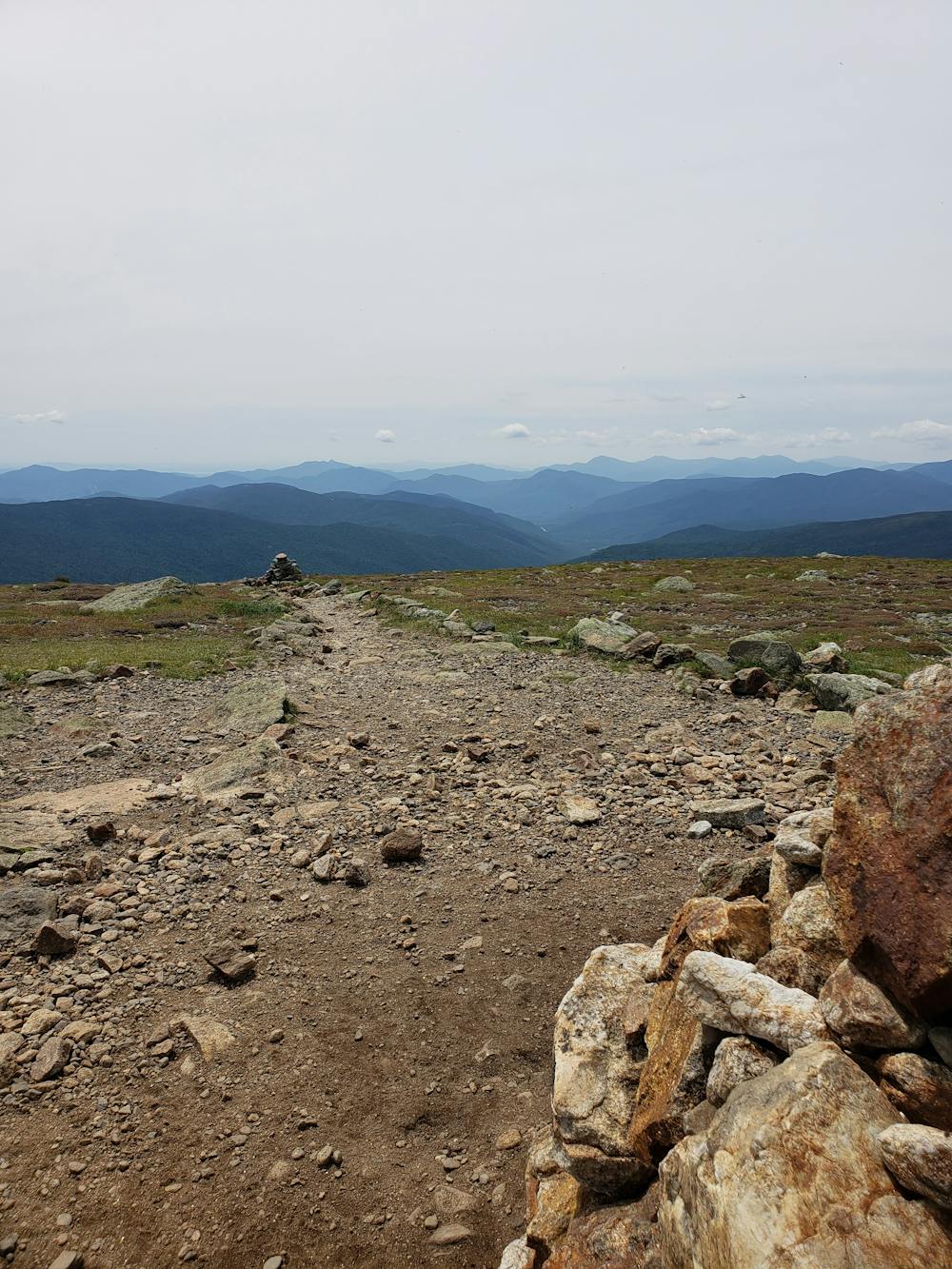
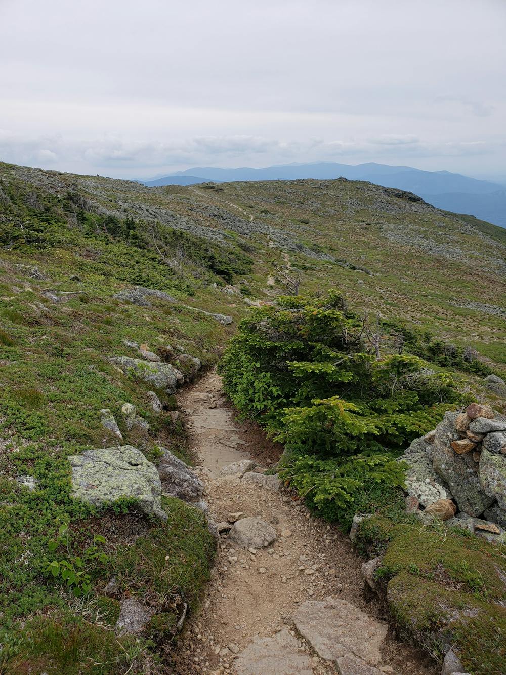
There are a few ways to finish the southern end of the route. Mount Jackson is the final "official" peak of the traverse and offers a direct path down to Crawford Notch, the southern terminus. Many maps also include a visit to Mount Webster (shown here), named after "an American statesman who represented New Hampshire and Massachusetts in the United States Congress and served as the United States Secretary of State under Presidents William Henry Harrison, John Tyler, and Millard Fillmore," according to Wikipedia.
Sources: https://en.wikipedia.org/wiki/DanielWebster https://sectionhiker.com/great-hikes-a-presidential-traverse/ https://newengland.com/today/travel/new-hampshire/white-mountains/expert-tips-on-hiking-the-presidential-traverse-in-new-hampshires-white-mountains/
Severe

Some trail sections have exposed ledges or steep ascents/descents where falling could cause serious injury.
Little chance of being seen or helped in case of an accident.
11 routes · Trail Running