4.3 km away
Williams Lake
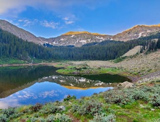
The most popular trail in Taos Ski Valley—but for good reason!
Moderate Trail Running
- Distance
- 6.2 km
- Ascent
- 313 m
- Descent
- 313 m
Steep climb to beautiful views of the Sangres.
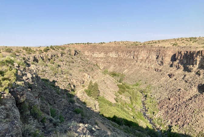
Trail Running Difficult

The climb up the Gavilan Trail isn't easy, but it sure is rewarding! This steep trail climbs 2.4 miles one-way to the top of a mountain ridge, gaining almost 2,300 feet of vert in the process.
Several sections of the trail are steep and rocky, making for arduous climbing. According to the USFS, the most difficult section is at the bottom, but the route "becomes relatively easier as the trail opens up into meadows towards the ridge." The trail winds through aspen groves that turn a beautiful gold in the fall, eventually entering a coniferous zone as you climb higher.
According to reports, there are only two minor creek crossings to negotiate, but those creeks could swell early in the season. The trail follows the banks of Gavilan Creek almost the entire way, providing plenty of opportunities to refill water bottles (as long as you treat the water thoroughly).
Once at the top, turn around to enjoy stunning views of Taos Ski Valley on the opposite ridge! Not only that, but Wheeler Peak, the tallest mountain in New Mexico, dominates the scene in the background.
Sources: https://www.onlyinyourstate.com/new-mexico/gavilan-trail-payoffs-nm/ http://www.taostrails.com/gavilan.html https://www.fs.usda.gov/recarea/carson/recreation/hiking/recarea/?recid=44360&actid=50
Difficult

The trail contains some obstacles such as outcroppings and rock which could cause injury.

Little chance of being seen or helped in case of an accident.
4.3 km away
The most popular trail in Taos Ski Valley—but for good reason!
Moderate Trail Running
7 routes · Hiking · Trail Running