6.9 km away
Sam's Knob and Black Balsam Knob
An incredible trail run across bald summits and exposed overlooks.
Difficult Trail Running
- Distance
- 22 km
- Ascent
- 661 m
- Descent
- 661 m
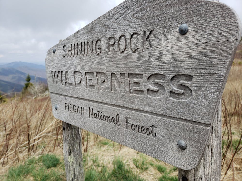
A iconic and scenic trail running route best known for its traverse through Shining Rock Wilderness.
Trail Running Difficult

The Art Loeb is one of the best long-distance trail running routes within Pisgah National Forest. It begins at Daniel Boone Boy Scout Camp, traverses Shining Rock Ridge, then descends into the valley below. It ends near the popular tourist town of Brevard and takes roughly an hour to drive between the two trailheads.

At roughly 30 miles, a single-day traverse is a highly sought after accomplishment for trail runners. To divide the route into multiple days, lean-to shelters and countless primitive camping sites can be found along the way. Campsites near Black Balsam Knob are an excellent option to divide the route into two portions, with the potential to stage a car at the nearby parking area.
Beginning at Daniel Boone Boy Scout Camp, the trail begins with a steep 4 mile climb to Deep Gap. There, a confusing and unmarked trail junction offers the option to summit Cold Mountain, the first peak along the Shining Rock Ridge.
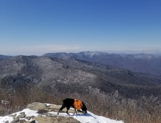
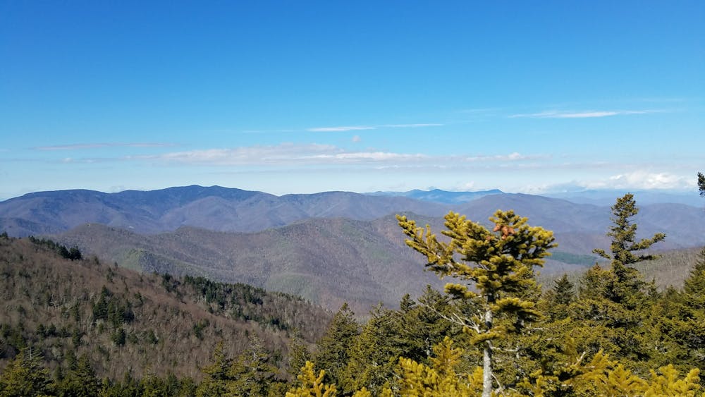
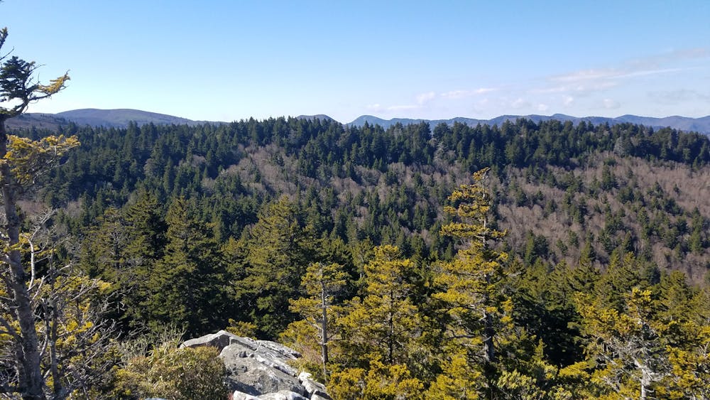
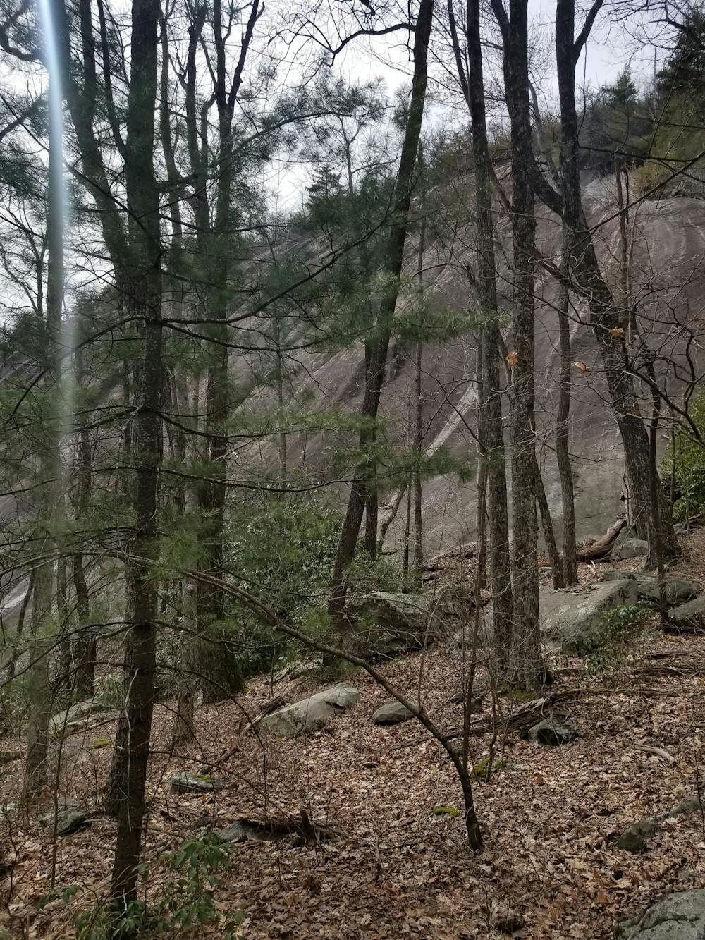
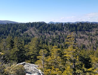
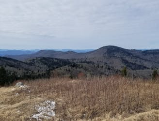
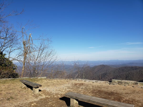
The Black Balsam portion of the trail is known for its bald summits and wide panoramic views. Two-thirds of the way through the hike, the trail also skirts the base of Cedar Rock Mountain--a highlight due to a large rock face frequented by climbers.
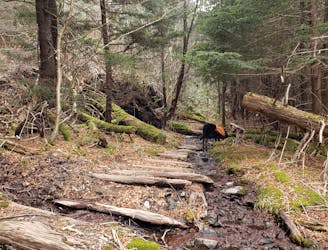
The majority of the trail is marked with white blazes or written trail markers. Within the boundaries of the Shining Rock Wilderness, trail blazes are minimal. Familiarize yourself with the major intersections to ensure you stay on the trail. Several adjacent trails lead to other popular landmarks, but these trails could take you several miles off route if you're not careful.
After passing a paved road that leads to the Black Balsam/Sam's Knob parking area, the Art Loeb merges with the Mountains to Sea Trail (MST) for a short stretch. The trail is denoted with a white blaze and white dot for this stretch.
Near the top of Silvermine Bald, the Art Loeb takes a sharp left and descends towards the Blue Ridge Parkway, where it crosses and continues towards Farlow Gap. From here, the remainder of the trail is marked very well as it continues through multiple gaps and several smaller mountains. Pilot Mountain, in particular, provides some of the best views along the latter half of the route.
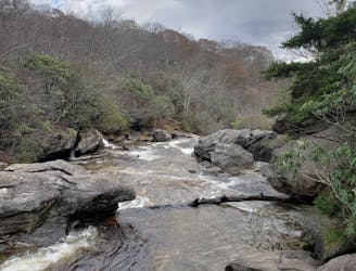
For water, there are a few seasonal sources atop Shining Rock Ridge and reliable water past Farlow Gap and Butter Gap. After a recent rain, fresh springs may be more prevalent.
Support and aid services, as well as guided runs on the Art Loeb are available through local guide company White Dot Adventures. Commercial shuttles are also available through Pura Vida Adventures.
Difficult

Some trail sections are extremely exposed where falling will almost certainly result in serious injury or death.

Little chance of being seen or helped in case of an accident.
6.9 km away
An incredible trail run across bald summits and exposed overlooks.
Difficult Trail Running
7.4 km away
A challenging and incredibly-steep approach to Shining Rock.
Severe Trail Running
8.6 km away
A classic trail run in a high mountain valley with two waterfalls.
Moderate Trail Running
8.8 km away
A short, easy run through a dark forest with a few views along the way.
Easy Trail Running
9.3 km away
An all seasons route to one of the best views in Western North Carolina.
Severe Trail Running
9.7 km away
A lightly-traveled trail run through an old logging area turned wilderness.
Severe Trail Running
12 routes · Trail Running

17 routes · Hiking · Trail Running

10 routes · Trail Running