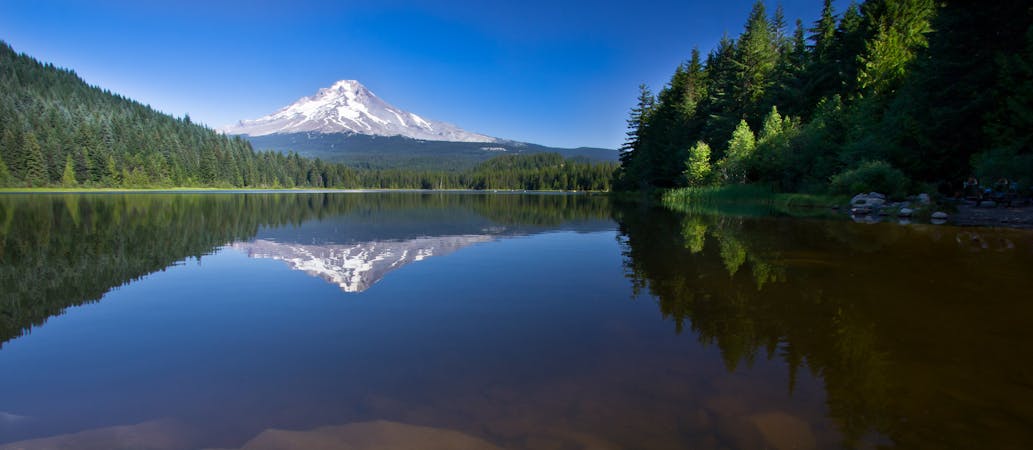
9 km away
Latourell Falls Loop
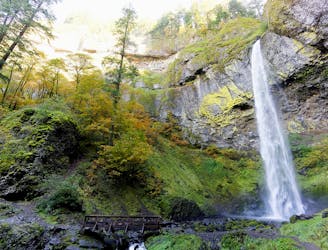
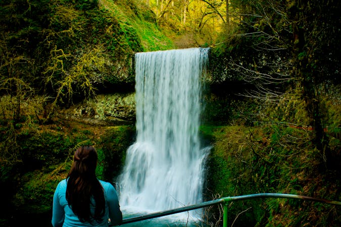
Two majestic waterfalls in basalt amphitheaters, both along the same hiking loop and within an easy drive from Portland.
Moderate Hiking
- Distance
- 3.2 km
- Ascent
- 204 m
- Descent
- 197 m
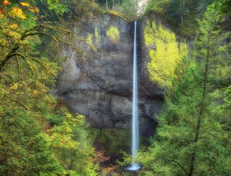
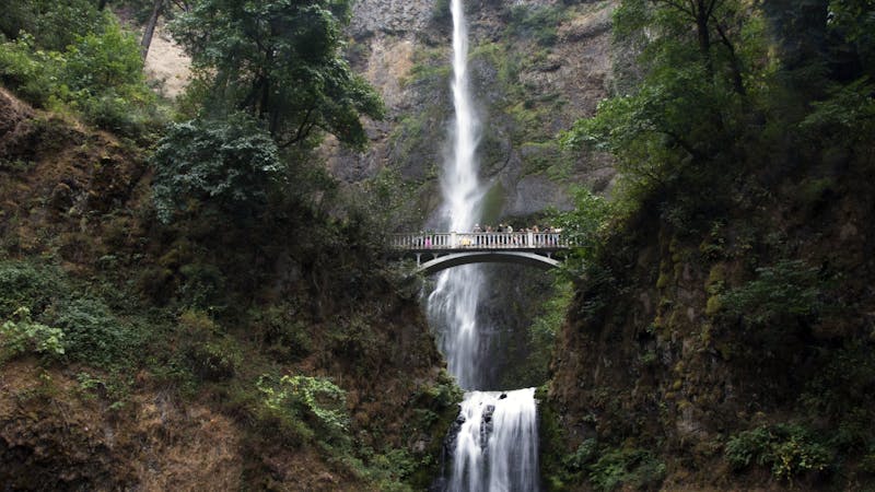
The tallest waterfall in the state of Oregon is a truly spectacular sight to behold!
Hiking Moderate

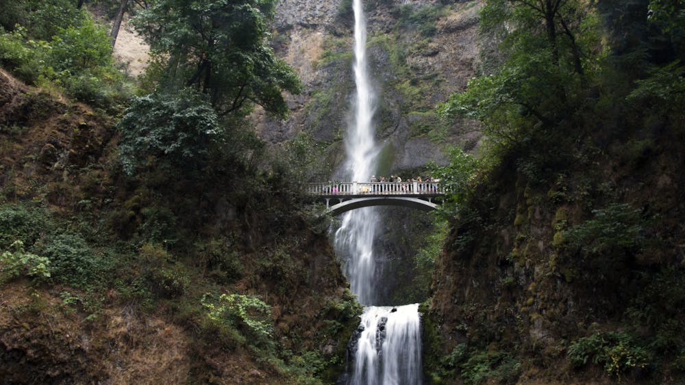
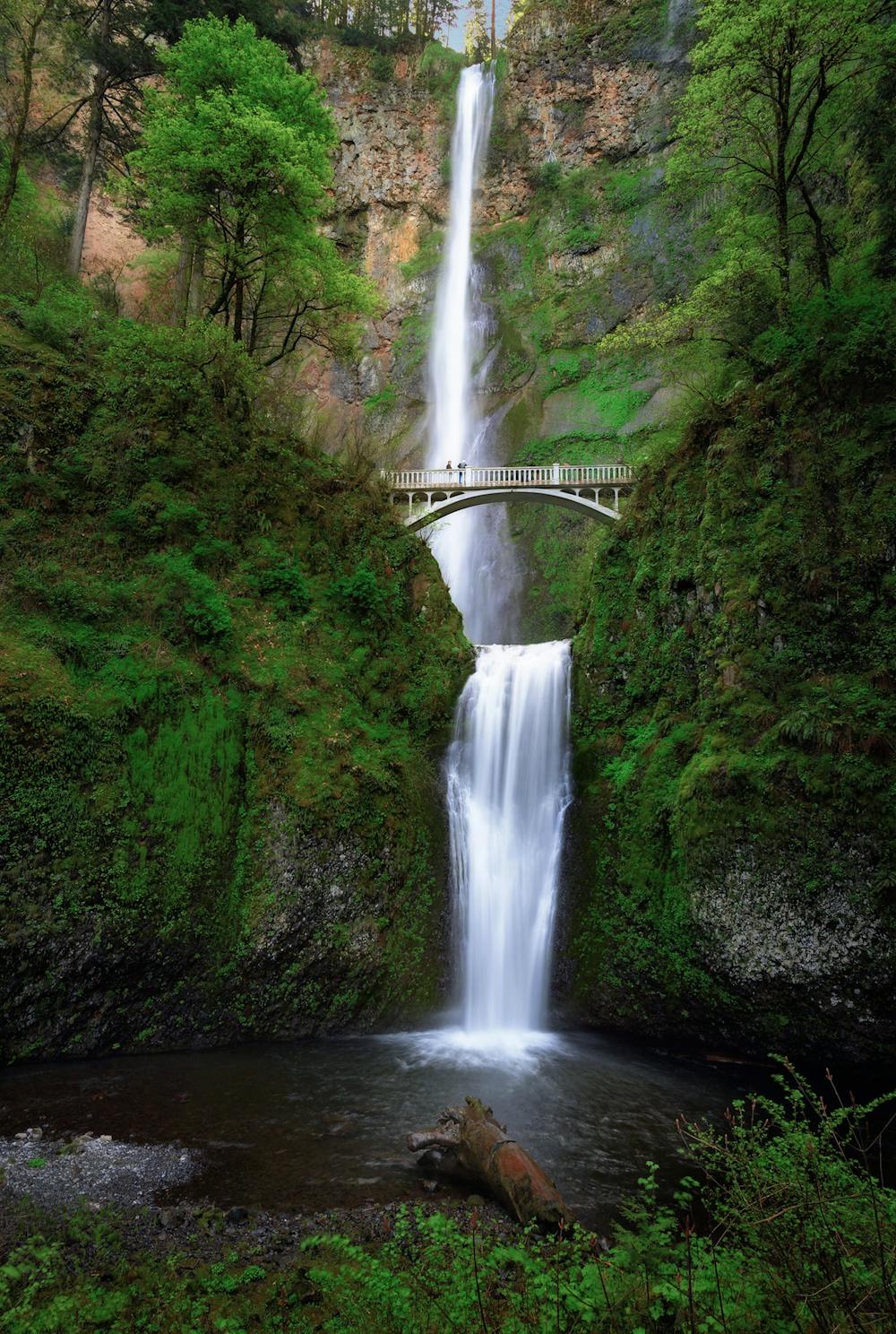
Multnomah Falls reigns as the tallest waterfall in the state of Oregon, soaring to a height of 620 feet. While some waterfalls might seem from their stats to be worth checking out but somehow don't live up to the hype in person, Multnomah is the exact opposite. This stunning waterfall is one of the most picturesque spots in the entire state—and that's saying something!
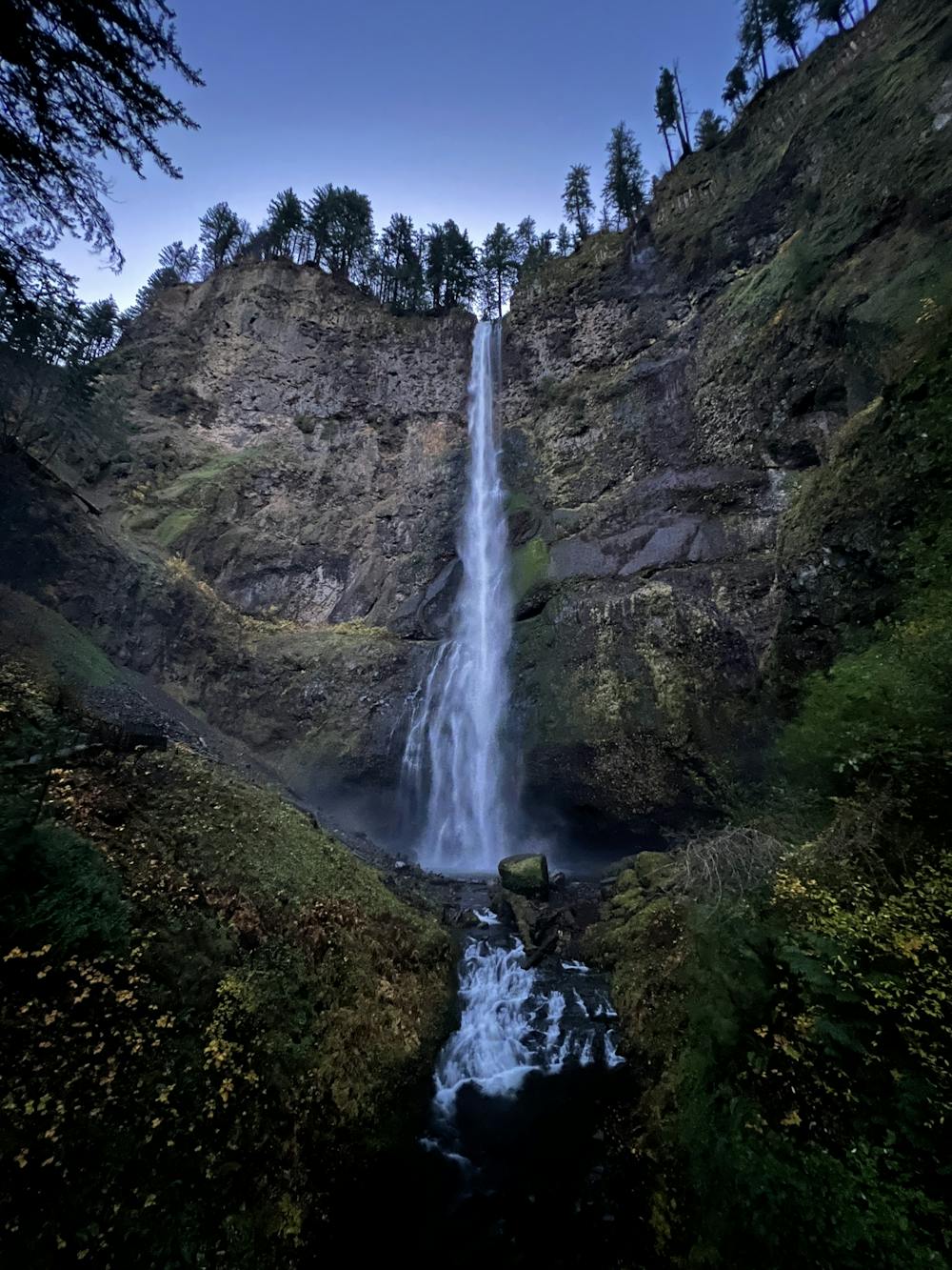
This waterfall hike follows a paved switchbacked path up the steep hillside near the waterfall. While the trail itself is paved and well-maintained, the almost 1,000 vertical feet of elevation gain increases the difficulty to a moderate rating.
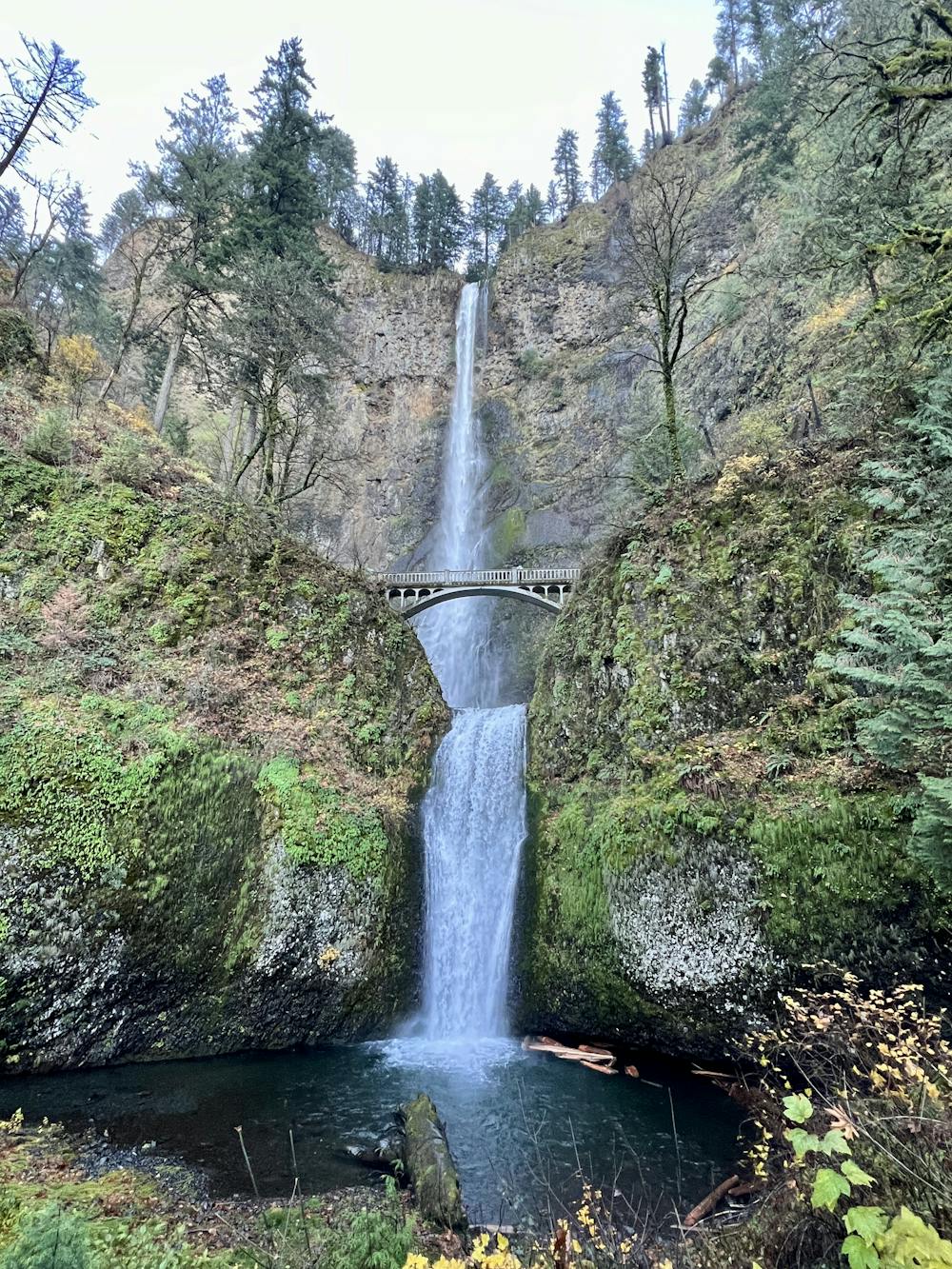
After the first set of switchbacks, the trail crosses a magnificent arched stone bridge between the lower falls and the upper falls. The subject of most photographs of the falls, this beautiful construction gives the whole experience a fantastical feeling, as if you're walking in an elven city from Lord of the Rings.
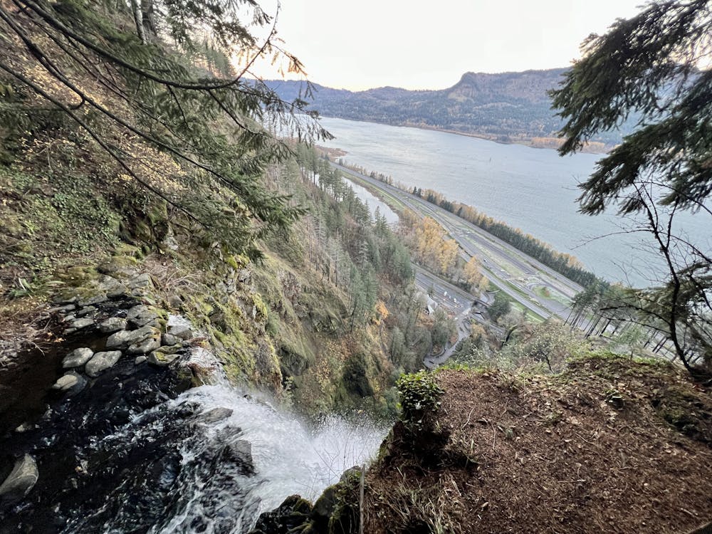
From the bridge, keep climbing to reach the upper viewpoint from the top of Multnomah Falls. "The dizzying view aims down the cataract to the toy-sized lodge and its ant-like crowds," according to Oregon.com.
Once done soaking in the grand views from the falls, either return to your car the way you came or extend your hike into a loop.
Moderate
Hiking along trails with some uneven terrain and small hills. Small rocks and roots may be present.

The trail contains some obstacles such as outcroppings and rock which could cause injury.

Close to help in case of emergency.
9 km away
Two majestic waterfalls in basalt amphitheaters, both along the same hiking loop and within an easy drive from Portland.
Moderate Hiking
9.6 km away
A combo of two waterfalls on one short but steep hike in the Columbia River Gorge.
Moderate Hiking
10 routes · Hiking · Trail Running
5 routes · Hiking
7 routes · Hiking