18 routes · Mountain Biking · Gravel Biking · Hiking · Stand Up Paddle
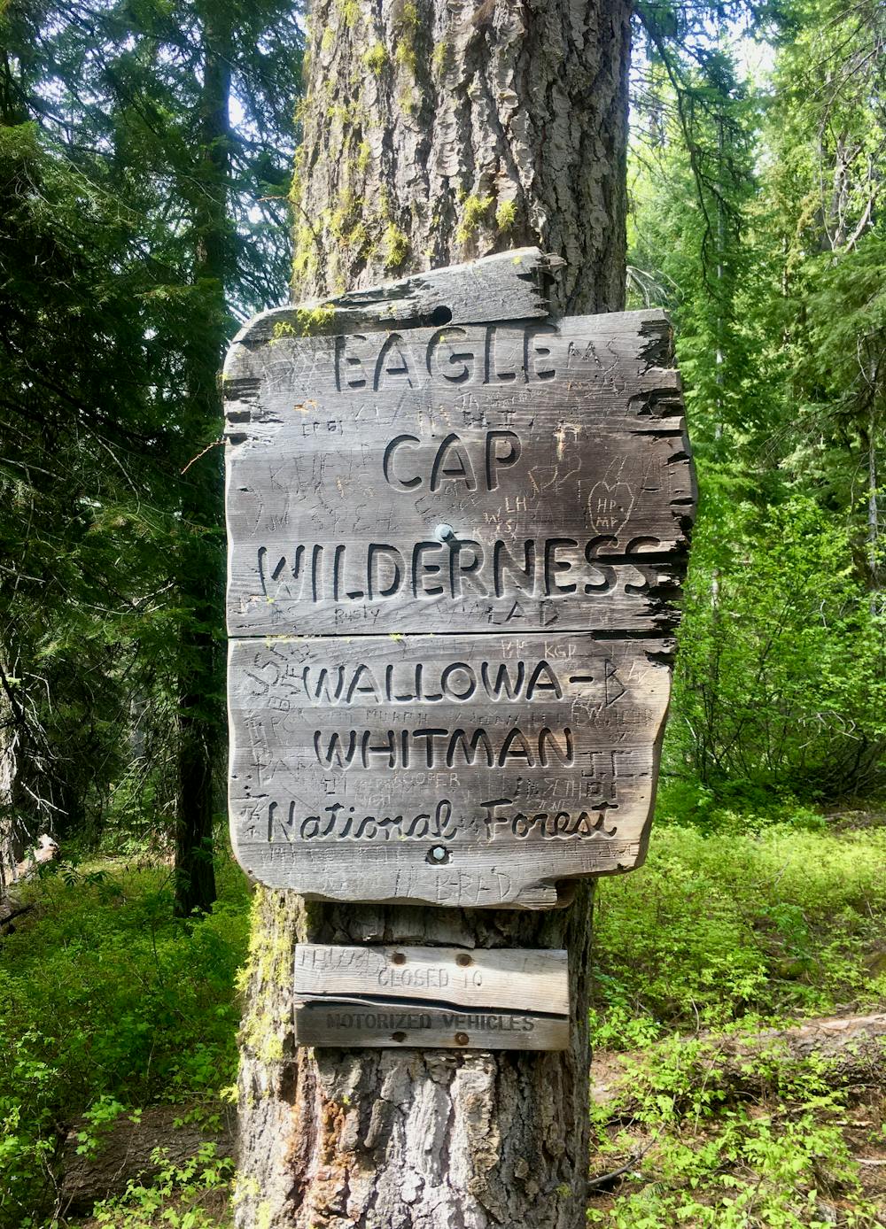
A locals' favorite hike in the Eagle Cap Wilderness.
Hiking Moderate

This locals' favorite hike can serve as either a long day in the mountains, a short backpacking trip, or the beginning of a much longer backpacking trip if you carry on with the rest of the North Fork Catherine Creek Trail. The route as mapped here is a logical out-and-back route with a gorgeous turn around point.
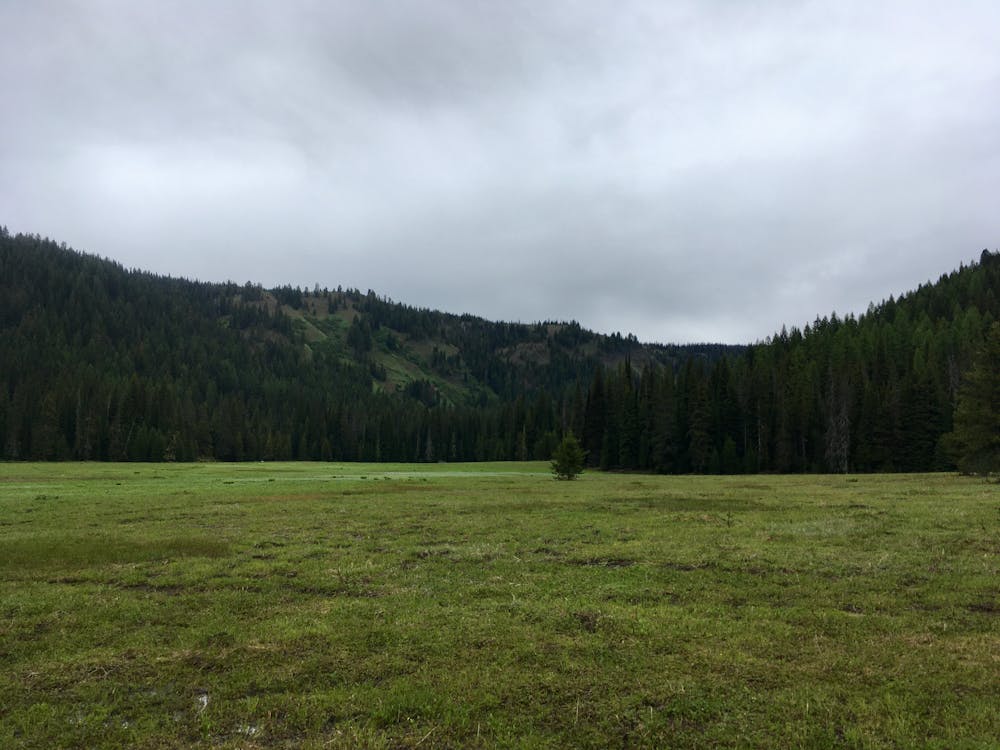
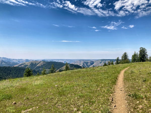
Known simply as “The Meadow,” the turn around point for this hike is a beautiful meadow in the bottom of a stunning mountain valley. After hiking through a deep, dark forest for 5 miles, the wide-open expanse is shocking and out of place, providing a delightful lunch spot or campsite.
At times (especially during the spring), the meadow can become very wet and marshy, but later in the summer it usually dries out, providing a great spot to camp for the night. If you continue on the trail a little past the meadow and through a stand of trees, you’ll reach an ancient cabin that’s now surrounded by the massive Eagle Cap Wilderness.
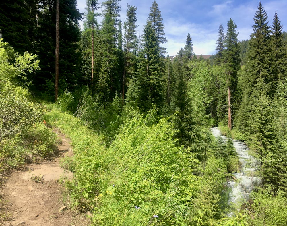
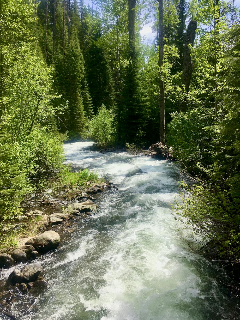
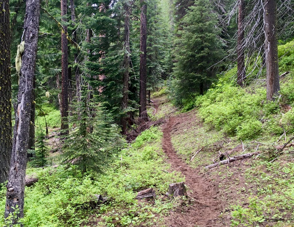
The 5-mile (one-way) hike to reach the cabin climbs up a narrow mountain valley, home to the roaring Catherine Creek at the valley’s low point. The singletrack trail crosses the creek once via a sturdy bridge, but it does ford through several feeder streams that are quite deep. Especially in the springtime, plan on getting your feet wet on this hike.
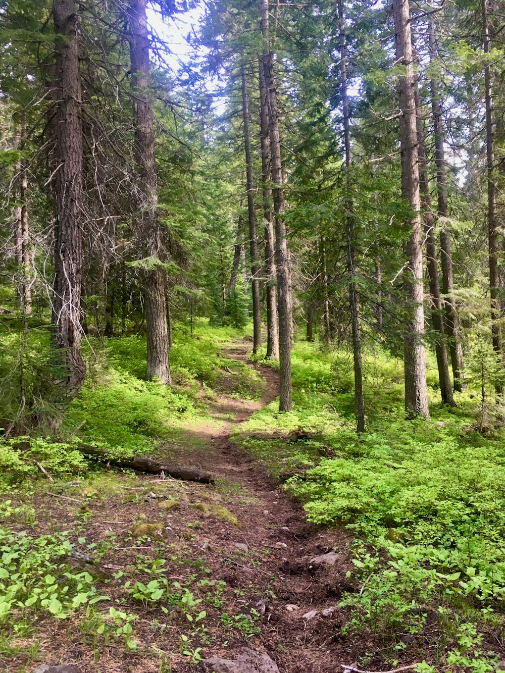
As the trail only climbs 1,555 feet over its 5-mile length, this hike isn’t all that steep or aerobically-challenging. Even the trail tread is relatively smooth—while there are a few rocky spots, the majority of the trail consists of dark, black dirt in the forest. The only thing that could make this hike challenging is the distance, but you can, of course, turn around whenever you desire.
In addition to the roaring creek, you’ll enjoy the solitude of the massive Eastern Oregon forest covering the Wallowa Mountains. Pine trees soar overhead, leaving you feeling small and insignificant as you navigate around their mammoth bases. The undergrowth is lush and green, the dirt is dark and tacky, and on the right day, you may not see another soul.
That said, this trail is quite popular in comparison to other trails in the Eagle Cap Wilderness, due to its easy access and low elevation. Especially on weekends, you can anticipate some trail traffic, including equestrians.
Moderate
Hiking along trails with some uneven terrain and small hills. Small rocks and roots may be present.

The trail contains some obstacles such as outcroppings and rock which could cause injury.

Little chance of being seen or helped in case of an accident.
18 routes · Mountain Biking · Gravel Biking · Hiking · Stand Up Paddle