1 m away
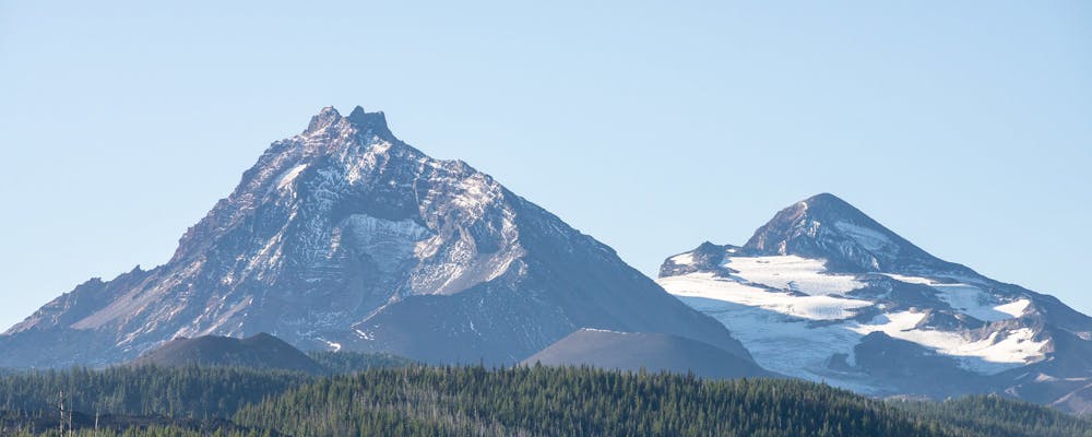
Middle Sister
The shortest of the Three Sisters is still more technical to climb than the tallest.
Extreme Hiking
- Distance
- 26 km
- Ascent
- 1.6 km
- Descent
- 1.6 km
The most technical of Oregon's Three Sisters.
Hiking Extreme

Note: this route warrants a "Moderate" Mountaineering difficulty rating.
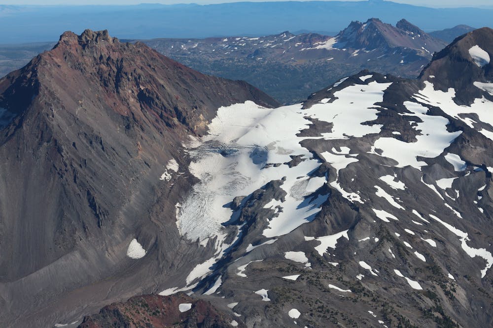
The North Sister is the most difficult of the Three Sisters to climb. While South Sister is the tallest, North Sister is the most technical, with some class 4 scrambling required on poor rock and loose dirt. While it might not be as technical as the heavily glaciated peaks of Mount Hood and Mount Jefferson, the ascent of North Sister is still demanding and requires competent mountaineering skills.
The route mapped here approaches via the Pole Creek Trail and Camp Lake Trail. The same approach can be used for Middle Sister, so some climbers will turn this into a multi-day expedition and climb both peaks from a basecamp in the middle.
After departing from the approach trail, the climb begins in earnest. The route mapped here gains a spine and follows it all the way to the summit ridge.
Once on the summit ridge, the technicality ratchets up significantly. “In summer conditions, the traverse to the Bowling Alley, the final summit pitch up a loose, steep gulley, is on a narrow, crumbly, loose rock ledge and the Bowling Alley is Class 4 junk,” writes Brian Jenkins on SummitPost.org.
The final section to the summit mapped here traverses around the west side of the summit, makes a push to a saddle, then finishes the ascent from the north. However, note that conditions on the mountain can and do change, and route finding or an alternative approach may be required.
Sources: PeakBagger.com SummitPost.org
Extreme
Scrambling up mountains and along technical trails with moderate fall exposure. Handholds are necessary to navigate the trail in its entirety, although they are not necessary at all times. Some obstacles can be very large and difficult to navigate, and the grades can often be near-vertical. The challenge of the trail and the steepness of the grade results in very strenuous hiking. Hikes of this difficulty blur the lines between "hiking" and "climbing".

Some trail sections have exposed ledges or steep ascents/descents where falling could cause serious injury.

In the high mountains or remote conditions, all individuals must be completely autonomous in every situation.
1 m away
The shortest of the Three Sisters is still more technical to climb than the tallest.
Extreme Hiking