7.6 km away
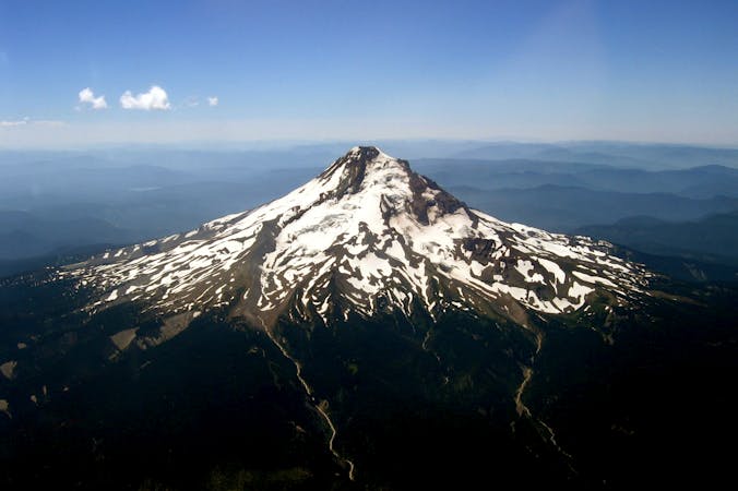
South Sister
Climb the tallest of Oregon's Three Sisters, the third tallest mountain in the state.
Severe Hiking
- Distance
- 19 km
- Ascent
- 1.5 km
- Descent
- 1.5 km
Miles 1952.6-1983.8 of the northbound PCT: Out of the woods and into a mosaic of black and green, crossing volcanic plateaus and lava flows at the feet of the Three Sisters.
Hiking Moderate

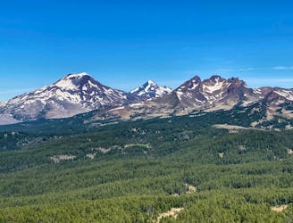
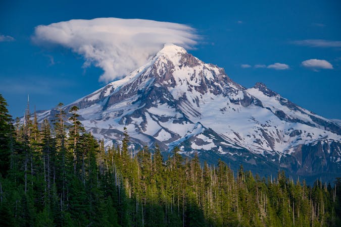
To finish up Oregon Section E, the PCT proceeds northward through the Three Sisters Wilderness, passing the namesake trio of dormant volcanoes. The South, Middle, and North Sisters each rise thousands of feet, with South Sister as the tallest. Their stony, snow-streaked slopes tower above an array of cones and domes, culminating in glaciated peaks that command the horizon. Here the PCT finally exits the nearly continuous forest that lies to the south, and enters a mosaic of conifers, meadows, and lava flows at the feet of the volcanoes.

Elk Lake junction makes a reasonable entry or exit to the PCT within Three Sisters Wilderness, as it’s less than a mile via side trail to a paved road at Elk Lake (NB mile 1952.6). Continuing north from the junction, the PCT remains shrouded in conifers, through a dry stretch of forest. Climbing over Koosah Mountain (NB mile 1957) grants a preview of South Sister up ahead, and on the other side the trail descends to Sisters Mirror Lake (NB mile 1958.8), a water source with several good campsites.
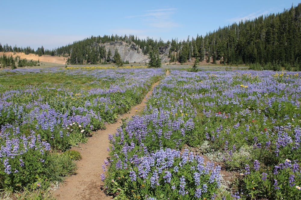
From there, a gentle ascent through more forest soon leads to the stark change in scenery. The trail emerges from the trees into a vast meadow, with South Sister looming up ahead (NB mile 1960.2). The trail continues across this open plain for a few miles, with the snowy mountain as a centerpiece and smaller, timbered cones all around.
After reentering the forest, the trail descends and soon crosses a creek in a grassy clearing (NB mile 1963). Next, the trail turns uphill and begins a sinuous climb through rocky, spacious forest at the foot of South Sister. Pumice meadows and heaps of basalt punctuate the trees here and there, and meltwater creeks flow through little valleys. Decent campsites near water are plentiful, especially in a wetter summer. Note that camping is not allowed within 100 feet of water sources, however.
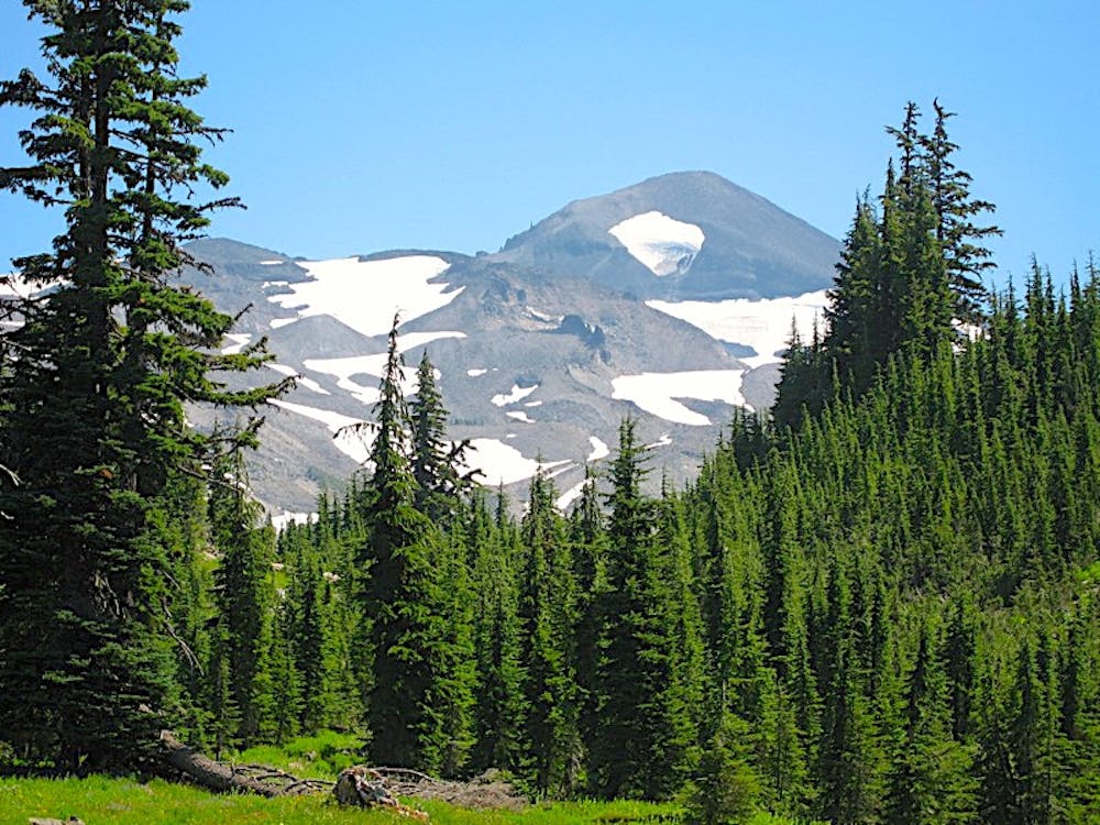
Ups and downs through this volcanic mosaic bring the trail near the base of Middle Sister, where it traverses lava fields beneath the barren face of the mountain. On this stretch between the tiny Linton Creek (NB mile 1968.1) and reliable Sister Spring (NB mile 1972.1), rocky slopes make water and camping scarce.
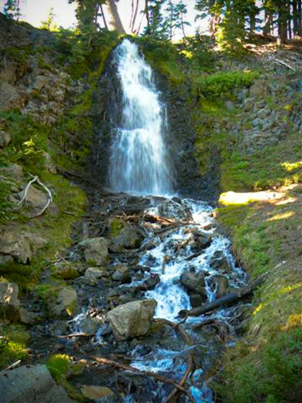
Upon reaching Obsidian Falls (NB mile 1971.9) and climbing to the spring shortly after, the PCT enters a more popular area of the Three Sisters Wilderness. Water and campsites become more plentiful, but you can expect more people and perhaps competition for sites. Be aware also that special regulations apply to camping for the remainder of the way to McKenzie Pass.
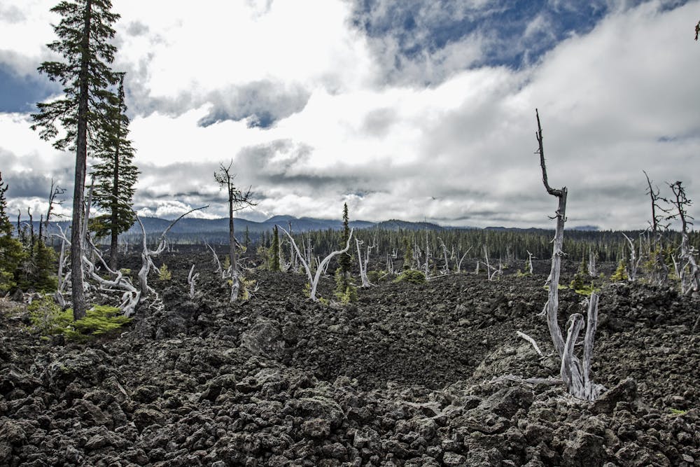
After crossing a gully called White Branch (NB mile 1974.7) the trail emerges into a black-rock wasteland, left by a geologically recent lava flow. Switchbacks lead up a canyon of jagged basalt, with expanding views to the swath of hardened lava behind. The trail then continues through patchy forest and over more lava fields around Yapoah Crater. Even on this desolate terrain, water can be found at Minnie Scott Spring (NB mile 1976.2) and South Matthieu Lake (NB mile 1979.7), along with good but limited camping.
The north end of Oregon Section E comes a bit farther on, at Highway 242 at McKenzie Pass (NB mile 1983.8). An alternate endpoint is at Lava Camp Lake, where there’s a trailhead and a primitive campground about ½ mile east along a side trail (NB mile 1982.6). The lake is also the last reliable water for several miles northbound, so it could be worth the side trip. If in need of resupply or rest, PCTers may hitch along the highway into the small town of Sisters, or all the way into Bend.
Permits: This segment of the PCT is entirely within the Three Sisters Wilderness, which requires the Central Cascades Wilderness Permit. Section hikers who get the wilderness permit may also need the Northwest Forest Pass for parking at certain trailheads. Note that the PCT travels through a handful of special use areas within this wilderness, where additional restrictions apply. It is the responsibility of all users to know and follow regulations specific to location and season in the wilderness area.
Sources: https://www.fs.usda.gov/recarea/willamette/recarea/?recid=4355 https://www.fs.usda.gov/recarea/deschutes/recarea/?recid=79444 https://pctmap.net/trail-notes/ https://pctwater.com/
Moderate
Hiking along trails with some uneven terrain and small hills. Small rocks and roots may be present.

The trail contains some obstacles such as outcroppings and rock which could cause injury.

Little chance of being seen or helped in case of an accident.
7.6 km away
Climb the tallest of Oregon's Three Sisters, the third tallest mountain in the state.
Severe Hiking
9 km away
One of the most rewarding hikes near Bend, Oregon.
Moderate Hiking
9 km away
A ridge hike and scramble to an impressive summit in the Three Sisters Wilderness.
Extreme Hiking

3 routes · Alpine Climbing · Hiking
9 routes · Hiking
10 routes · Alpine Climbing · Hiking
5 routes · Alpine Climbing · Hiking

72 routes · Hiking