
72 routes · Hiking
Miles 1773.4-1820.9 of the northbound PCT: Threading between wooded lakes among volcanic hills, then crossing a long expanse of dry forest on the way into Crater Lake National Park.
Hiking Moderate

Oregon Section C follows the Cascade Crest through Crater Lake National Park, and this first leg of the journey delivers the PCT across the park’s southern boundary to Highway 62 near Mazama Village. For the most part, it is miles of pleasant walking through shady conifer woodland that’s bursting with huckleberry bushes. There are also lengths of trail through flower-filled burn scars, secluded campsites by forest lakes, and a walk beneath a toothy skyline of volcanic crags. Campsite clearings are generally easy to find along this segment, but by late season water sources are not. Early season comes with its own challenges, however, like snow over the trail in spring and mosquitoes at the lakes in early summer.
Peak season PCTers will need to plan mileage carefully around water sources on this segment. It is possible to camp near water every night, but perhaps only with detours from the PCT proper. The Sky Lakes trail, for example, is one alternate that’s popular for its bonus scenery and desirable camping. North of where Sky Lakes rejoins the PCT, however, there remains a 20-mile stretch known as the Oregon Desert, where water is usually scarce by mid-summer. This necessitates additional detours if an excessive water carry is to be avoided.
Oregon Section C begins at Highway 140 near Fish Lake. Just north of the road crossing the trail goes over a creek on a bridge (NB mile 1773.4). This is actually a canal that empties into Fish Lake, so though it normally has water, it can be shut off. Continuing through evergreen forest and slightly uphill, the trail soon enters the Sky Lakes Wilderness (NB mil 1774.2). The ascent steepens somewhat on a plateau beside Mount McLoughlin, then turns downhill to continue around the mountain’s northeast flank. This walk is all in the forest, and is mostly easy-going except for rugged portions over lava rock and perhaps some downed logs. The trail turns uphill once more at Twin Ponds trail junction (NB mile 1781.5) where water sometimes flows, but is more often stagnant in a nearby pond. The next reliable source is Christi’s Spring (NB mile 1784.9), which a sign should indicate is about 100 yards off the trail. From there, the next source might not be for 15 more miles.
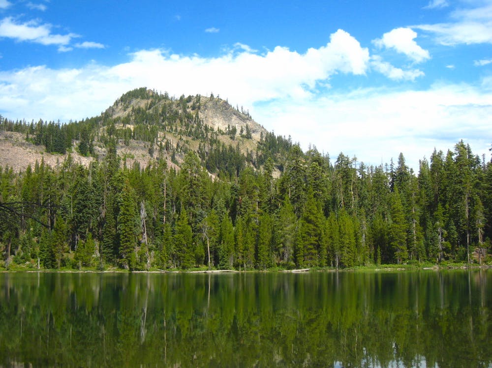
After a steady uphill and then a brief descent, there’s a junction for Island Lake (NB mile 1786.8). This lake makes one place to camp near water with only a short detour from the PCT. A few miles farther, however, is the junction for Sky Lakes trail (NB mile 1790.4). This PCT alternate leads through an abundance of tree-lined lakes with idyllic camp spots. Thus, it’s a popular deviation for PCT hikers. Without the detour, the PCT climbs to an elevated ridge of forest and burned areas. Views can be quite good from the fire-scar clearings, but the miles are dry and often hot. The Divide Trail (NB mile 1794.9) provides a second opportunity to detour to the Sky Lakes, and then Snow Lakes Trail (NB mile 1796.0) is where the alternate rejoins the PCT.
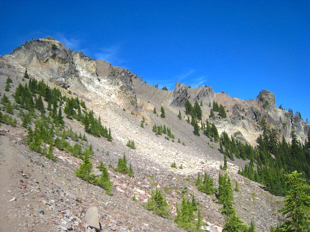
From the Snow Lakes junction the PCT climbs higher, soon leaving the burned areas behind for a rocky ridge mottled with forest. This leads to a spectacular traverse beside Lucifer and Devils Peak, on talus slopes beneath the jagged horns of the mountain. A switchbacking descent from Devils Peak returns the trail to the forest, where there is a small creek (NB mile 1799.3). Soon after is another option for lakeside camping, however, via the short detour on Seven Lakes trail (NB mile 1800.8). Just past this junction is another creek (NB mile 1801.0) which usually has flowing water.
What comes next is the dry stretch of trail known as the Oregon Desert, where water may not be found for nearly 20 miles. The surroundings are forested, not actually desert-like, but there are simply no reliable water sources nearby. It’s essentially a long walk through woods and regenerating burned areas all the way to Highway 62 in Crater Lake National Park.
There are chances at finding water in Honeymoon Creek (NB mile 1802.1), Ranger Spring (NB mile 1804.3), and Jack Spring (NB mile 1808.9), but all should be considered unreliable by mid-summer. A better chance is perhaps the tiny bench lake near NB mile 1817.0, less than half a mile off trail to the east (Use the USGS Topo basemap in the FATMAP app to find it). Another option for water is to take the Stuart Falls alternate, which is a rugged trail through a burn area that adds mileage and difficulty over the PCT, but has the advantage of finding reliable water and a 40-foot falls.
Finally the Oregon Desert ends at Highway 62 (NB mile 1820.9). Mazama Village of the national park is about 1 mile east by road. There hikers can find a range of amenities including the Camper Store which accepts resupply packages. Note that there is also an option to walk to the village by trail, by continuing to the Annie Springs connector (NB mile 1821.7).
Permits: Most of this segment is in Rogue River National Forest, where no permit is needed for hiking or camping, but it enters Crater Lake National Park. According to the park’s website, thru hikers need only sign the register at the park boundary, rather than obtain a backcountry permit. All the park’s other backcountry regulations still apply to thru hikers. Section hikers wishing to start in the park and camp overnight must obtain a backcountry permit from the park office. Hikers who start in the national forest instead will likely need a Northwest Forest Pass for parking at trailheads. Note also that the PCT long-distance Permit is good for travel and camping in both the national forest and the national park.
Sources: https://www.nps.gov/crla/planyourvisit/pacific-crest-trail.htm https://www.fs.usda.gov/recarea/rogue-siskiyou/recarea/?recid=69836 https://pctmap.net/trail-notes/ https://pctwater.com/
Moderate
Hiking along trails with some uneven terrain and small hills. Small rocks and roots may be present.

The trail contains some obstacles such as outcroppings and rock which could cause injury.

Little chance of being seen or helped in case of an accident.
72 routes · Hiking