4 km away
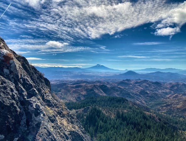
Pilot Rock

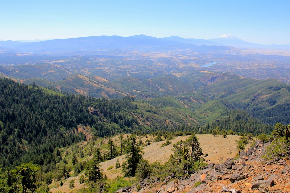
Reach stunning views of Mount Shasta and Northern California with this short hike.
Difficult Hiking
- Distance
- 4.4 km
- Ascent
- 247 m
- Descent
- 247 m
Miles 1718.9-1742.7 of the northbound PCT: Beginning the ranges of Oregon with a climb and a ridgewalk, among fragrant forest and meadows plus a giant tower of basalt.
Hiking Moderate

Here the PCT travels through the Soda Mountain Wilderness in the heart of Cascade-Siskiyou National Monument. It’s the convergence zone of multiple ecoregions, where species blend from the Cascades and the Sierras, plus the coast to the west and the desert to the east. That makes these mountains especially diverse, and has earned their status of protection as a national monument. While walking the trail, you’ll certainly feel the transition into the rich forests of the Cascade Range. Though the foliage is lush, this stretch can still be quite dry, as it traces a ridgeline above most of the drainages. In a parched summer this segment to Hyatt Lake can be rather brutal, so plan accordingly.

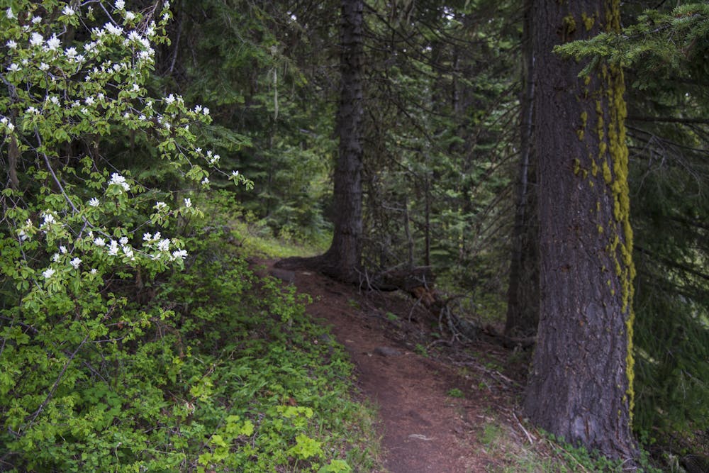
From the interstate the PCT continues along the paved Highway 99 for about half a mile, then takes a footpath into the woods and turns uphill. It’s a steady climb for the next few miles, through a patchwork of fir forest and tall-grass clearings with Pilot Rock rising up ahead. This landmark butte makes a popular day hike from a nearby trailhead. Where the PCT crosses the Pilot Rock trail (NB mile 1723.5) you can choose to take a side hike to see its crown of columnar basalt up close.
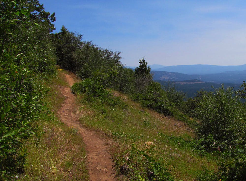
The PCT proceeds around the shoulder of Pilot Rock and begins to trace a ridgeline, with rolling ups and downs and occasional gaps in the trees that reveal Mount Shasta on the horizon. These miles can be very hot and dry in summer. There are two possible water sources, a piped spring at NB mile 1728.1 and another two miles later. The first is generally better than the second, but neither should be considered reliable. Check the PCT Water Report for current updates.
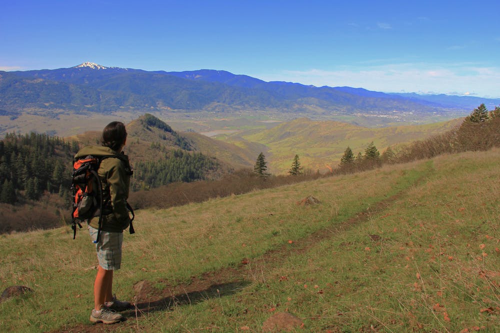
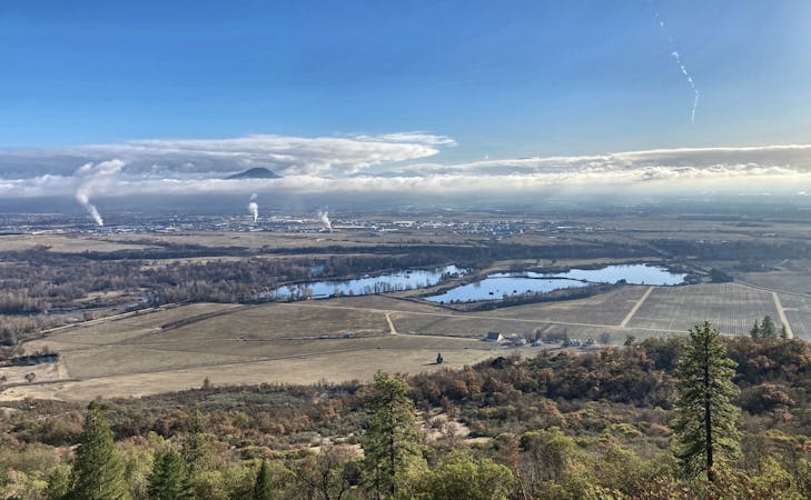
If in need of water, you might leave the trail at Green Springs Highway (NB mile 1735.4). Keene Creek Reservoir is a short detour along this road, and Green Springs Inn is about 2 miles away. Continuing northward, it’s similar forest-and-meadow scenery for a while, but the trail crosses a few dirt roads and swings westward for a view off the side of Green Springs Mountain. From there you’ll gaze over the Rogue Valley and the town of Ashland way below.
Next the trail passes Little Hyatt Reservoir (NB mile 1741.2), where water can usually be obtained from the outlet stream. Shortly after is the road to Hyatt Lake (NB mile 1742.7). A mile and a half north along the road is Hyatt Lake Resort, which has rental cabins and a restaurant. Also nearby is the Hyatt Lake Recreation Area campground, which has a water spigot plus other facilities, and campsites available by reservation.
Permits: This segment is within Cascade-Siskiyou National Monument, administered by the Bureau of Land Management. No permits are needed for hiking or camping. Campfires are generally allowed, but you must be sure to check for seasonal restrictions.
Moderate
Hiking along trails with some uneven terrain and small hills. Small rocks and roots may be present.

The trail contains some obstacles such as outcroppings and rock which could cause injury.

Little chance of being seen or helped in case of an accident.
4 km away
Reach stunning views of Mount Shasta and Northern California with this short hike.
Difficult Hiking

52 routes · Mountain Biking · Freeride Skiing · Gravel Biking · Hiking · Road Biking
7 routes · Hiking
11 routes · Hiking

72 routes · Hiking