81 m away
Union Peak
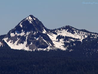
Escape the crowds on this remote summit hike.
Severe Hiking
- Distance
- 15 km
- Ascent
- 555 m
- Descent
- 554 m
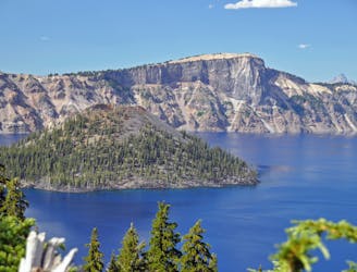
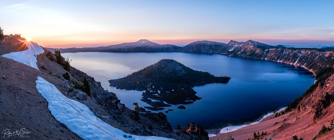
Miles 1820.9-1847.8 of the northbound PCT: Weaving through the volcanic landscape of Crater Lake National Park, but bypassing the namesake attraction itself.
Hiking Moderate

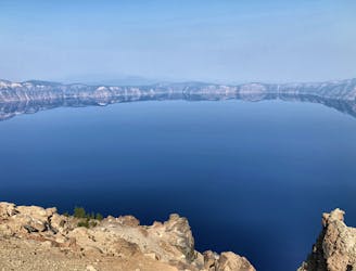
From Highway 62, the rest of Oregon Section C is within Crater Lake National Park. Mazama Village in the south of the park is a common resupply or endpoint for section hikes. From the village you have the choice to return to the PCT by the highway, or to walk on Annie Springs trail and pick up the PCT about a mile farther north (NB mile 1821.7). Here the trail begins its indirect arc around Crater Lake, where the miles to Highway 138 are not particularly interesting––at least not compared to the views which it bypasses on the crater rim. For that reason, many PCTers choose to take the Crater Rim alternate, trading the solitude of the PCT for the possibly crowded but certainly spectacular walk along the rim.
Dutton Creek junction (NB mile 1823) is where you’ll choose between the PCT or the alternate. If staying on the PCT, Dutton creek provides a water source nearby, and Trapper Creek comes a bit later (NB mile 1824.2). In the proceeding miles there are several small streams, but they should all be considered seasonal and unreliable in a dry summer. These occur among swaths of burns areas that the trail travels through. The fire scars are attractive in their own way, with vibrant flowers and green saplings filling in the skeleton forest. On hot days the sun can be overpowering though, and overgrowth or downed logs may slow you down. Shady camp spots and water sources can still be found, so cooler days on this segment of the PCT are really not so bad.
Camping is allowed anywhere within the park’s dispersed camping guidelines, but there are also designated backcountry camps which you can use with the proper permit (See permit info below). One designated camp with reliable water is Bybee Creek, located about half a mile down a side trail (NB mile 1828.6). Another is Red Cone camp (NB mile 1835.3) which is near a spring.
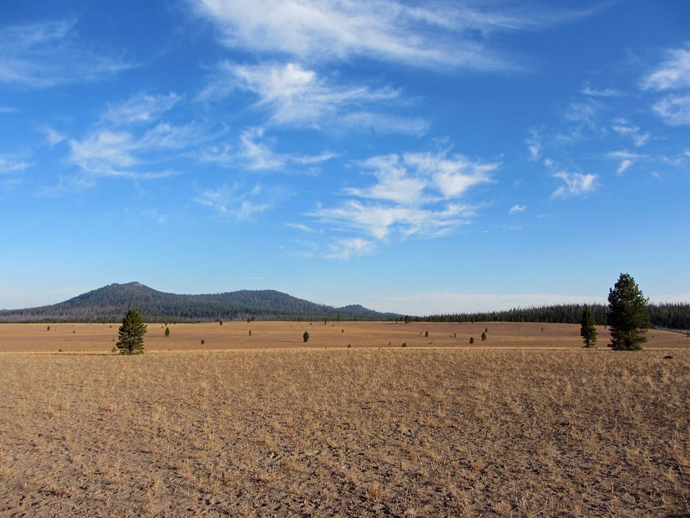
Eventually the PCT meets the park road and crosses it near a trailhead (NB mile 1839.2), where a metal locker serves as a water cache. Just across the road is where the Crater Rim alternate rejoins the PCT. Proceeding northward, the trail soon reaches an edge of the Pumice Desert (NB mile 1842)––an expansive dry meadow of volcanic deposits, so porous that very few plants can grow.
At Highway 138 (NB mile 1847.8) the PCT hits the northern boundary of Crater Lake National Park, and the end of Oregon Section C. Diamond Lake is a few miles west by road, where there is a Forest Service campground and the hiker-friendly Diamond Lake Resort. The resort has lodging, a restaurant, pizza parlor, and a post office.
Permits: This segment is within Crater Lake National Park, which allows backcountry camping with a permit. However, according to the park’s website, thru hikers need only sign the register at the park boundary rather than pick up a backcountry permit. All the park’s other backcountry regulations still apply to thru hikers. Section hikers wishing to start in the park and camp overnight must obtain a backcountry permit from the park office.
Sources: https://www.nps.gov/crla/planyourvisit/pacific-crest-trail.htm https://pctmap.net/trail-notes/ https://pctwater.com/
Moderate
Hiking along trails with some uneven terrain and small hills. Small rocks and roots may be present.

The trail contains some obstacles such as outcroppings and rock which could cause injury.

Little chance of being seen or helped in case of an accident.
81 m away
Escape the crowds on this remote summit hike.
Severe Hiking
2.4 km away
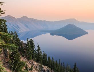
A popular detour from the PCT in Crater Lake National Park, tracing the edge of the caldera for astounding views over the lake.
Moderate Hiking
5.3 km away
Climb to a stunning overlook of Crater Lake.
Difficult Hiking
7.4 km away
One of the most beautiful but logistically difficult to reach points in Crater Lake National Park.
Severe Hiking
6 routes · Hiking

52 routes · Mountain Biking · Freeride Skiing · Gravel Biking · Hiking · Road Biking

72 routes · Hiking

63 routes · Alpine Climbing · Hiking