
72 routes · Hiking
Miles 1890.7-1907.9 of the northbound PCT: Continuing Oregon Section D around the base of Diamond Peak, through a wilderness of deep woods and hidden lakes.
Hiking Moderate

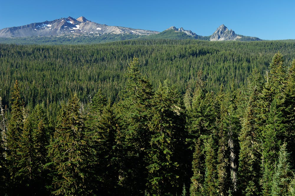
Summit Lake, located at the end of the previous segment, makes a popular and beautiful place to spend the night along the PCT. From a vantage on the lake’s south shore, Diamond Peak crowns the horizon proudly. On this next segment, the PCT skirts beneath this volcanic peak, rising nearly to the timberline on its way around the mountain. The surrounding forest is thick with conifers and lush understory, and dotted with pothole lakes and little creeks, bringing a welcome end to the water woes of Section D. With these lakes come many tempting camp spots, but long-distance hikers generally press on to cover these 17 miles within a day, to reach refreshment at Shelter Cove Resort or a ride at Highway 58.
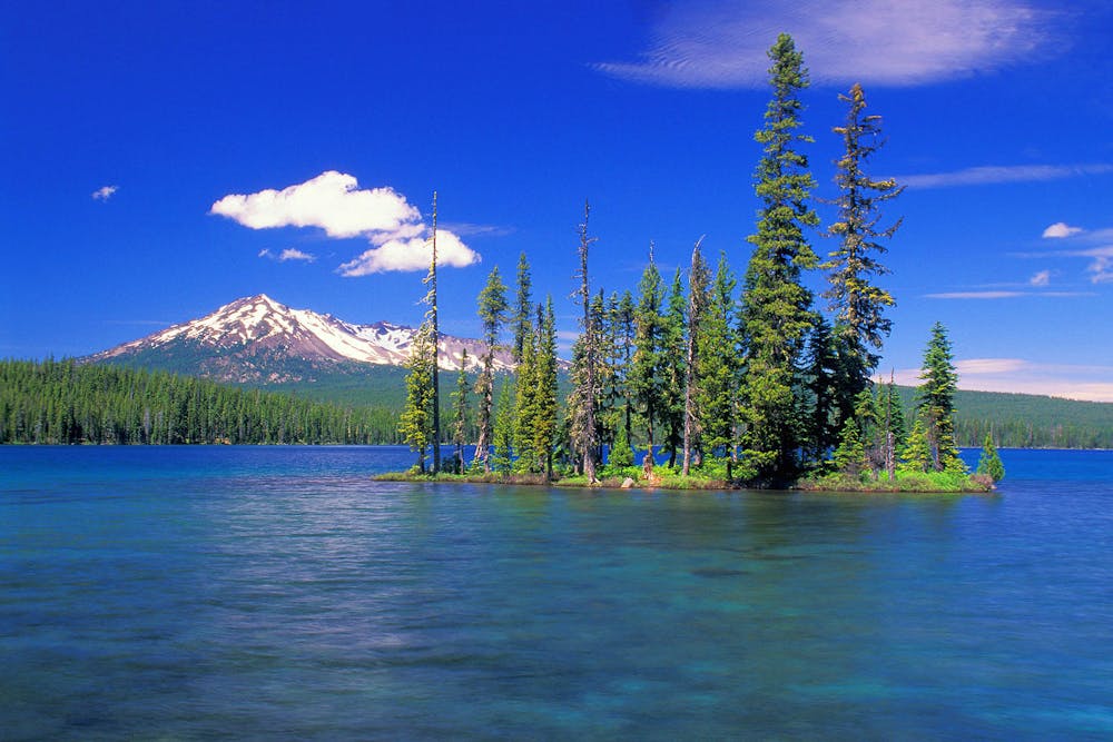
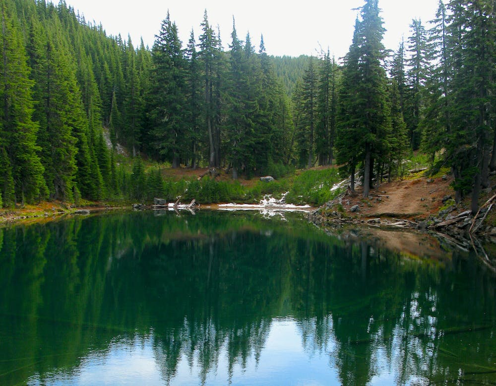
Setting off from Summit Lake, the PCT crosses a forest road with a small trailhead parking area (NB mile 1890.7). On the other side is the Diamond Peak Wilderness. There the trail proceeds generally uphill, soon passing the first of several lakes in a cluster (NB mile 1891.4). More ponds come in the next couple of miles, and beside them decent campsites.
These water sources are left behind as the trail climbs higher on the flank of Diamond Peak. From talus clearings in the trees, views open up to the snow-streaked slopes of the mountain. The trail is rugged in places, but easy to follow if there’s not too much snow cover. A meltwater stream near the timberline (NB mile 1896.6) and a seasonal creek farther on (NB mile 1899.3) provide chances at flowing water. Eventually the trail descends to thicker forest once more, and finds more lakes. Short side trails lead to some of these, where secluded campsites might be found by the water. But soon enough comes Odell Lake and the end of Section D.
The trail crosses a dirt road at Pengra Pass (NB mile 1906.2). From there you can walk to Shelter Cove Resort by going east on this road then taking the Yoran Lake trail. The resort is a hiker-friendly hideaway with camping, cabins, a restaurant, and range of services for PCTers. They can accept resupply packages as well. If not detouring to the resort, you’ll walk a bit farther to an overlook of Odell Lake, then soon meet Highway 58 near Willamette Pass. Just across the road is a PCT trailhead with a toilet and ample parking.
Permits: Most of this segment is within the Diamond Peak Wilderness, which does require a permit, but it’s self-issued at trailheads. Simply fill out the required information when you pass a register, and adhere to posted restrictions while in the area. Section hikers may also need a Northwest Forest Pass9https://www.fs.usda.gov/detail/r6/passes-permits/recreation/?cid=fsbdev2027010), however, for parking at certain trailheads.
Sources: https://www.fs.usda.gov/recarea/deschutes/recarea/?recid=79404 https://pctmap.net/trail-notes/ https://pctwater.com/
Moderate
Hiking along trails with some uneven terrain and small hills. Small rocks and roots may be present.

The trail contains some obstacles such as outcroppings and rock which could cause injury.

Little chance of being seen or helped in case of an accident.
72 routes · Hiking