9.5 km away
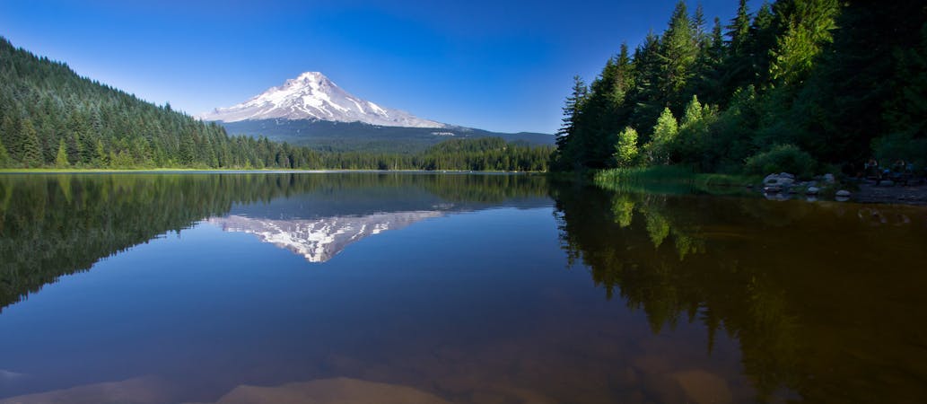
Laurance Lake

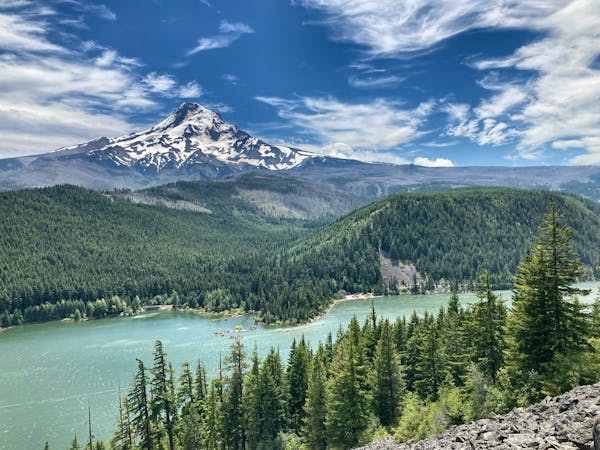
Gain otherworldly views of Mount Hood from this ridge above Laurance Lake.
Difficult Hiking
- Distance
- 11 km
- Ascent
- 367 m
- Descent
- 366 m
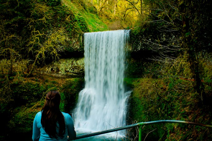
A beautiful hike through a narrow stream valley leads to a picture-perfect waterfall.
Hiking Moderate

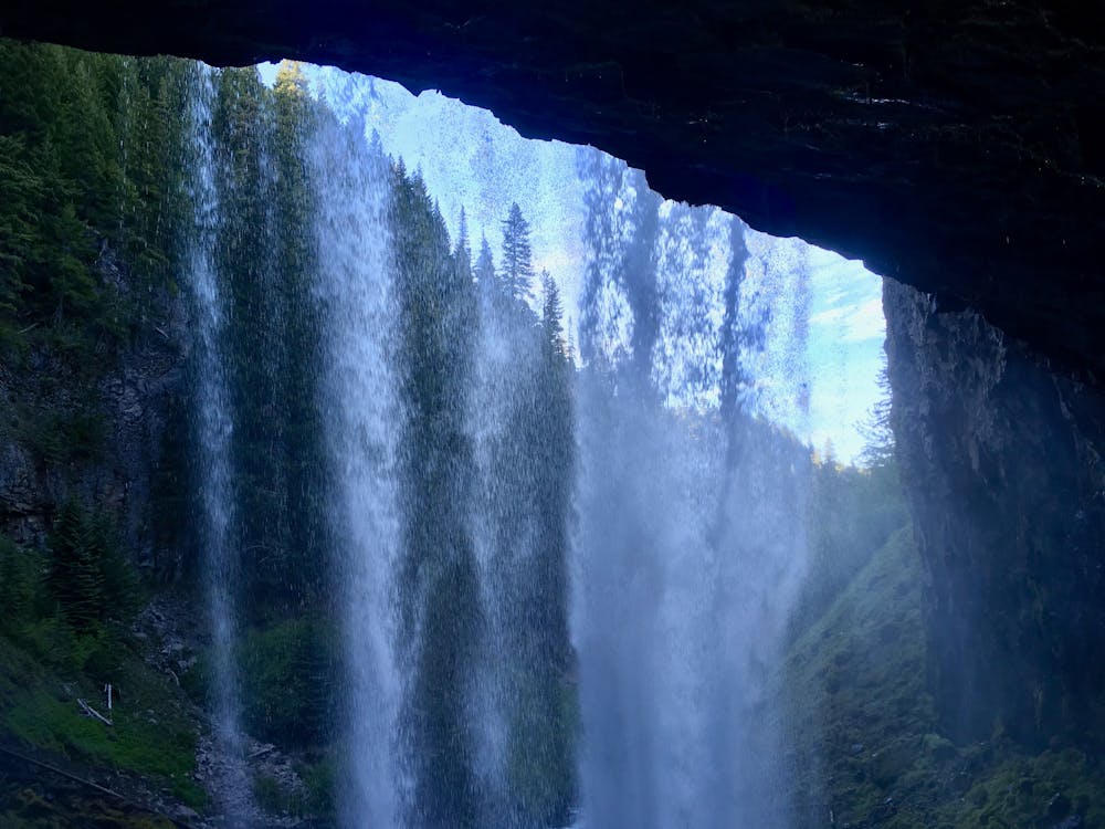
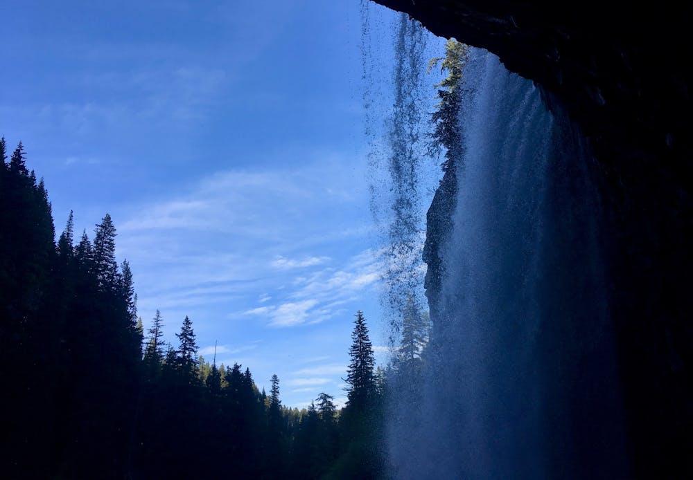
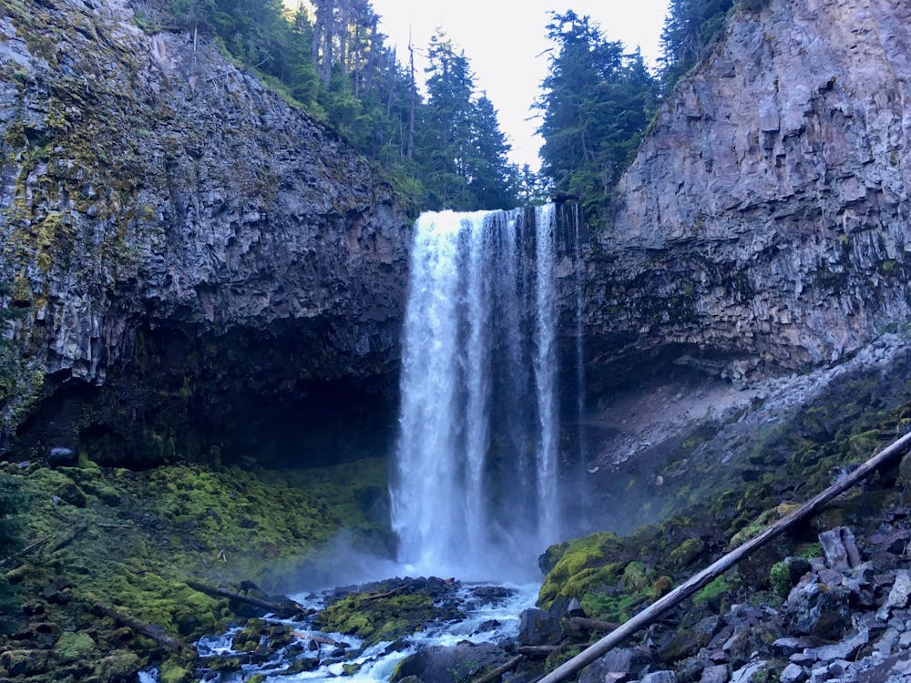
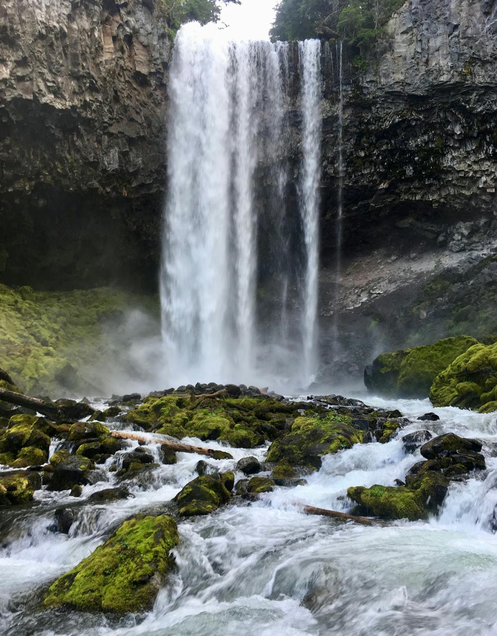
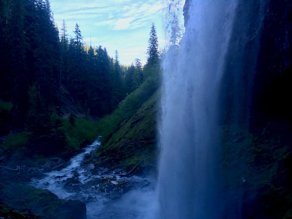
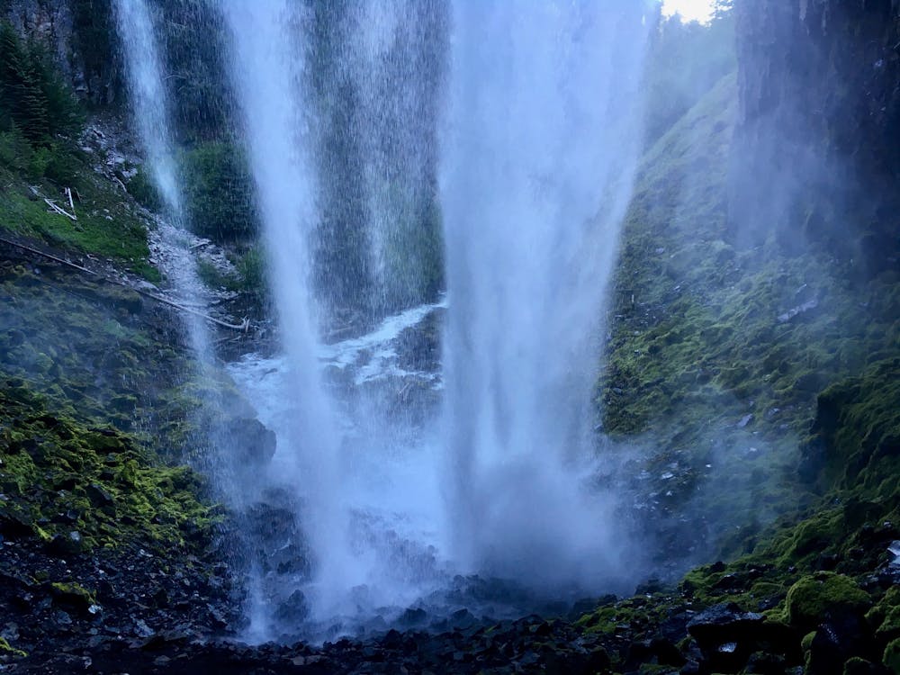
While Oregon may be the land of epic waterfalls, it's still rare to find a waterfall as impressive and stunningly-situated as the tremendous free fall of Tamanawas Falls. The thundering Cold Spring Creek plummets off of "a 150' lava cliff near the eastern base of Mount Hood," free falling onto a boulder field below, according to OregonHikers.org. This hike is immensely popular, and the trailhead often fills to capacity… but reaching the falls can pose a small challenge.

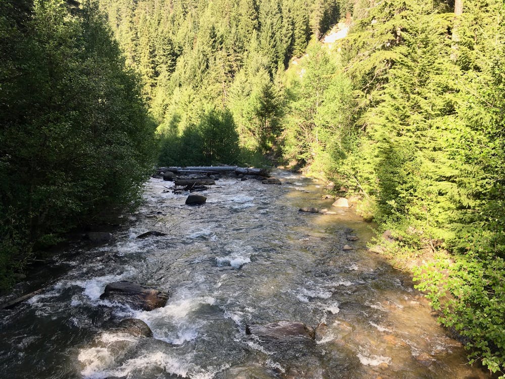
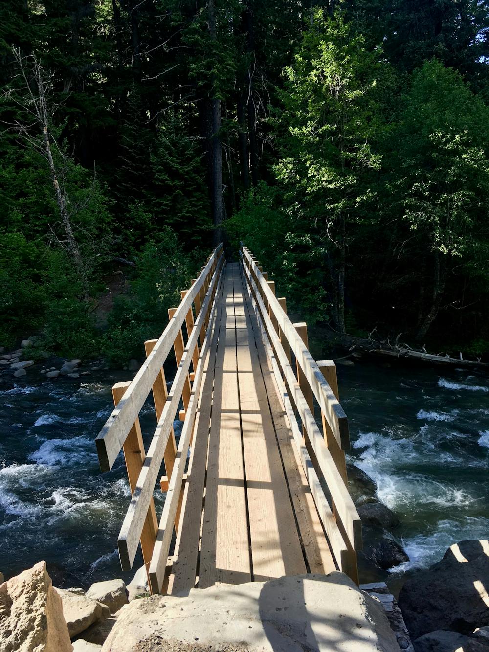
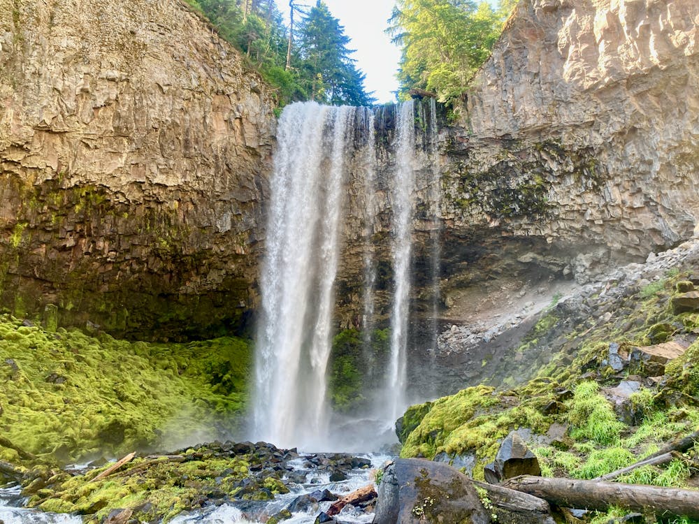
While many websites list the difficulty of the hike as "easy," the route to Tamanawas Falls requires a 3.6-mile round trip hike with 700 feet of elevation gain. Most of that elevation gain comes during the final pitch, which climbs up the bottom of a narrow stream valley to the falls itself. The final ascent is steep, filled with boulders, and has some sections of loose dirt where you may be required to use your hands to ascend the hillside. While most of the hike is indeed easy, simply meandering along the banks of a rushing stream, and plenty of families do reach the falls, know that for those unaccustomed to hiking or who haven't hiked in some time, this trail can definitely pose a small challenge.
Overcoming that challenge is richly rewarded! The vertical falls is an awe-inspiring sight. Located at the very end of a narrow valley, the setting of this waterfall couldn't be more idyllic and serene—serene, except for the thunder of the water splashing onto the boulders below and echoing off the walls of the narrow canyon!
Hikers who want a bit more challenge can scramble up the slick boulder field and claw their way back behind the falls. There, you can sit in the dry dirt under the overhang and watch the curtain of water plummet down in front of you.
Once you've soaked in the natural grandeur of the falls, return the way you came.
Moderate
Hiking along trails with some uneven terrain and small hills. Small rocks and roots may be present.

The trail contains some obstacles such as outcroppings and rock which could cause injury.
Away from help but easily accessed.
9.5 km away
Gain otherworldly views of Mount Hood from this ridge above Laurance Lake.
Difficult Hiking
10 routes · Hiking · Trail Running
7 routes · Hiking
10 routes · Hiking