58 m away
Tyler's Traverse Shuttle
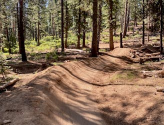
A fast, flowy shuttle run on the southern end of the Bend trail system.
Moderate Mountain Biking
- Distance
- 24 km
- Ascent
- 262 m
- Descent
- 666 m
Bend's classic enduro stage.
Mountain Biking Severe

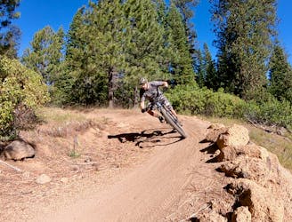
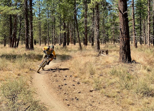
Combining Funner and Storm King into one high-speed shuttle run creates the classic Bend, Oregon enduro stage. Of all the trails in Bend, this combination delivers the goods!
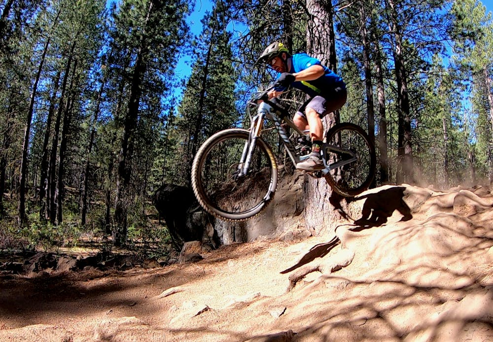
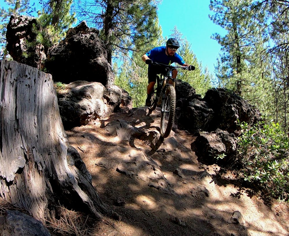
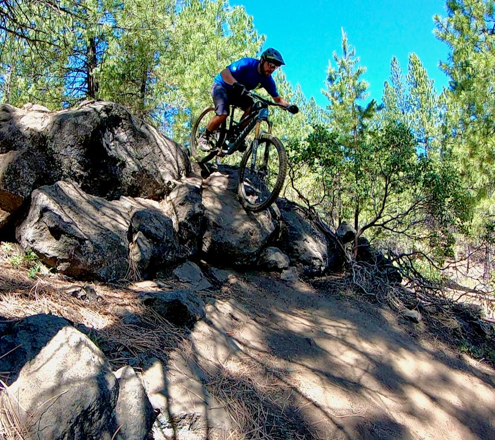
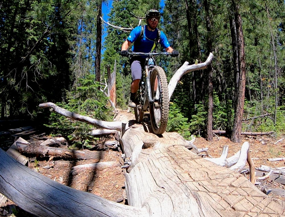
Funner may just be the most technical trail in Bend, Oregon, if you hit all the alt features while ripping downhill. If you avoid the alt features, you could turn Funner into an achievable intermediate trail, or if you opt for the tough lines, it would easily be rated as a black diamond! To keep the fun going, drop into Storm King and keep looking for the alt line rock rollers.
Funner offers up some significant 5-7 foot drops if you air them all out. Some can be rolled, and others can be avoided, but if you want to get sendy, Funner will scratch that itch! You’ll also encounter big rock rolls, rock gardens of all shapes and sizes, log skinnies, roots, and so much more.
If you aren’t in a hurry to rip through at race pace, taking time to session the multitude of lines is an enjoyable way to spend a day. Since Funner includes divided climbing and descending routes in places, you can easily loop back up on the climbing trail to session a different line on the technical descending route. Also, be sure to keep an eye open for the big log skinny—a truly unique feature!
While there are a few ways to climb to the top of this route, the climb up Tiddlywinks isn’t very enjoyable. While it’s a pretty short shuttle, setting up the two-car shuttle is definitely the best way to ride this trail.
Severe
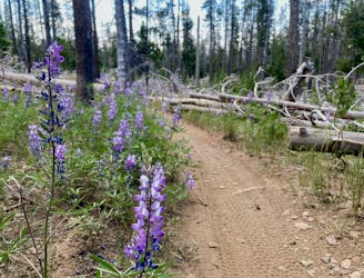
Widely variable, narrow trail tread with steeper grades and unavoidable obstacles of 15in/38cm tall or less. Obstacles may include unavoidable bridges 24in/61cm wide or less, large rocks, gravel, difficult root sections, and more. Ideal for advanced-level riders.

The trail contains some obstacles such as outcroppings and rock which could cause injury.

Close to help in case of emergency.
58 m away
A fast, flowy shuttle run on the southern end of the Bend trail system.
Moderate Mountain Biking
2.8 km away
One of the most rewarding mountain bike rides in Bend!
Difficult Mountain Biking
5.7 km away
North Fork from Skyliner Trailhead.
Difficult Mountain Biking
6.1 km away
A feature-rich loop ride removed from the business of the Phil's Trailhead.
Difficult Mountain Biking
7 routes · Mountain Biking
5 routes · Mountain Biking · Hiking · Stand Up Paddle

20 routes · Mountain Biking

15 routes · Mountain Biking