2.9 km away
Hardesty Mountain Shuttle
Deep, dark, and fast--this is one of the furthest shuttles from Oakridge.
Difficult Mountain Biking
- Distance
- 12 km
- Ascent
- 349 m
- Descent
- 1 km
The deepest, darkest zone in Oakridge.
Mountain Biking Difficult

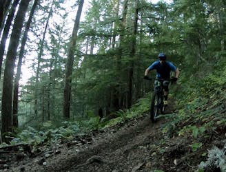
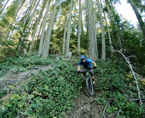
If you want to get deep and dark in Oakridge, head to the Patterson Mountain zone. While some other parts of the forest have seen select cuts in recent years or the trees are generally just a little more open, allowing more sunlight to filter through the canopy. But on Patterson mountain, the timber stands wide and rises tall, with only a dim glow reaching the ground.
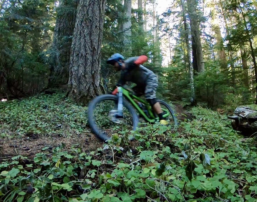
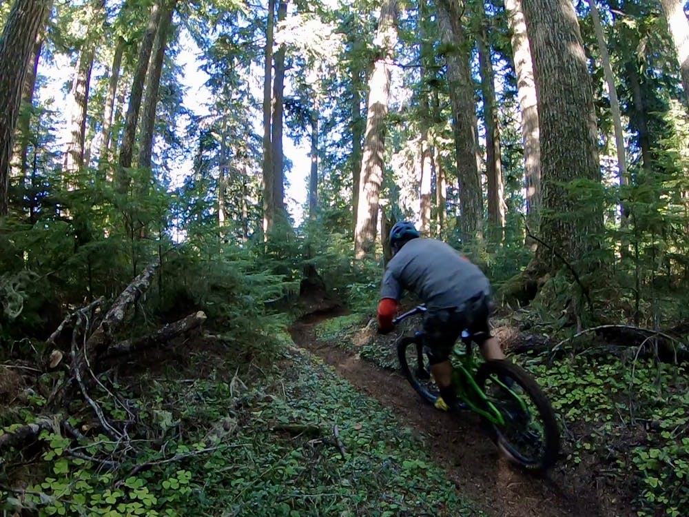
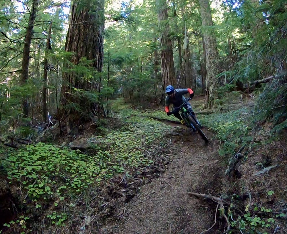
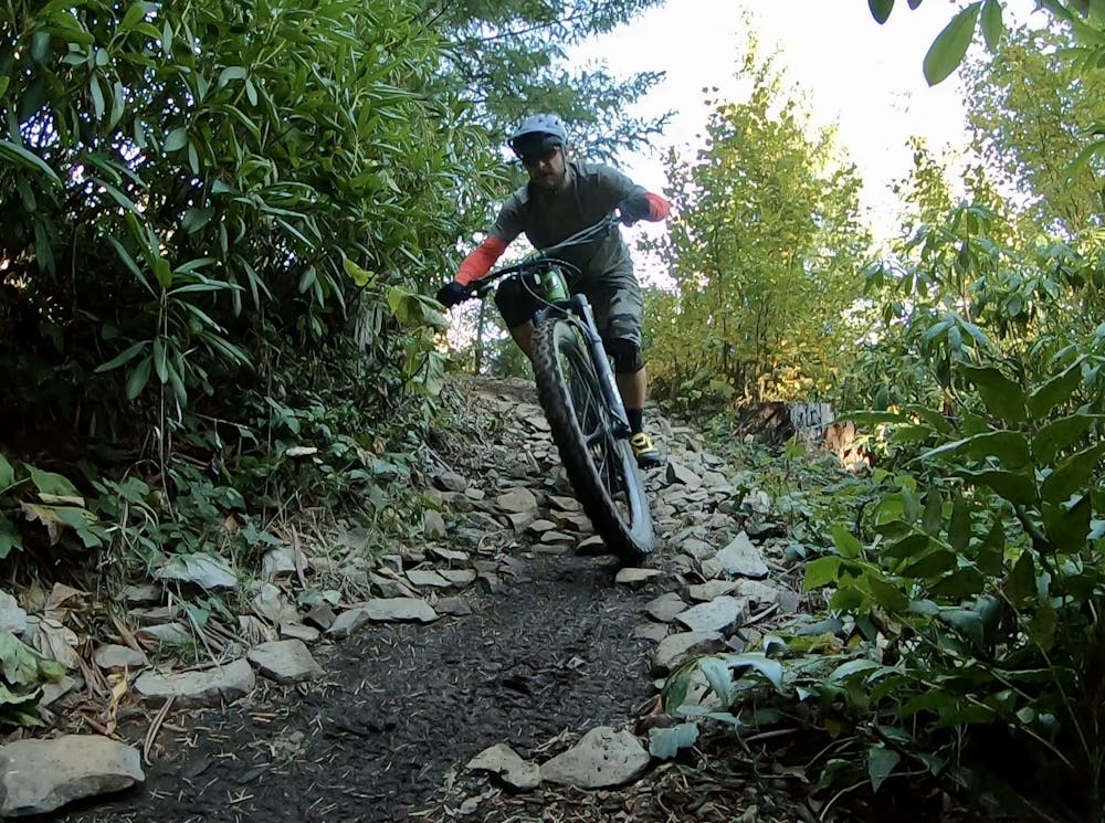
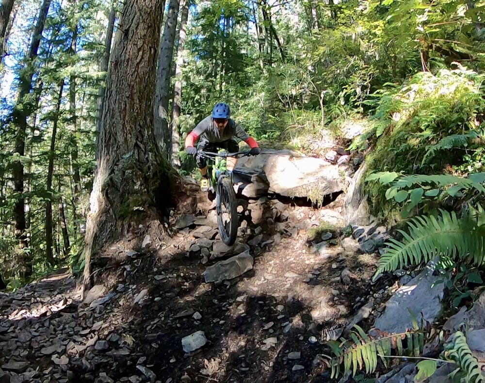
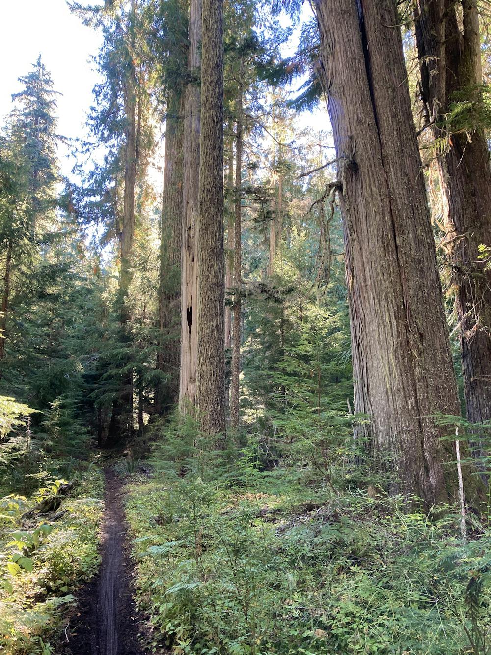
Hidden beneath that deep forest is a ripping singletrack trail with the darkest, loamiest dirt imaginable! Rich black soil provides traction for days when dry, but the dense forest hangs onto whatever moisture falls from the sky, and at times the forest floor can remain damp for days after the most recent rain. That black dirt can turn slick in places, but the trail generally does a great job of holding you in the corners.
Many of the corners feel like they have small berms and predictable, fast lines to keep you moving down the trail at top speed. This sensation is largely due to the moto traffic this trail receives. Many (but not all) of the best mountain bike trails in Oakridge are also open to dirt bikes, and Lawler seems to receive a bit more moto traffic than the other popular bike trails. While it is generally still in great shape considering the throttle-twisting traffic, keep your eyes peeled for a few moto-induced ruts and obstacles.
Even though Lawler is loamy and fast overall, there are a few rock sections sprinkled along its length that could prove tricky to some riders. These are all short-lived and could easily be walked, and consequently, I only assigned this trail a "difficult" rating. Lawler does blur the lines on the upper end of that rating a bit, and could offer a good progression for riders looking to move up to "severe" trails, aka true black diamond singletrack riding.
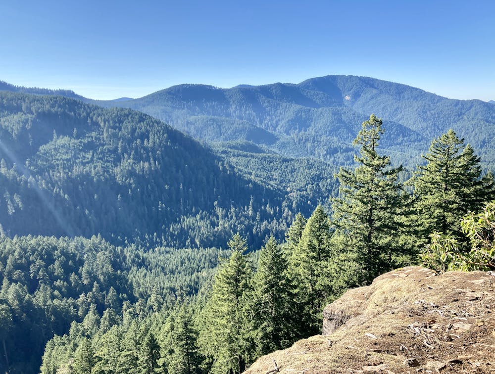
While the forest is generally deep and dark, you will stumble upon one stunning mountain top vista. After ripping through the green room, the long-range views might take your breath away! Be sure to pack a snack to enjoy at this stunning viewpoint.
Difficult
Mostly stable trail tread with some variability featuring larger and more unavoidable obstacles that may include, but not be limited to: bigger stones, roots, steps, and narrow curves. Compared to lower intermediate, technical difficulty is more advanced and grades of slopes are steeper. Ideal for upper intermediate riders.

The trail contains some obstacles such as outcroppings and rock which could cause injury.

Little chance of being seen or helped in case of an accident.
2.9 km away
Deep, dark, and fast--this is one of the furthest shuttles from Oakridge.
Difficult Mountain Biking
2.9 km away

The steepest descent in Oakridge!
Severe Mountain Biking
9.9 km away

Score beautiful views of the North Fork of the Willamette River.
Difficult Mountain Biking

10 routes · Mountain Biking

20 routes · Mountain Biking
6 routes · Mountain Biking

15 routes · Mountain Biking