1.8 km away
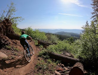
Bad Motor Scooter -> Grand Prix -> Toilet Bowl Jump Run
Shred a hot lap on some of Post Canyon's best jumps.
Severe Mountain Biking
- Distance
- 8.6 km
- Ascent
- 301 m
- Descent
- 301 m
An excellent sampler of a loop ride in the expansive Post Canyon trail system.
Mountain Biking Difficult

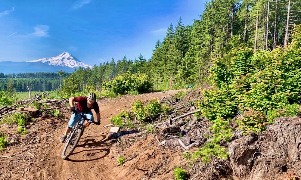
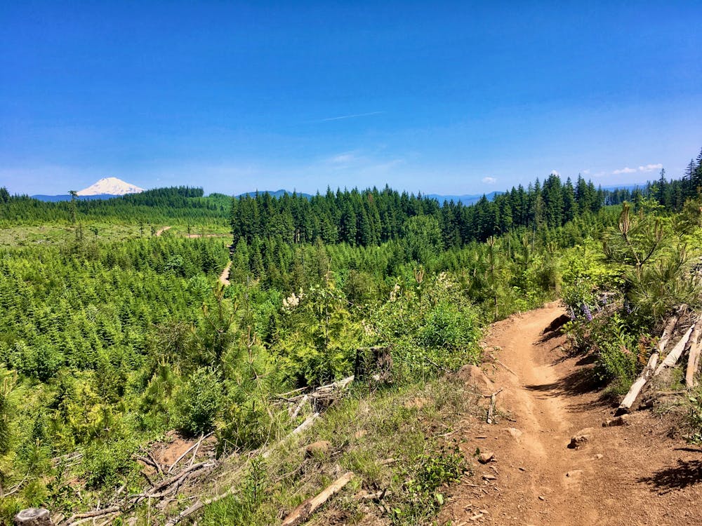
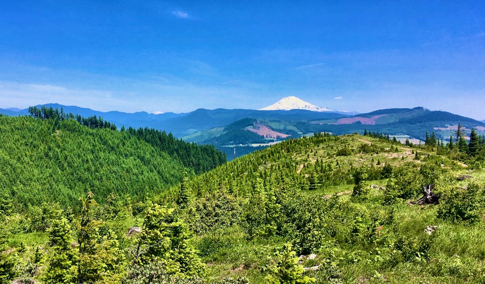
Post Canyon reigns supreme as the most popular—and most expansive—trail system in Hood River, Oregon. The trails here are so good, and the network so expansive, that Post Canyon draws riders from Portland every day of the week… despite the 1 hour, 15 minute drive.
Local rider Chris Daniels characterizes Post Canyon as "the epitome of trail networks” in his article on Singletracks.com, saying "you can sample from the largest buffet of trail types within a relatively small geographic area.”
While shuttling is extremely popular at Post Canyon, many riders choose to pedal loops through this complex network. If you choose to pedal, "the easy-grade roll out from the Seven Streams trailhead seems to be the most intuitive place to start Post Canyon,” according to Daniels. From there, continue climbing and climbing. Eventually, most riders choose to pedal up the gravel road for the most direct route to the top of the network.
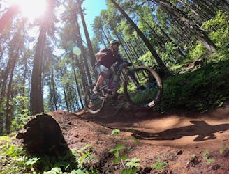
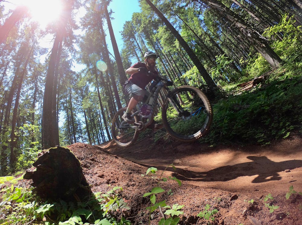
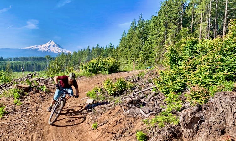
From there, any number of options will lead you back down the mountain, but the route mapped here follows some of the highest quality trails in the system. Flow and airtime are the priorities on this route. A continuous cascade of berms allows you to rail down trails such as Dirt Surfer, Bad Motor Scooter, and Grand Prix.
Grand Prix and Kleeway provide a never-ending line of jumps and air opportunities as you wrap up the second half of your descent. While most all of the jumps can be rolled, many provide two line options—the bigger option often featuring a big kicker followed by a gap to the landing.
Most of the trails on this loop ride are considered the most popular in the network, so expect to share the trail with other riders. Thankfully, most of the trails have an agreed upon direction of travel, making it uncommon to meet riders traveling the other direction. That said, most of these trails are still technically two-way and multi-use, so be sure to ride heads up!
Difficult
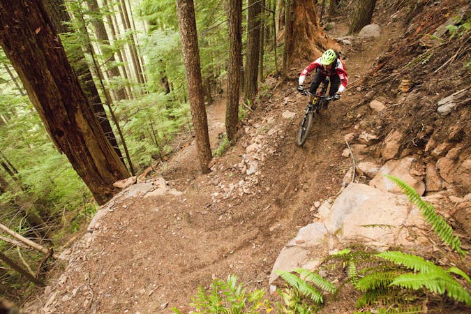
Mostly stable trail tread with some variability featuring larger and more unavoidable obstacles that may include, but not be limited to: bigger stones, roots, steps, and narrow curves. Compared to lower intermediate, technical difficulty is more advanced and grades of slopes are steeper. Ideal for upper intermediate riders.

Some trail sections have exposed ledges or steep ascents/descents where falling could cause serious injury.

Away from help but easily accessed.
1.8 km away
Shred a hot lap on some of Post Canyon's best jumps.
Severe Mountain Biking
7.4 km away
A top-to-bottom shuttle run through some of the roughest trails and sweetest flow at Post Canyon
Severe Mountain Biking

16 routes · Mountain Biking
7 routes · Mountain Biking
6 routes · Mountain Biking

15 routes · Mountain Biking