1 m away
Smokies High Peaks
An epic tour of the Smokies reserved for the most adventurous trail runners.
Severe Trail Running
- Distance
- 51 km
- Ascent
- 2.8 km
- Descent
- 2.8 km
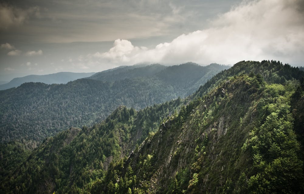
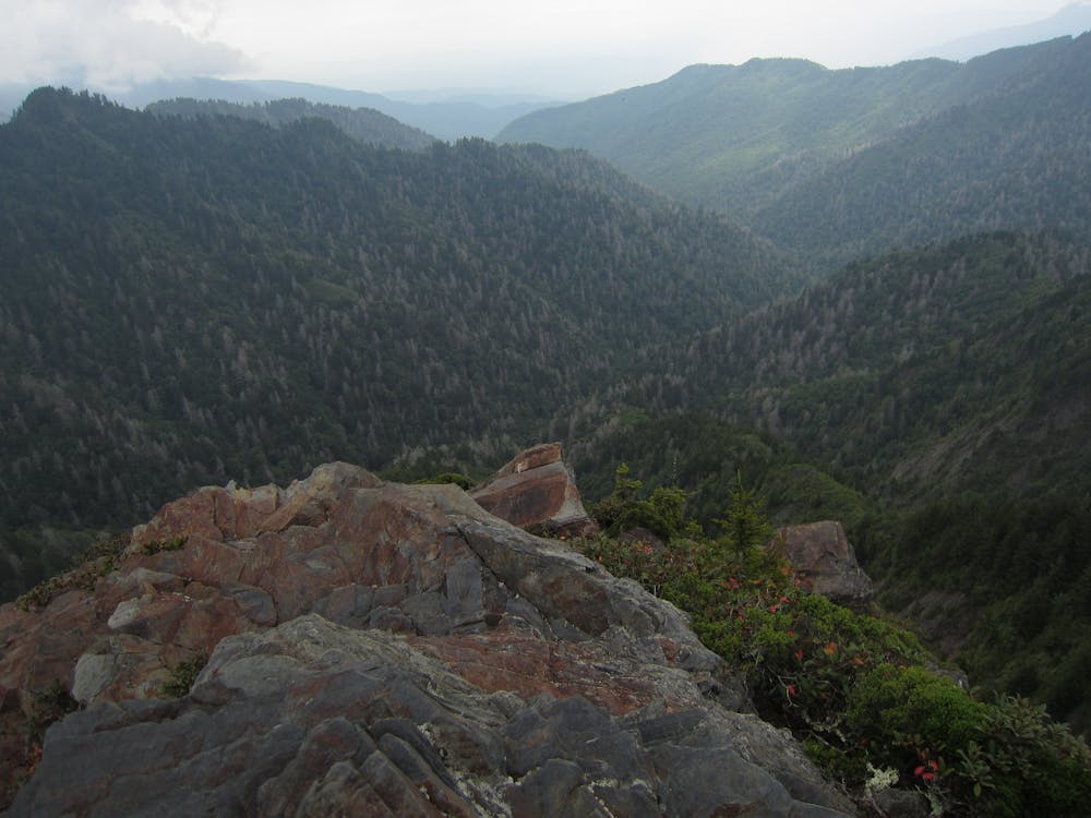
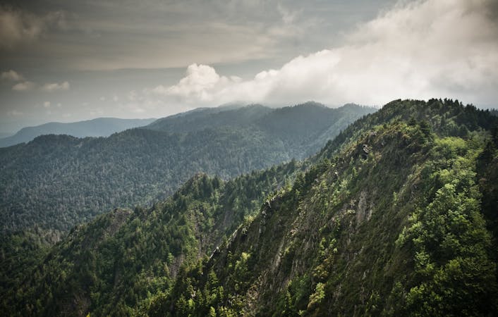
A epic trail run with spectacular views from Charlies Bunion and the iconic "Jump Off" on the AT.
Trail Running Difficult

This circuit is the perfect half-day trail run if the Smokies High Peaks seems a bit too daunting. It begins at one of the quieter trailheads within the National Park, and showcases two of the most coveted overlooks on the Appalachian Trail in the region: Charlies Bunion and the "Jump Off." With over 4,000' of climbing in 15-miles, this route is anything but easy - your legs will undoubtedly feel the punishment the following day!
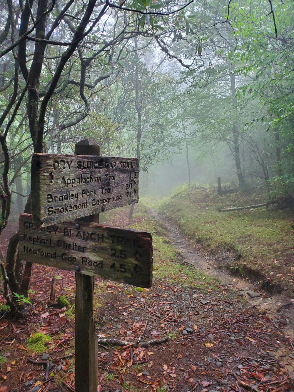
This lollipop begins at the bottom of Kephart Prong Trail, named after an early advocate for what is now America's most-visited National Park. According to Wikipedia, "Kephart was later named one of the fathers of the national park," and even "helped plot the route of the Appalachian Trail through the Smokies."
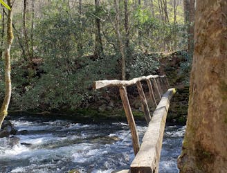
After climbing up Kephart Prong, the loop portion of the route is best run/hiked clockwise. It could be equally rewarding when reversed, and water is also abundant along the loop as long as you filter or treat it first. As with most trails in the Smokies, dogs are not allowed on any portion of this loop.
Both Charlies Bunion and The Jump Off come around the mid-point of the run, as you follow the Appalachian Trail. The turns can be easy to miss, but both spurs have been included in this GPS. Ice Spring Shelter is also located along this portion and is a great opportunity to refill on water. For those who only run when chased, it's also a great way to turn this loop into an overnight trip in the summer and fall. During the spring, however, it would be wise to find a campsite off of the Appalachian Trail since thru-hikers can quickly fill the shelter.
Difficult

Some trail sections have exposed ledges or steep ascents/descents where falling could cause serious injury.
Little chance of being seen or helped in case of an accident.
1 m away
An epic tour of the Smokies reserved for the most adventurous trail runners.
Severe Trail Running
5.8 km away
A classic loop from Smokemont Campground perfect for trail running.
Moderate Trail Running
4 routes · Trail Running