4.6 km away
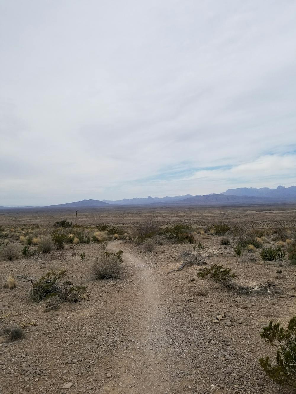
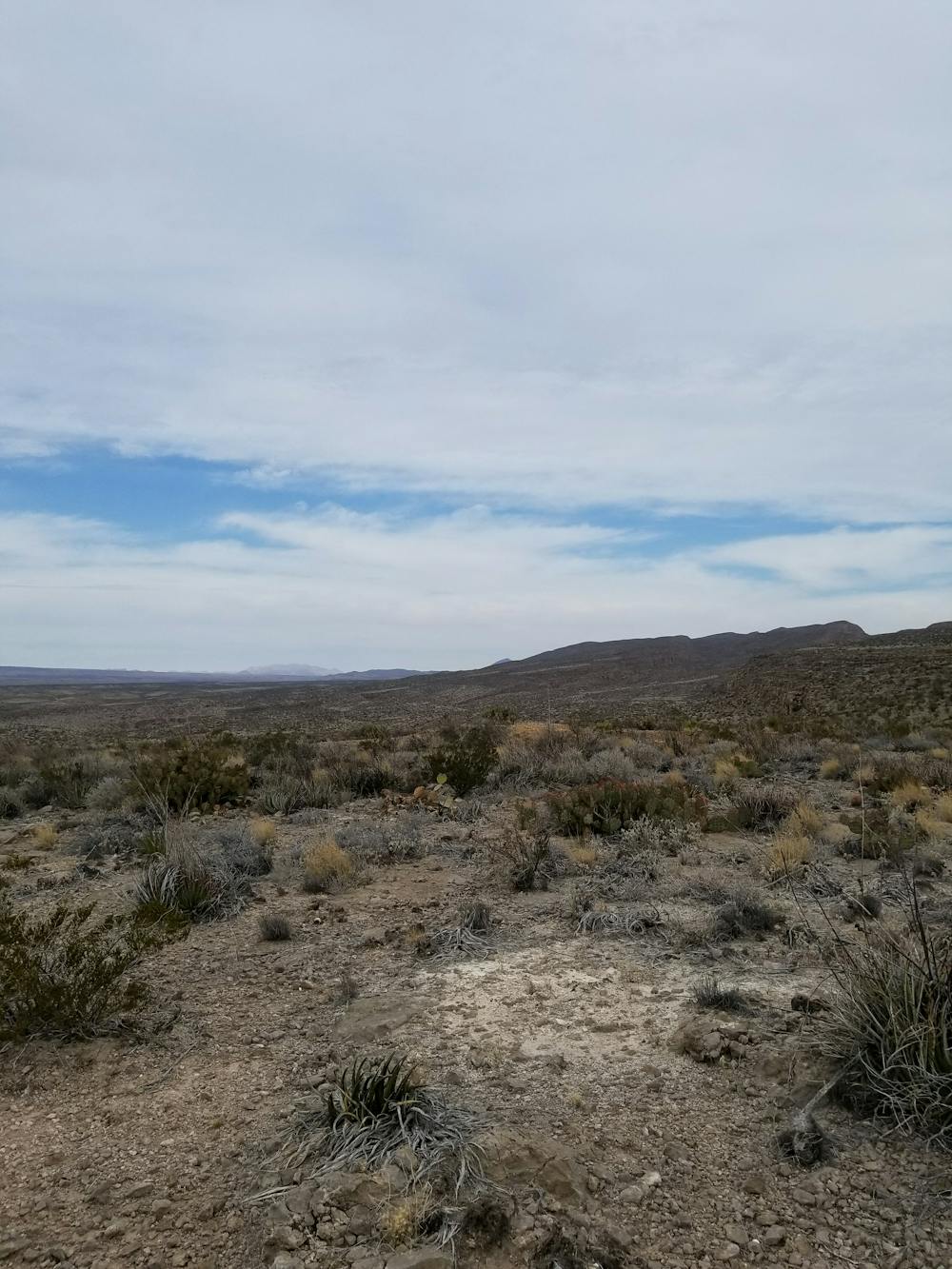
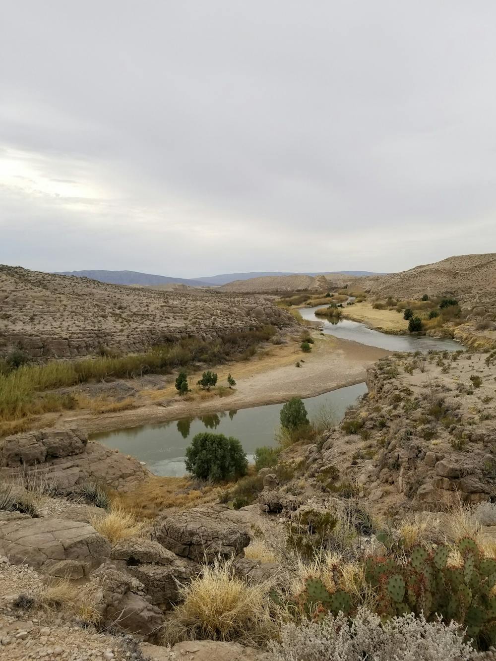
Marufo Vega Trail
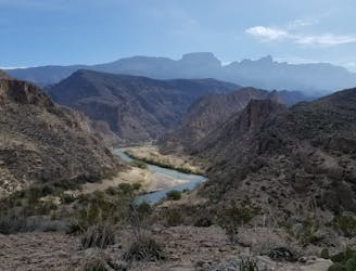
A remote loop in Big Bend National Park that traverses through a canyon and offers stunning views of the Rio Grande.
Severe Hiking
- Distance
- 21 km
- Ascent
- 749 m
- Descent
- 749 m
A popular hike through a historic region of Big Bend National Park.
Hiking Moderate

Located near the Rio Grande Village, this is one of the more popular hikes in Big Bend National Park. The hot spring, originally owned by J.O. Langford, maintains a year-round temperature of 105° F and "carries dissolved mineral salts reputed to have healing powers," according to the NPS. A shorter 0.25-mile hike from the western trailhead allows access to the spring.

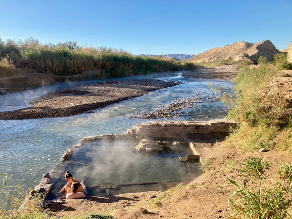
Lesser known to many, a hot spring in Mexico lies shortly down the river but now lies in disrepair. Should you visit Mexico via the ferry crossing, you may be able to convince a local to take you there.
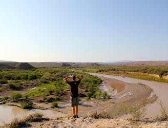
There are two ways to hike this trail: from the east or the west. The eastern trailhead is a short walk from Rio Grande Village, one of the main campgrounds in the park. The western trailhead is located at the end of a two-mile gravel road and is limited to passenger vehicles without trailers. A narrow stretch of road through a sandy wash may intimidate some drivers.
From the east, the hike begins with a steep climb up the side of a bluff where you're quickly welcomed with sweeping views of the distant Chisos Mountains. Ahead, soak in even more incredible views of the Rio Grand River below. On the opposing bank, you may catch glimpses of livestock or horses roaming along the shore looking for a place to cool off.
The western portion of this route has two separate trails that form a loop. The lower trail skirts along the river and takes hikers below sandstone bluffs and the namesake hot spring. The upper trail is more rugged, but offers some excellent views from above the bluff.
Sources: https://visitbigbend.com/j-o-langfords-hot-springs-brief-history/ https://www.nps.gov/bibe/planyourvisit/soakinthesprings.htm
Moderate
Hiking along trails with some uneven terrain and small hills. Small rocks and roots may be present.

The trail contains some obstacles such as outcroppings and rock which could cause injury.
Away from help but easily accessed.
4.6 km away
A remote loop in Big Bend National Park that traverses through a canyon and offers stunning views of the Rio Grande.
Severe Hiking
5.4 km away
A fun, family-friendly hike with both clifftop and riverside views of Boquillas Canyon.
Moderate Hiking
12 routes · Hiking
4 routes · Hiking