1 m away
Seminole Canyon State Park: Presa Overlook Out-and-Back
A rewarding out-and-back hike to an overlook of a canyon confluence.
Moderate Hiking
- Distance
- 5.7 km
- Ascent
- 67 m
- Descent
- 67 m
Hike along a scenic rock rim and then reach the US/Mexico border!
Hiking Difficult

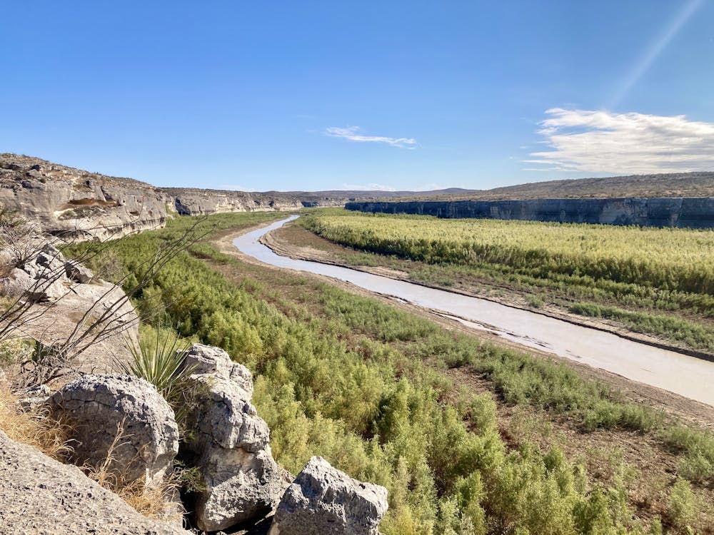
Seminole Canyon State Park is a hidden gem in the massive Texas State Parks system. Seminole Canyon is situated directly on the banks Rio Grande, which forms the US/Mexico border. While this isolated park might be small, it boasts incredible beauty and history.
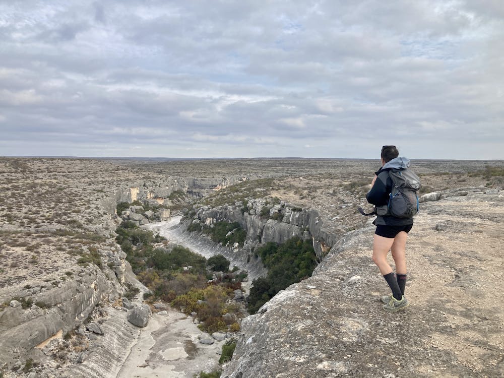

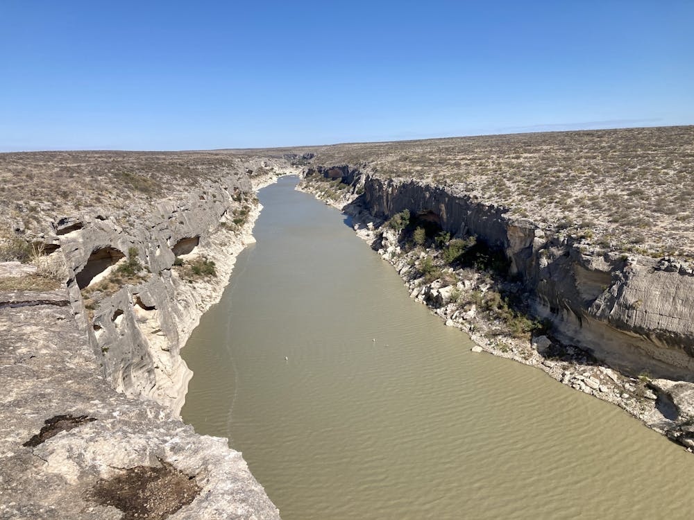
Seminole Canyon was primarily designated as a state park to protect pictographs left by early canyon dwellers. There are over 200 different pictograph sites in the park! While you can only hike down into the canyon and see the pictographs up close if you sign up for one of the guided tours, several trails along the top of the canyon provide access to the park's natural beauty and long-range views of pictographs on the far canyon walls.
The route mapped here makes the most of the trails at Seminole Canyon to create a beautiful loop
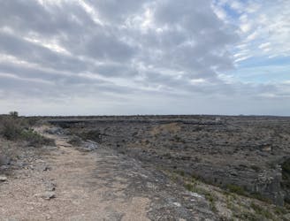
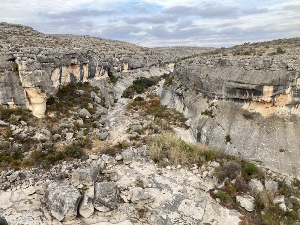
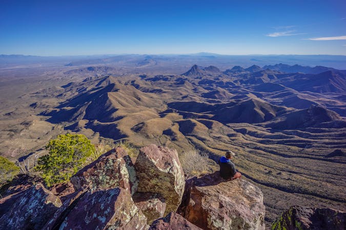
The hike begins on smooth, sandy singletrack, but soon the sand disappears in favor of a rough, rippled slickrock slab that runs along the rim of the canyon. While the slab of rock is pocked with shallow holes, there aren't any true obstacles to overcome in this section. This rippled slickrock forms about half of the loop, granting incredible views all along the way!
After passing the major overlook and shelter, which provides a long-range view of pictographs on the opposite canyon wall, comes the crux section of the trail. The singletrack drops steeply off the top of the mesa, descending steep rock gardens, a few ledges, and some loose sections, seemingly heading straight for the Rio Grande. The trail stops just short of the river, turning hard right on top of another cliff face that towers directly above the Rio Grande. It's a unique experience to get to hike the border of the country on top of a gorgeous rock cliff!
Take some time to soak it in, because it's over quickly. After you turn away from the rim, you'll have to grind back uphill to regain the top of the mesa, on trail that's just as technical as it was on the way down.
Once back on top, the technicality of the hike reduces dramatically. The return stretch of the loop mostly follows sandy doubletrack roads with nary a technical feature to be had. For a more engaging return route, drop back down to the rocky traverse along the canyon and turn this into a lollipop instead of a loop.
Difficult
Hiking trails where obstacles such as rocks or roots are prevalent. Some obstacles can require care to step over or around. At times, the trail can be worn and eroded. The grade of the trail is generally quite steep, and can often lead to strenuous hiking.

Some trail sections have exposed ledges or steep ascents/descents where falling could cause serious injury.

Away from help but easily accessed.
1 m away
A rewarding out-and-back hike to an overlook of a canyon confluence.
Moderate Hiking
14 routes · Hiking