Palo Duro Canyon: Comanche Loop
A classic singletrack loop pairing fast riverside flow trails with the infamous Comanche Trail, Palo Duro Canyon's most challenging singletrack.
Difficult Mountain Biking
- Distance
- 14 km
- Ascent
- 243 m
- Descent
- 243 m
A long XC tour of Palo Duro Canyon's classic mountain biking trails.
Mountain Biking Moderate

In contrast to the challenging Comanche Loop, this route samples some of the park's classic XC trails, including GSL, Little Fox, Juniper Cliffside, and Capitol Peak—which is the only trail in the park exclusively set aside for mountain biking. Wander through vibrant red rock canyons, through sandy washes, and along riverside bluffs on this must-do 15-mile route in Palo Duro Canyon.
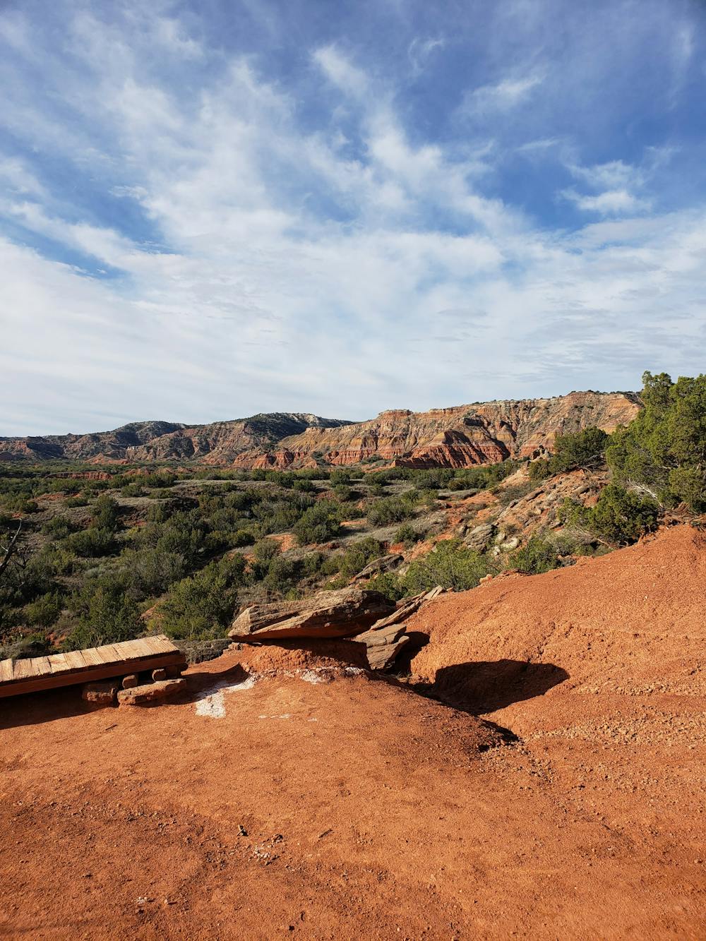
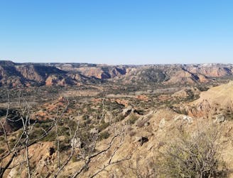
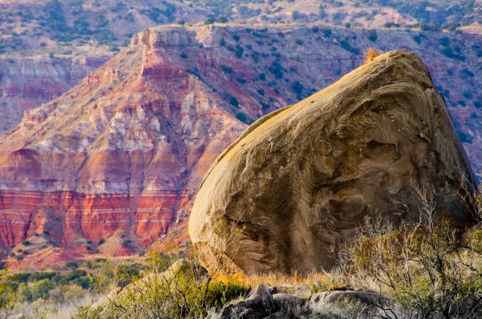
Palo Duro Canyon is the second largest canyon in the United States, second only to the Grand Canyon. It is the most visited state park in Texas, but has only recently become a destination for those outside of the region. There are multiple campgrounds within the park, plus limited backcountry sites and even a group campground that can be reserved. Current fees, including those to access the park can be viewed here.
As mapped, this route starts at the Chinaberry Day Use Area on the northern end of the park. You could also park at the GSL or Lighthouse trailheads, or access this loop from one of the campgrounds if you're spending the night. Chinaberry has picnic tables, potable water, and restrooms, making it a go-to for most visitors.
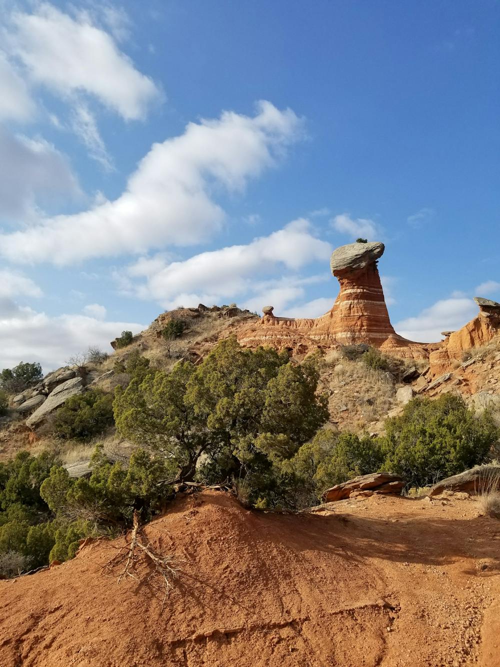
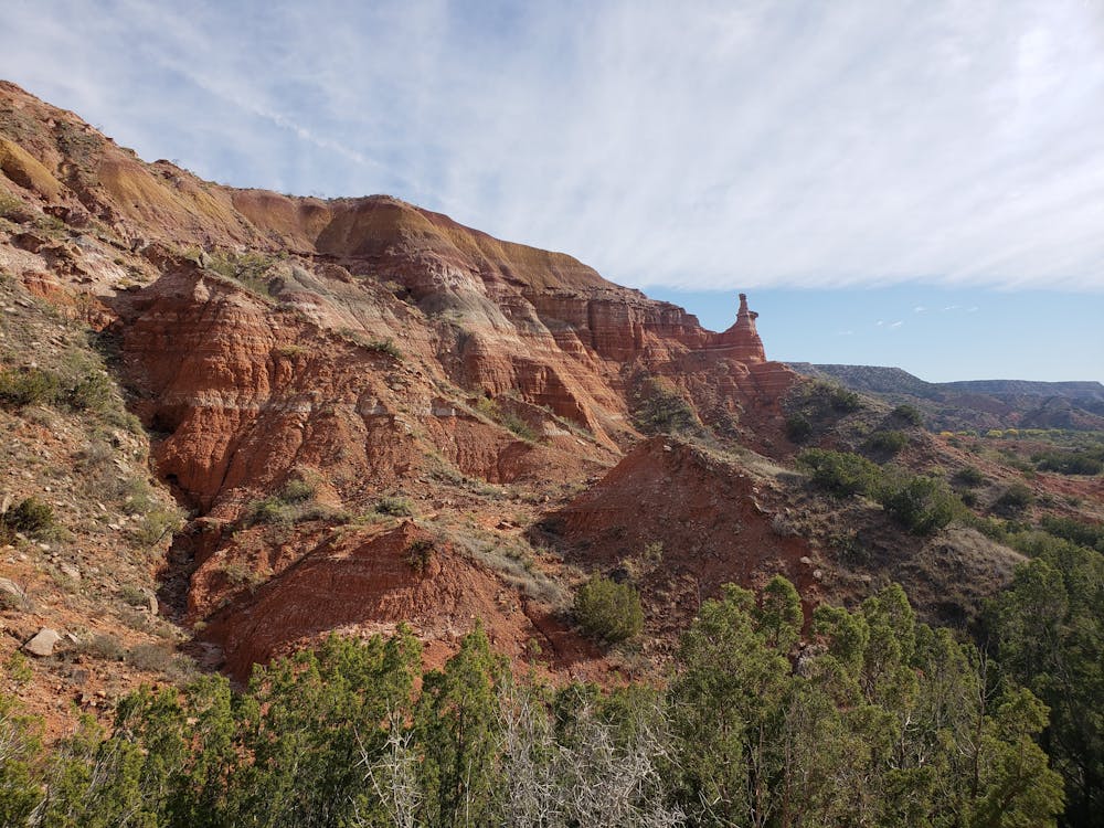
One major factor that makes this loop great is its versatility. It is equally enjoyable in either direction, and as you head south past the Lighthouse Trailhead, you can shorten the loop a number of ways. Capitol Peak Trail has several side trails you could explore, and Little Fox Loop is a spur through a quiet sandstone canyon lined with sandy washes, and the famous "Beach Box," a small kiosk that welcomes riders to sign their name on an unofficial trail registry.
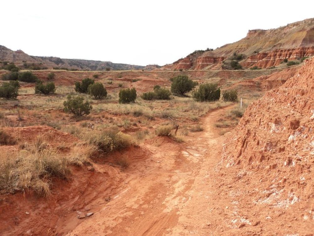
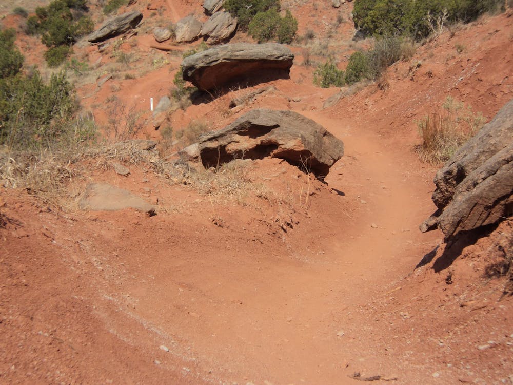
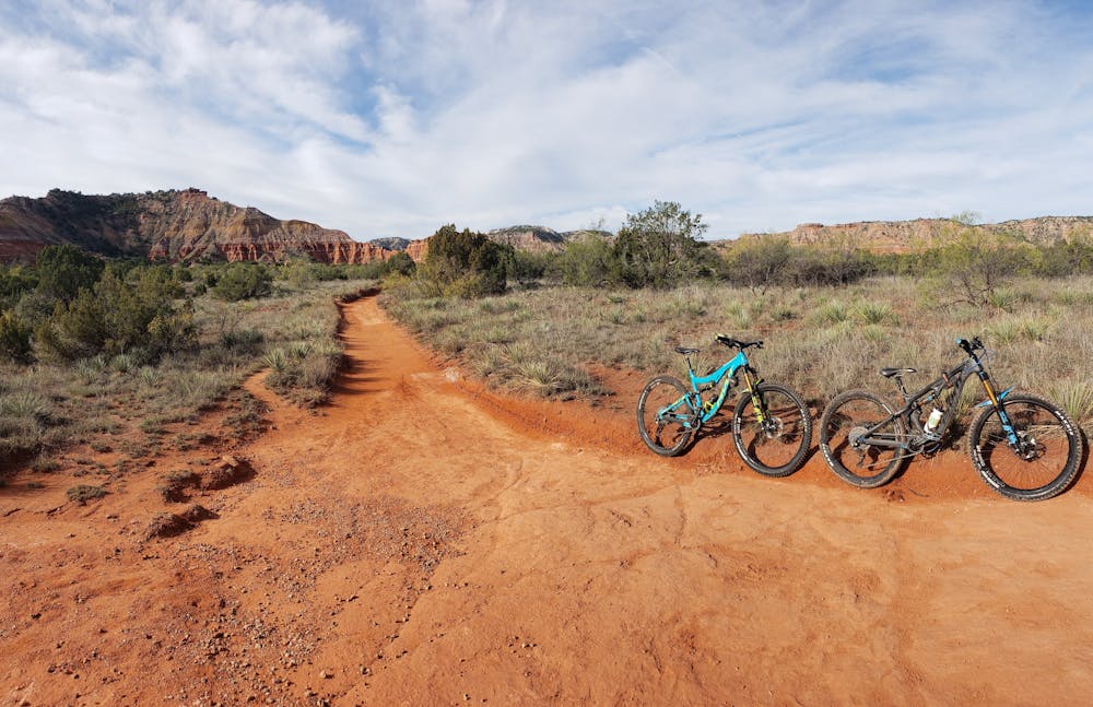
Most of this loop is suitable for a hardtail or XC setup with 120mm of travel. Single-speeders also love this loop, given there are no long, sustained climbs. The lower sections along Juniper Cliffside and Riverside are fast and flowing along the creek, with only a few steep inclines to test your lungs. Capital Peak is slow and winding and requires a bit more finesse, and Givens/Spice/Lowry (GSL) Trail wanders along the edge of stunning red rock formations and offers several fast, flowy descents no matter which way you ride it.
Worth noting, Palo Duro Canyon is infamously known for causing flat tires from both punctures and torn sidewalls. If you are running tubeless, consider topping off your sealant before your ride, and pack at least one tube and emergency patch kit. Water is also sparse during the summer months, and temperatures can reach well over 100 degrees, so pack adequate gear and get an early start if the forecast calls for high temperatures.
Moderate
Mostly stable trail tread with some variability, with unavoidable obstacles 8in/20cm tall or less. Other obstacles such as rock gullies and steep sections may exist. Ideal for lower intermediate riders.

The trail contains some obstacles such as outcroppings and rock which could cause injury.

Little chance of being seen or helped in case of an accident.
A classic singletrack loop pairing fast riverside flow trails with the infamous Comanche Trail, Palo Duro Canyon's most challenging singletrack.
Difficult Mountain Biking
5 routes · Mountain Biking · Hiking · Trail Running