6.1 km away
North Franklin Mountain
A 13.1-mile out-and-back to North Franklin Mountain, the highest peak in El Paso.
Difficult Trail Running
- Distance
- 21 km
- Ascent
- 929 m
- Descent
- 929 m
An epic run tour of the Franklin Moutains utilizing Mundys Gap and the Northern Pass to bridge the east and west side of the mountain.
Trail Running Difficult

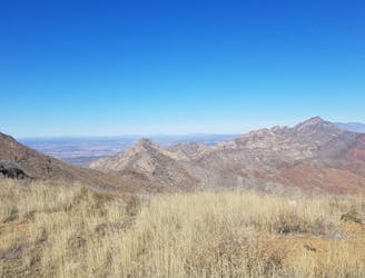
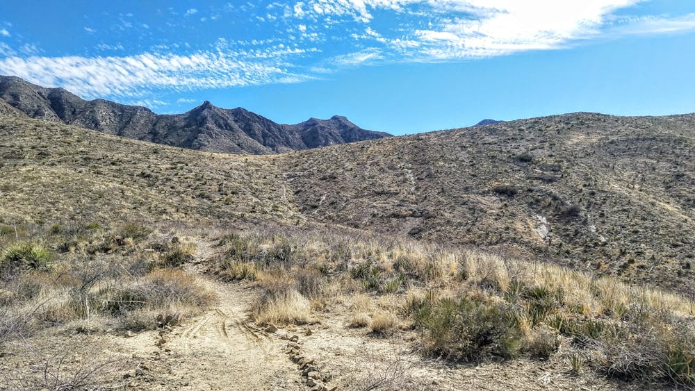
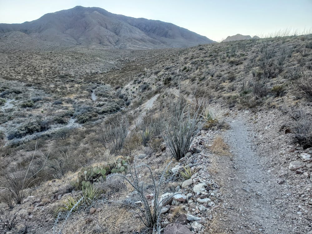
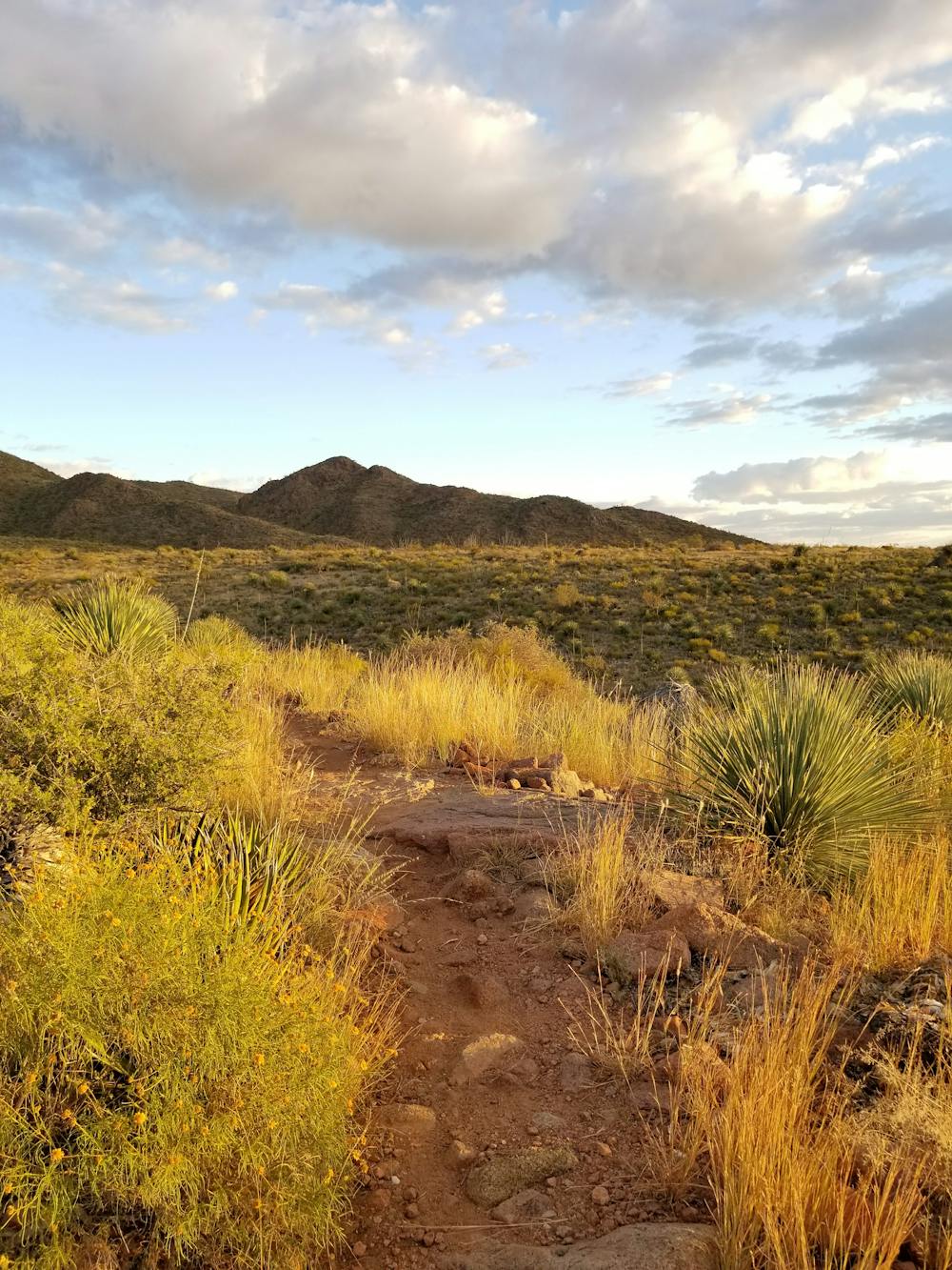
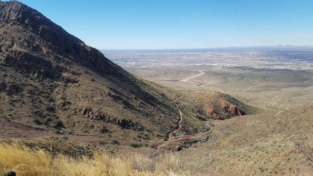
This trail run around the Franklin Mountains is arguably the most epic run you can map out in the area. Starting on the west side of the state park, you begin with a grueling climb through Mundys Gap followed by relaxing and beautiful singletrack along Scenic Road and Sotol Forest. After heading through the mountain's northern pass, you'll enjoy quiet rolling singletrack along the western foothills of the range and a finish near the picnic pavilion with a view to the west.
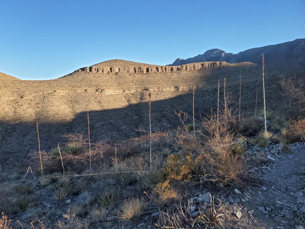
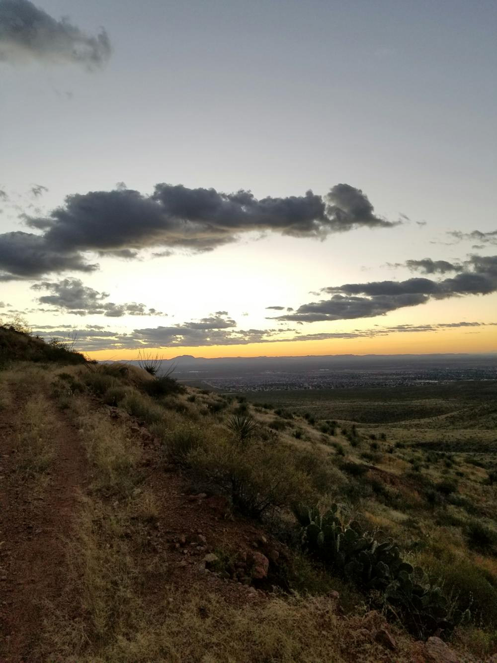
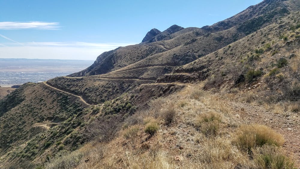
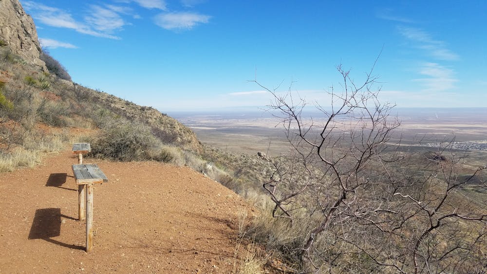
If you're eying this loop, there are a few things you should know as a runner. First, there is no potable water available anywhere along the trail, and none immediately available at the trailhead. The mid-day summer heat can also be unbearable, so an early morning start is recommended if you plan to run during the warmer months. Trekking poles are recommended by some, though despised by others - since the rocky and loose climbs can be conquered without them just as effectively to some.
This run begins at the picnic area in the Tom Mays Unit of the Franklin Mountains SP. You could also park at Chuck Heinrich Memorial Park and access the loop a number of ways. There is plenty of parking, no matter what you drive, and there are vault toilets nearby. Water and other drinks can also be purchased at the visitor center when you arrive. There is also a $5 day pass required to enter the park if you are not a Texas State Parks Pass holder.
For those looking to spend the night in the park, many of the campsites are located within walking distance from where this hike begins. Primitive walk-in, drive-up, and group campsites can all be viewed and reserved here. The park ranger is also eager to provide recommendations for campsites should you have any questions.
For those wondering, this loop is also open to both hikers and mountain bikers. Bikers should expect a considerable amount of hike-a-bike, and hikers should plan to finish within a day since camping is restricted in the backcountry.
Difficult

Some trail sections have exposed ledges or steep ascents/descents where falling could cause serious injury.
Little chance of being seen or helped in case of an accident.
6.1 km away
A 13.1-mile out-and-back to North Franklin Mountain, the highest peak in El Paso.
Difficult Trail Running

7 routes · Mountain Biking · Hiking · Trail Running
22 routes · Mountain Biking · Hiking · Trail Running