Deseret Peak
A fabulous journey through varied and beautiful terrain.
Hiking Difficult
- Distance
- 13 km
- Ascent
- 1.2 km
- Descent
- 1.2 km
- Duration
- 4-5 hrs
- Low Point
- 2.3 km
- High Point
- 3.3 km
- Gradient
- 14˚

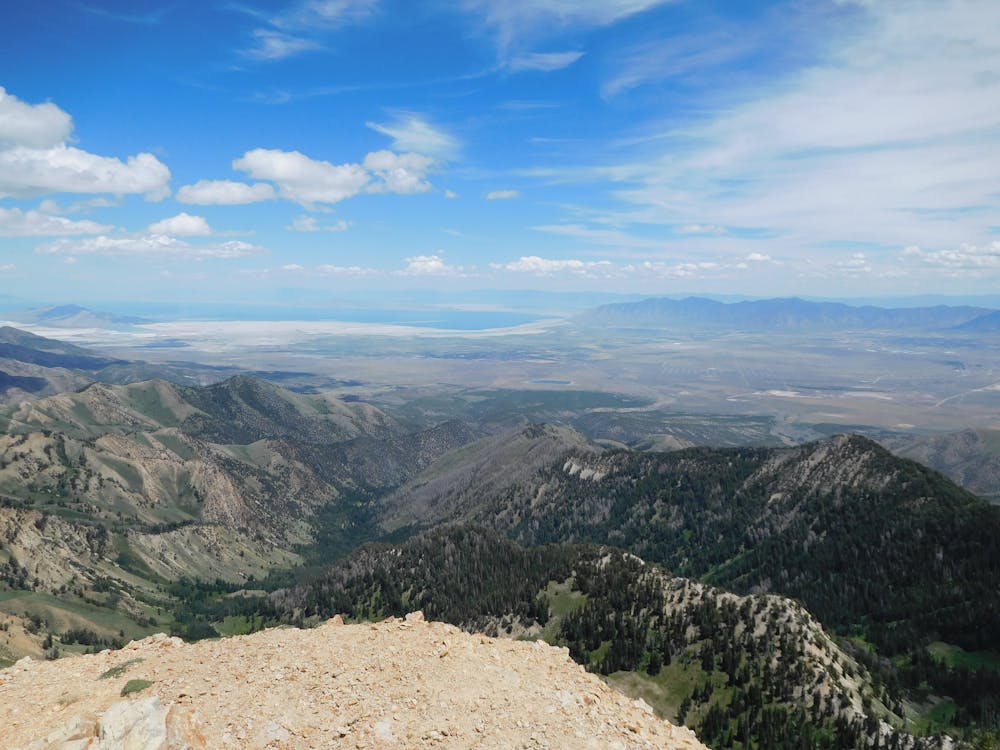
Lying south-west of Salt Lake City, the Deseret Peak Wilderness area is a truly special place. It has numerous types of terrain and has views of lakes, salt flats and a series of small towns! It takes you well above 3000 metres so expect to feel the altitude at times during the day.
- •
- •
- •
- •
Description
Head west out of Salt Lake City and pass through the small town of Grantsville before heading up S Willow Canyon Road to reach the Loop Campground, where the road ends. There are several parking places but park considerately and leave maximum space for other hikers to park their cars.
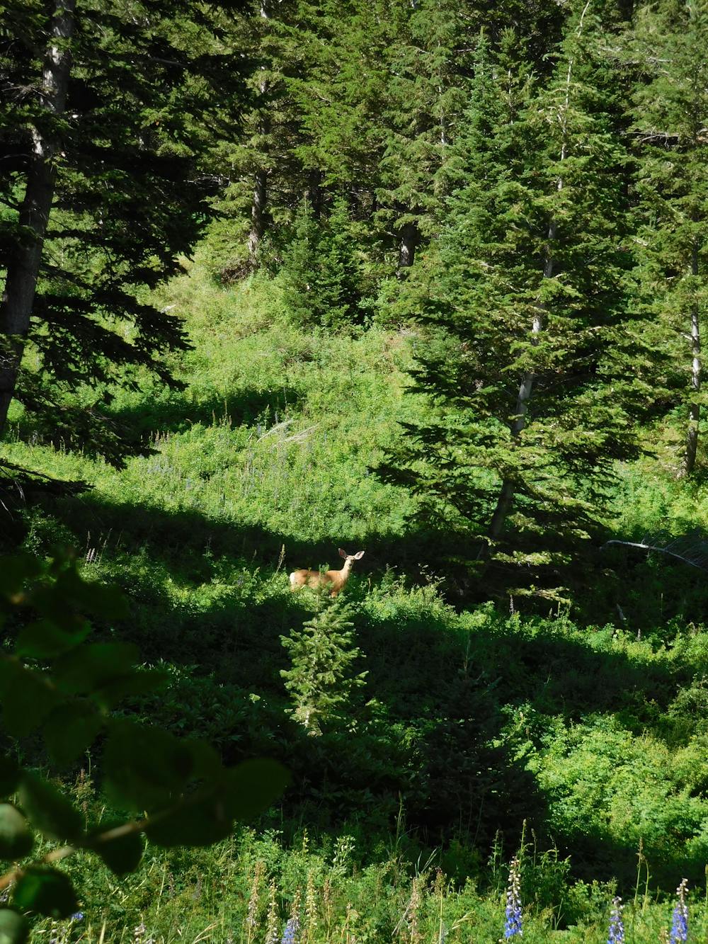
Hike south-west away from your car into beautiful quiet forests, where you might be lucky enough to spot a deer. Shortly after crossing a stream the path splits. Go left and continue climbing up through forests all the way to Deseret Peak's east ridge. Upon cresting the ridge you get a fabulous view of the barren flats south and west of the Deseret Peak.
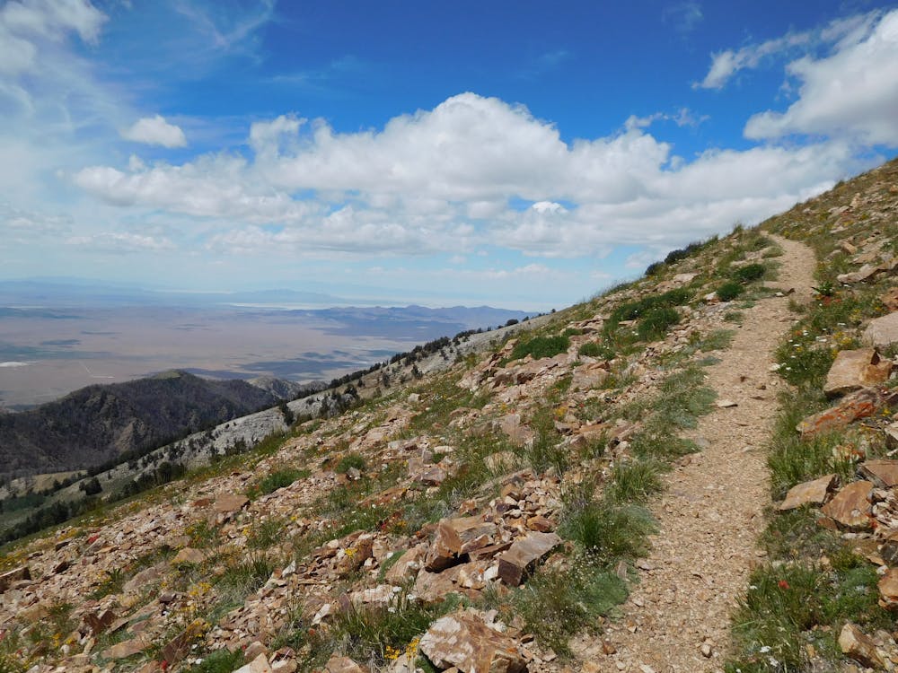
Turn right and follow the ridge (or just to the left of it) all the way to the summit. The panorama of the Great Salt Lake, the Bonneville Salt Flats and the mountains all around is truly spectacular and helps you appreciate just how huge the terrain is around here. The famous "Big Sky" of the American West is also very prominent.
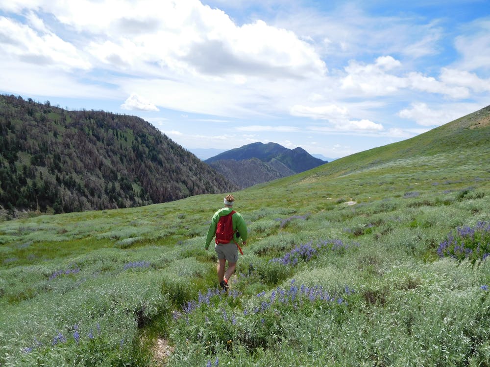
From the summit head north along a ridge which undulates through huge, expansive terrain. Eventually the path you're following branches right off the ridge and drops into a forested bowl, not dissimilar from the one you climbed at the start of the day.
Descend the bowl and exit it southwards into the valley your day started in. Join the trail you left around 6 hours ago and follow it back to the Loop Campground.
Difficulty
Difficult
Hiking trails where obstacles such as rocks or roots are prevalent. Some obstacles can require care to step over or around. At times, the trail can be worn and eroded. The grade of the trail is generally quite steep, and can often lead to strenuous hiking.
Medium Exposure

The trail contains some obstacles such as outcroppings and rock which could cause injury.
Remoteness

Little chance of being seen or helped in case of an accident.
Best time to visit
Features
- Wildlife
- Picturesque
- Summit Hike
- Wild flowers
- Forestry or heavy vegetation