5.1 km away
Fiery Furnace
This off-trail hiking area provides one of Moab's most challenging—and rewarding—hiking experiences.
Extreme Hiking
- Distance
- 2.9 km
- Ascent
- 180 m
- Descent
- 180 m
The most difficult maintained trail in Arches National Park.
Hiking Severe

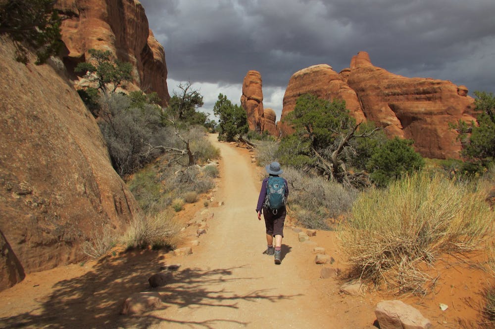
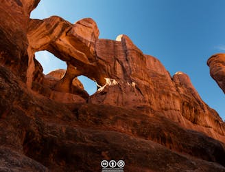
The Devil's Garden trail is the most difficult maintained trail in Arches National Park. Only Fiery Furnace—the unmarked, unsigned, and unmaintained scrambling area—is more difficult… until you get into full-on rock climbing and bouldering, that is. "Once you get past the early sections you'll be scrambling up and over long, narrow sandstone fins (future arches!), ducking under and crawling through existing arches, and trekking through ruggedly beautiful backcountry that few of the more casual tourists in Arches will ever get to see," writes Casey Schreiner on ModernHiker.com.
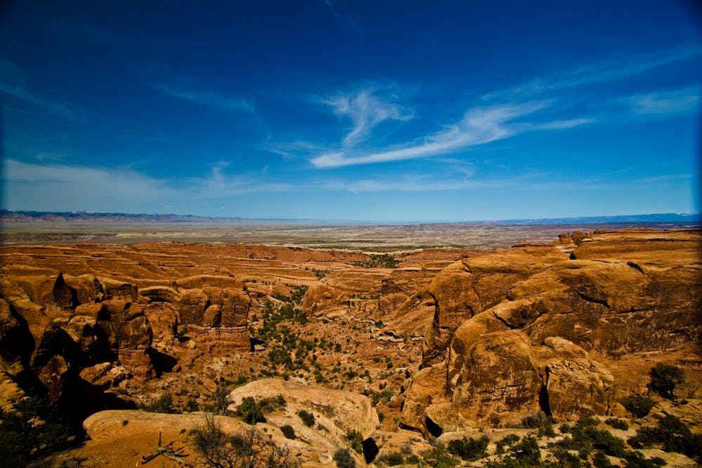
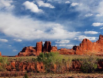
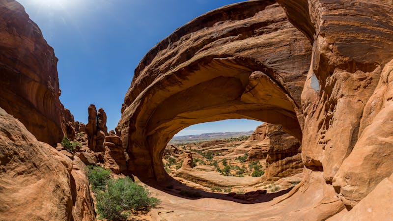
The Devil's Garden trailhead is located deep in the national park, at the end of the paved park road. This remote landscape is one of the premier locations in the park, but due to the length of the hike and the difficulty, it is one of the least visited areas in Arches National Park. But if you're up to the challenge, the Devil's Garden area will reward you with an incredible array of beautiful sandstone formations!
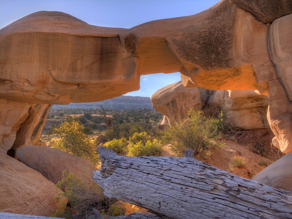
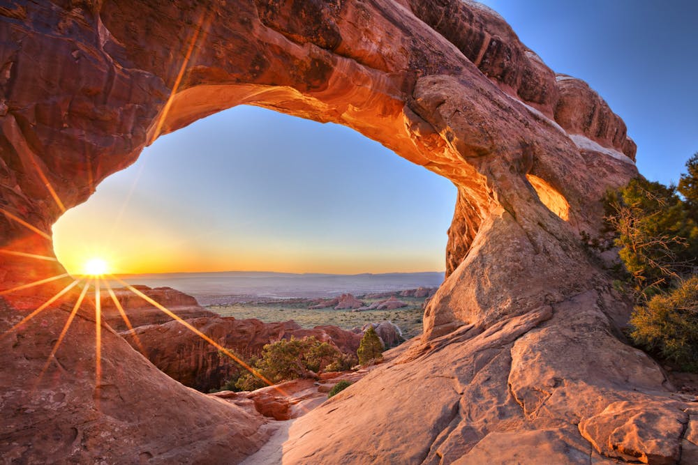
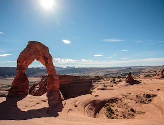
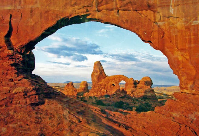
One of the most famous formations in this zone is Landscape Arch. "Landscape Arch is the longest arch in North America with a light opening of 306 feet (93.3 meters)," according to the NPS. "This awe-inspiring expanse is only 6 feet (1.8 meters) in diameter at its narrowest."
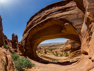
If you're interested in a more difficult hike, the trail to Double O will challenge your scrambling skills. According to the NPS, the "footing is rocky; there are narrow ledges with steep drop-offs. Hikers must use their hands and feet to scramble and climb. Though strenuous, the out-and-back hike to Double O Arch (4.2 mi/6.8 km roundtrip) is popular and offers incredible views."
Due to the intricate nature of the Devil's Garden area, you can tailor the length of your hike to how much time and energy you have. If you want to hike all of the various spur trails, you can craft a full-day adventure in this area. Or, you can choose to simply hike the main trail (or a portion thereof) for a more approachable day out in the rocks.
Severe
Hiking challenging trails where simple scrambling, with the occasional use of the hands, is a distinct possibility. The trails are often filled with all manner of obstacles both small and large, and the hills are very steep. Obstacles and challenges are often unexpected and can be unpredictable.

Some trail sections have exposed ledges or steep ascents/descents where falling could cause serious injury.
Little chance of being seen or helped in case of an accident.
5.1 km away
This off-trail hiking area provides one of Moab's most challenging—and rewarding—hiking experiences.
Extreme Hiking
7 km away
Hike to one of the most remote arches in Arches National Park.
Moderate Hiking
8.3 km away
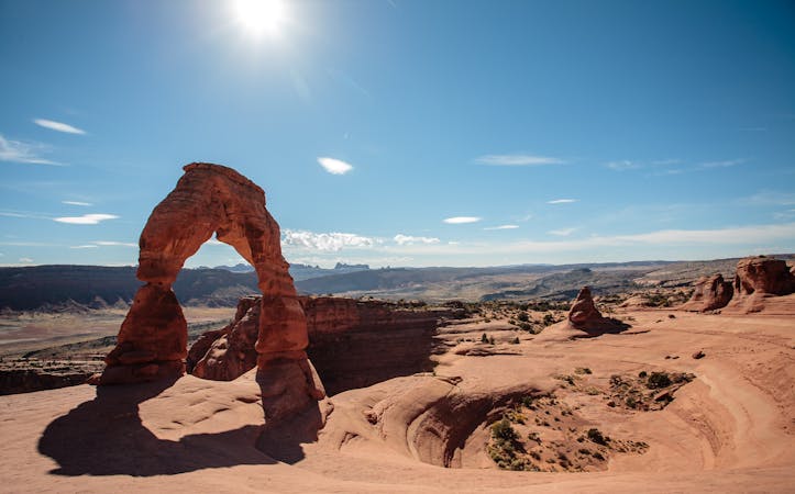
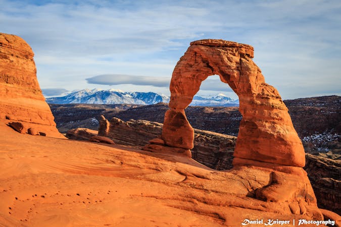
Hike to the iconic arch in Arches National Park.
Moderate Hiking
8.6 km away
A warm up in distance and difficulty for the 800-mile backcountry journey along the Hayduke Trail.
Difficult Hiking
6 routes · Hiking
14 routes · Hiking
4 routes · Mountain Biking · Hiking

14 routes · Hiking

25 routes · Alpine Climbing · Hiking

10 routes · Hiking

10 routes · Hiking
5 routes · Hiking

63 routes · Alpine Climbing · Hiking