
10 routes · Hiking
The highest peak on a spectacular island in the middle of the Great Salt Lake.
Hiking Difficult

The 5th most visited State Park in Utah (which is quite something when you consider its competition!), Antelope Island is a magical place. It's reached via a causeway (which costs $10 per vehicle) at the north-eastern end of the island and is home to some magnificent campsites. Bridger Bay, at the north-western corner of the island is probably the best and has fabulous sunset views and a beach close by where you can "swim" (the extremely high salt levels in the make swimming impossible because you can't keep your legs in the water!) in the Great Salt Lake itself.
Antelope is also home to some excellent hikes and despite the relatively large number of tourists who come to the island, very few people venture far from the road and the visitor centre, so you could well have this adventure all to yourself.
This route takes you to the highest point on the island - Frary Peak - and offers fantastic and very unusual views. Drive south on Antelope Island Road and then turn off right onto Frary Peak Trailhead Road and drive up to the large parking area.
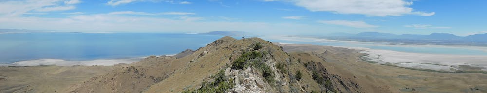
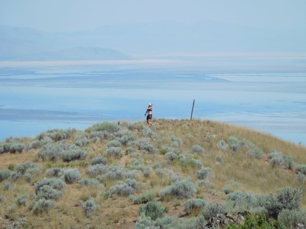
Follow the clear path south-west past Dooly Knob (a small summit which you can bag on the way down from Frary Peak) and then climb steeply up to Frary Peak's north ridge. Follow the ridge, which is initially wide and varied, all the way to where it narrows just south-east of Stringham Peak. From here you need to take slightly more care as the ridge gets rockier and more exposed but it's never difficult or scary.
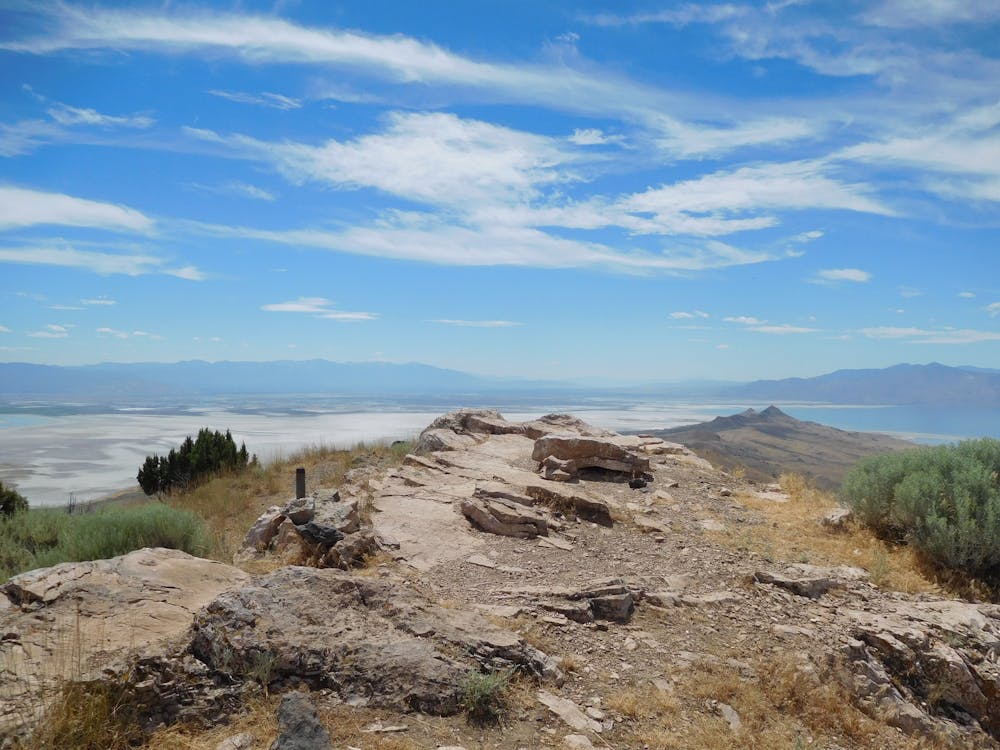
Upon reaching the summit sit down and soak in the enourmous views and the huge blue sky. The Great Salt Lake is an epic geographical feature and the massive space of Utah is extraordinary.
Retrace your steps to the car and grab an ice cream at the Antelope Island Visitor Centre to celebrate.
Difficult
Hiking trails where obstacles such as rocks or roots are prevalent. Some obstacles can require care to step over or around. At times, the trail can be worn and eroded. The grade of the trail is generally quite steep, and can often lead to strenuous hiking.

The trail contains some obstacles such as outcroppings and rock which could cause injury.

Little chance of being seen or helped in case of an accident.
10 routes · Hiking