
14 routes · Hiking
Cross the often-snowy Henry Mountains and the trail's highpoint, then descend back into canyon country toward Capitol Reef National Park.
Hiking Severe

From Highway 95, continue to follow Poison Springs Canyon dirt road toward the mountains. You’ll dip in and out of washes for a few miles, then leave the road at Butler Wash and pick your way through cliff bands to reach the bottom. Soon this canyon widens, and you’ll join another dirt road heading straight for the foot of the Henrys. Enjoy progressively cooler air and gradual appearance of pine trees as you climb steadily in elevation.
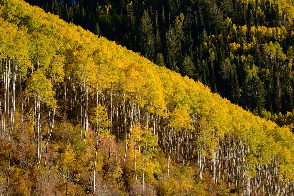
The road enters Crescent Creek Canyon, where there’s likely to be water, then begins its steep and winding climb along mountainside drainages. The forest turns to shady mixed conifer and aspen groves as you go up. From clearings, views over the desert you’ve just traversed are hugely inspiring. Pay close attention to your surroundings, and you might spot some bison. An introduced herd thrives in the Henrys, but they are elusive.
Snow can linger on these slopes into early summer. In early spring, or even later in a heavy snow year, expect a lot of miserable post-holing in the Henrys. It may be worthwhile to acquire snowshoes. You can alternatively take one a low-elevation bypass route, but the crossing at 11,419 feet elevation is a pillar of the Hayduke and deserving of bragging rights if you surmount it. The climax of the Henrys is a long ridge traverse above treeline, climbing to the trail’s highpoint on Mount Ellen’s south summit, then descending its airy spine to the far side of the range.
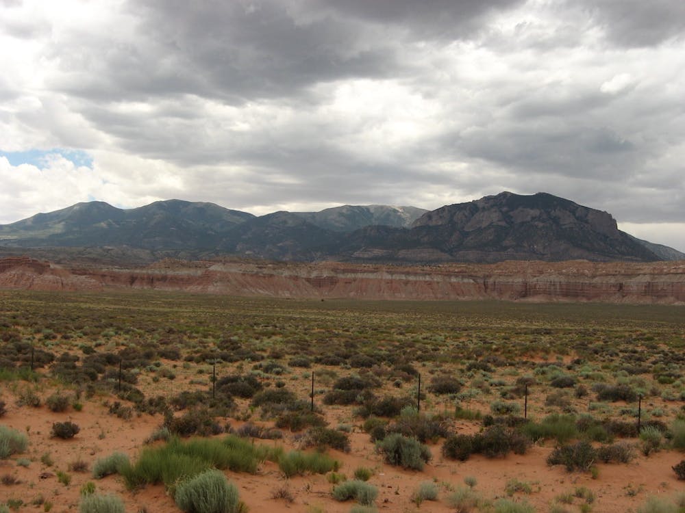
Next, you’ll stroll through juniper-fringed sagebrush meadows atop Tarantula Mesa, following a dirt road for a while, but then comes the crux of the whole section—getting off the mesa. It’s a scrambling route through a cliff band that goes safely only in one spot, which is hard to pick out from above. Proceed cautiously here. Once you’re down, you’ll briefly follow a wash before breaking out to cross gravelly hills and bouldery canyons, passing a spring or two along the way. On this section, progress is easiest if you stick to game trails and old mining roads, though they become faint and maze-like in some places.
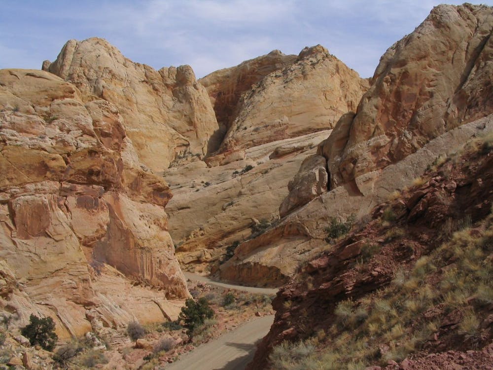
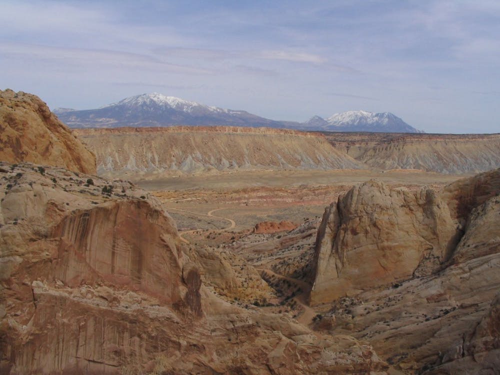
Eventually, you’ll join another wash in an ever-deepening canyon. Follow this for a while until it spits you out in the broad valley of the Waterpocket Fold, a huge ridge of buckled-up white sandstone. Cross this valley to join the Burr Trail, which cuts through a canyon then up broad switchbacks to find the other side of the fold, and to enter Capitol Reef National Park.
Sources: http://www.hayduketrail.org/TheRoute.html http://www.hayduketrail.org/Updates.html https://www.little-package.com/blog/2017/11/hayduke-trail-tips http://www.acrossutah.com/wordpress/hayduke-tarantula-mesa/ https://caltopo.com/m/5J0S https://caltopo.com/m/6V45 https://www.postholer.com/journal/Hayduke-Trail/2013/buck30/2013-05-20/SECTION-NOTES-FOR-FUTURE-HIKERS/37920
Severe
Hiking challenging trails where simple scrambling, with the occasional use of the hands, is a distinct possibility. The trails are often filled with all manner of obstacles both small and large, and the hills are very steep. Obstacles and challenges are often unexpected and can be unpredictable.

Some trail sections have exposed ledges or steep ascents/descents where falling could cause serious injury.

In the high mountains or remote conditions, all individuals must be completely autonomous in every situation.
14 routes · Hiking