461 m away
Sulphur Creek Canyon
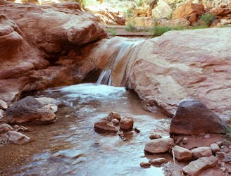
Wade and scramble through the twisting narrows of a deep canyon flowing with cold water.
Severe Hiking
- Distance
- 9 km
- Ascent
- 46 m
- Descent
- 227 m
A day or overnight hike through a canyon of colossal proportions, buried in the backcountry of the national park.
Hiking Difficult

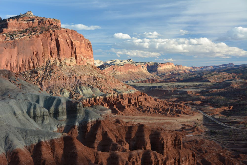
Spring Canyon is a long and deep gorge that cuts roughly west to east in the northern part of Capitol Reef National Park, deep into colorful sandstone layers. Among all the canyons in Capitol Reef, Spring is one of the most extensive and impressive. However, this canyon does not have any designated trails within it, so it gets overlooked on most park maps. Hiking in the wash through the canyon bottom is the way to go, but it takes some work just to get into it.
Lower Spring Canyon is the section mapped here. This is arguably the more spectacular of the two halves of Spring Canyon (Upper and Lower). It’s defined as the section between the junction of Chimney Rock Canyon and Highway 24 near the Fremont River. You can get into Lower Spring Canyon rather easily via Chimney Rock Canyon, but exiting requires fording the Fremont River to get to the highway.
It’s typical to do Lower Spring as a one-way hike, leaving one vehicle at a pullout near the endpoint and taking another vehicle to Chimney Rock Canyon trailhead. This makes a reasonable but difficult day hike or an overnight backpacking trip. Permits are required for camping.
Beginning at Chimney Rock Canyon, you’ll be on a popular hiking trail, but you’ll extend this to reach Spring Canyon by hiking farther down canyon in the wash. This hike is impressive in its own right, winding between vertical red walls and various other rock layers of Capitol Reef. Once in Spring Canyon, the predominant rock becomes yellowish Navajo sandstone, which rises in megalithic domes and spires overhead, and forms sinuous narrows in the canyon bottom.
The hiking through Lower Spring Canyon is mostly straightforward, but at one point, you must bypass a section of narrows that ends in a dry fall. This requires traversing a narrow ledge above an exposed drop-off. It’s not too difficult but requires extreme caution, especially if hiking with heavy packs. Other parts of the canyon have minor dry falls and boulder jumbles to negotiate. The final difficulty is fording the river, which can be impossible if it’s rained recently. Whether doing Lower Spring Canyon as a day hike or backpacking trip, you should check with rangers at the visitor center to get an update on conditions before setting out.
Sources: https://www.nps.gov/care/planyourvisit/springcanyon.htm https://liveandlethike.com/2015/03/11/lower-spring-canyon-capitol-reef-national-park-ut/
Difficult
Hiking trails where obstacles such as rocks or roots are prevalent. Some obstacles can require care to step over or around. At times, the trail can be worn and eroded. The grade of the trail is generally quite steep, and can often lead to strenuous hiking.

Some trail sections have exposed ledges or steep ascents/descents where falling could cause serious injury.
Little chance of being seen or helped in case of an accident.
461 m away
Wade and scramble through the twisting narrows of a deep canyon flowing with cold water.
Severe Hiking
6 km away

A backcountry route for seasoned desert hikers, potentially linking with the more popular Lower Spring Canyon.
Severe Hiking
7.3 km away
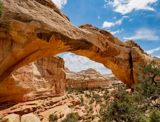
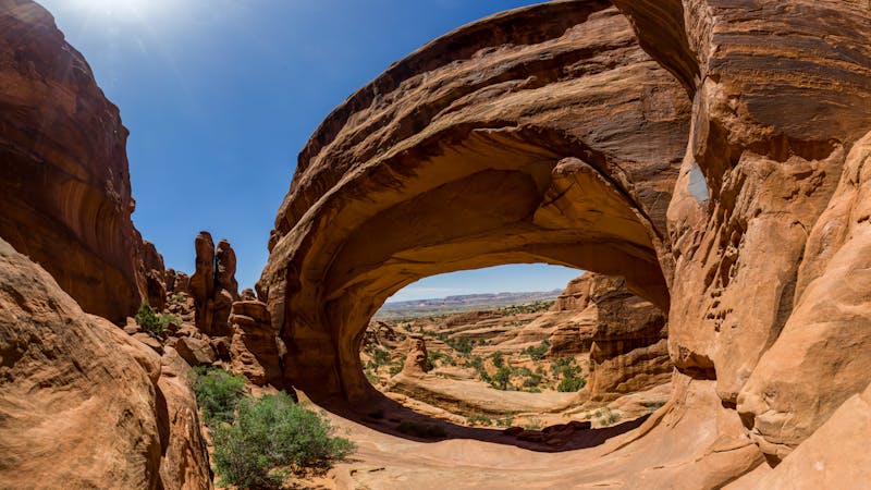
Capitol Reef's most popular hike leads to a massive natural arch soaring 125 feet high!
Moderate Hiking
8 routes · Hiking
5 routes · Hiking

63 routes · Alpine Climbing · Hiking