461 m away
Lower Spring Canyon
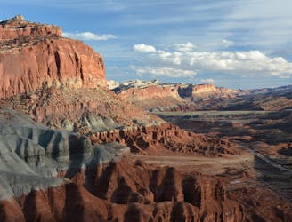
A day or overnight hike through a canyon of colossal proportions, buried in the backcountry of the national park.
Difficult Hiking
- Distance
- 16 km
- Ascent
- 402 m
- Descent
- 651 m
Wade and scramble through the twisting narrows of a deep canyon flowing with cold water.
Hiking Severe

Sulphur Creek is a narrow, twisting canyon that flows with water all year long. Capitol Reef’s ever-popular Goosenecks Overlook peers into this gorge, but hiking through the depths of its sinuous bends is far better than just seeing them from above.
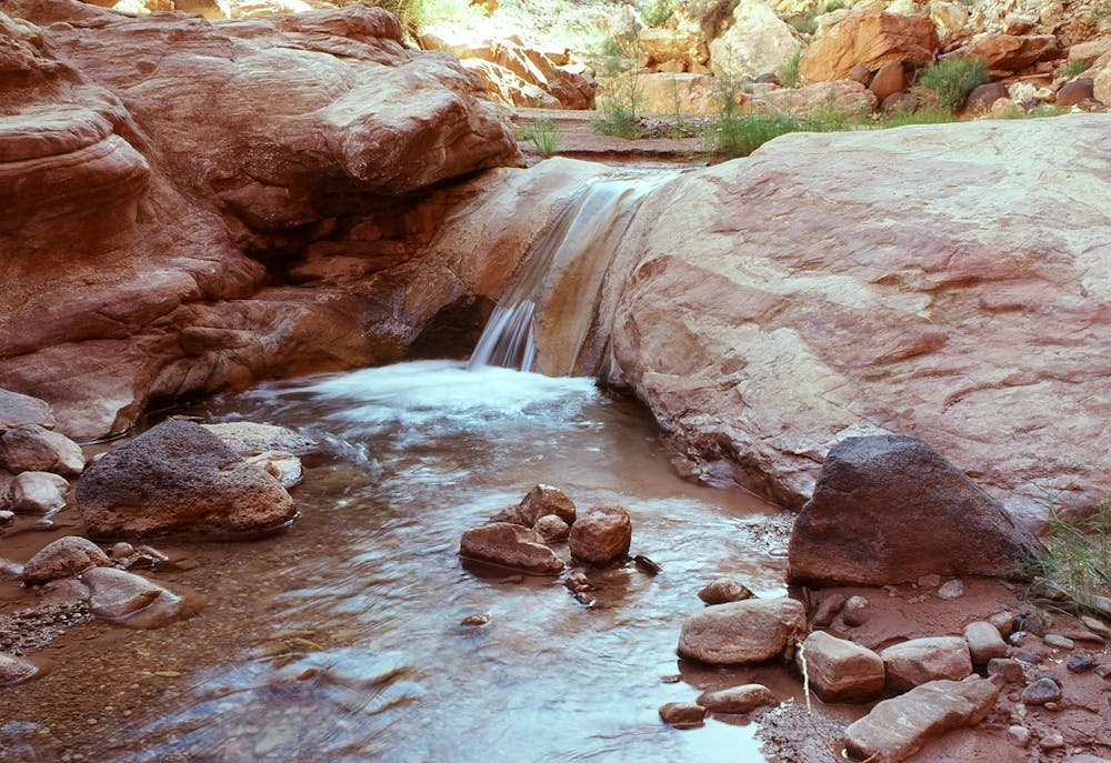
It’s not a hike on a trail, but more like a slog and scramble through the creek and boulders at the bottom of the canyon. Despite the difficulty, Sulphur Creek remains one of the more popular unofficial routes in Capitol Reef National Park. On a hot summer day, the promise of cool water and shade is hard to pass up in the Utah Desert. This one must be avoided if thunderstorms are in the forecast, however, because flash floods are deadly in a canyon so deep and narrow.
You may start at the Chimney Rock trailhead or at a pullout a bit farther along the road, then find the path that drops down into a wash. Walk this dry wash to its confluence with Sulphur Creek, where you’ll find the flowing water. Continuing downstream, the canyon walls rise and close in, eventually leaving no choice but to walk in the creek itself. This feels quite nice on a hot day, but uncomfortably cold otherwise, amid permanent shade within the narrows.
In three different places, the creek tumbles over waterfalls about 10 feet in height. They all require ledgy scrambles to bypass, so you’ll want good shoes for these and other friction-dependent maneuvers in the canyon. Those afraid of heights or uncomfortable with hand-and-foot scrambling might have a hard time with Sulphur Creek. You must also be comfortable swimming, because the water level varies and some pools might be too deep to wade across.
Completing the entire canyon end to end will deposit you back at the highway at the visitor center. It’s best to have two vehicles and leave one here before you start, ideally with dry clothes and shoes waiting. Public transport is not available, so the only alternatives are to walk along the highway or hitchhike back to Chimney Rock trailhead. Note that instead of hiking this full route as a one way, you could do an out and back from the visitor center and go as far up the canyon as you are willing.
Sources: https://www.nps.gov/care/planyourvisit/sulphur-creek.htm https://liveandlethike.com/2015/04/08/sulphur-creek-capitol-reef-national-park-ut/
Severe
Hiking challenging trails where simple scrambling, with the occasional use of the hands, is a distinct possibility. The trails are often filled with all manner of obstacles both small and large, and the hills are very steep. Obstacles and challenges are often unexpected and can be unpredictable.

Some trail sections have exposed ledges or steep ascents/descents where falling could cause serious injury.
Little chance of being seen or helped in case of an accident.
461 m away
A day or overnight hike through a canyon of colossal proportions, buried in the backcountry of the national park.
Difficult Hiking
5.6 km away

A backcountry route for seasoned desert hikers, potentially linking with the more popular Lower Spring Canyon.
Severe Hiking
7.8 km away
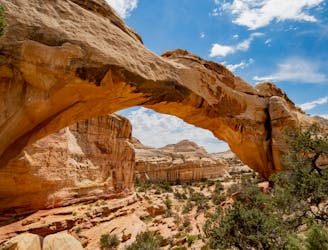
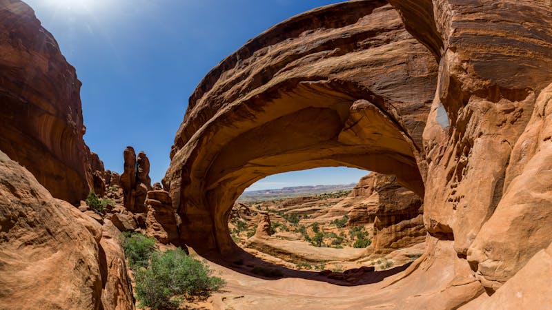
Capitol Reef's most popular hike leads to a massive natural arch soaring 125 feet high!
Moderate Hiking
8 routes · Hiking
5 routes · Hiking

63 routes · Alpine Climbing · Hiking