3 km away
Chisholm -> Rodeo Lariat
New school Moab singletrack offering superb cross country riding, Moab style.
Moderate Mountain Biking
- Distance
- 33 km
- Ascent
- 396 m
- Descent
- 396 m
Navajo Rocks embodies new school Moab mountain biking at its finest!
Mountain Biking Difficult

Much of Moab’s trail development in recent years has taken place in and around the Navajo Rocks area. In fact, a decade ago “Navajo Rocks” didn’t exist. This zone has been built from the ground up by mountain bikers, for mountain bikers. Singletrack connections now exist to 7 Up, Mag 7, and more, meaning you could theoretically ride from downtown Moab to Navajo Rocks and back on singletrack. Theoretically…
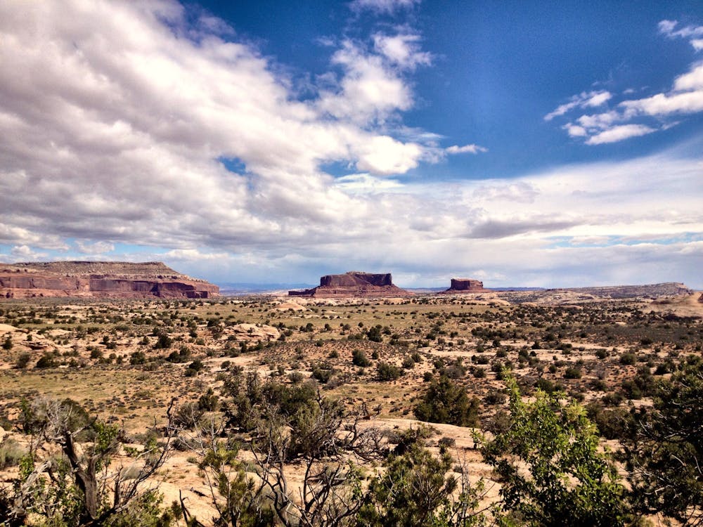
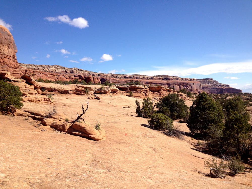
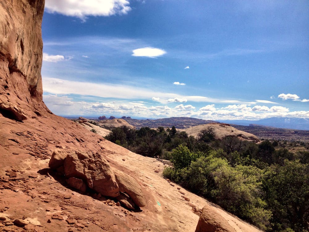
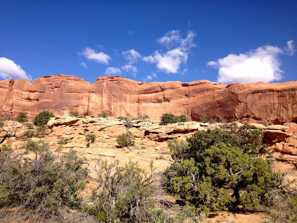

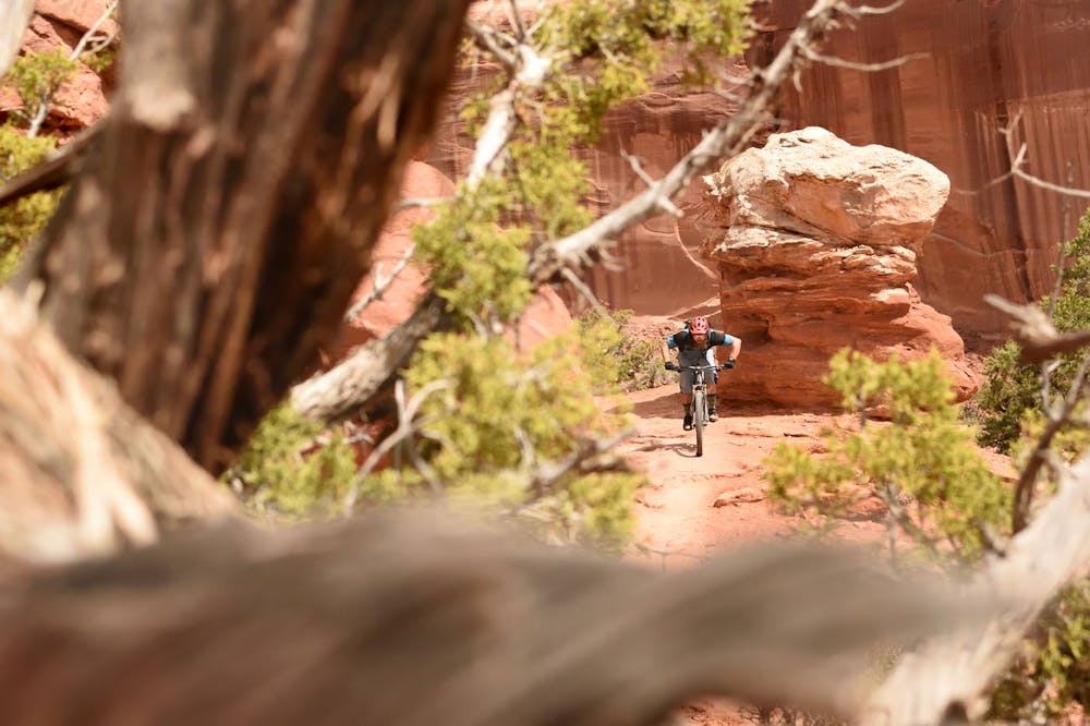
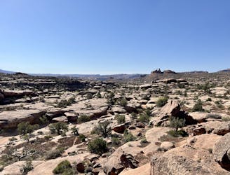
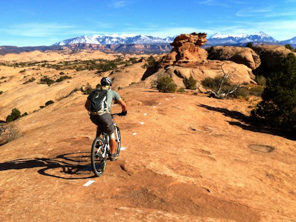
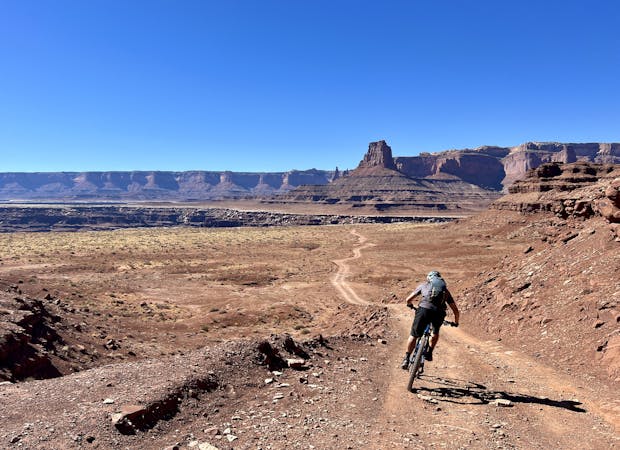
In actual practice, Navajo Rocks functions as its own riding zone due to its location about 24 miles outside of downtown Moab. The singletrack is located on a rise that provides expansive views of the entire region.
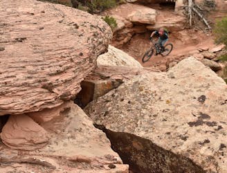
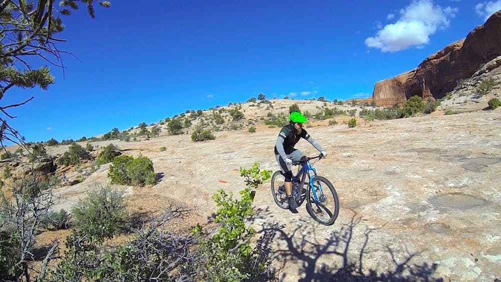
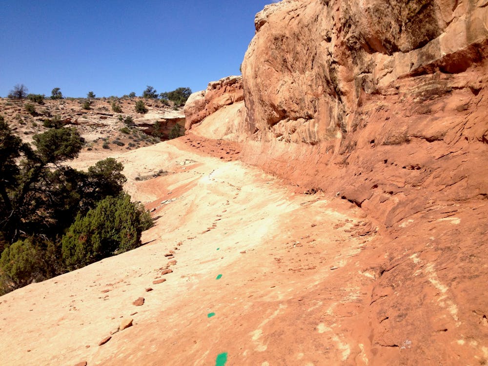
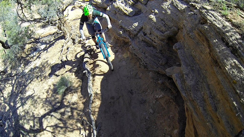
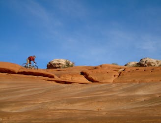
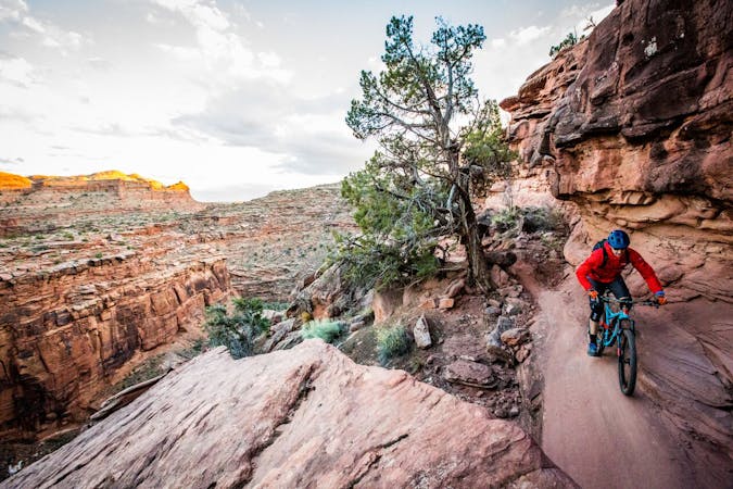
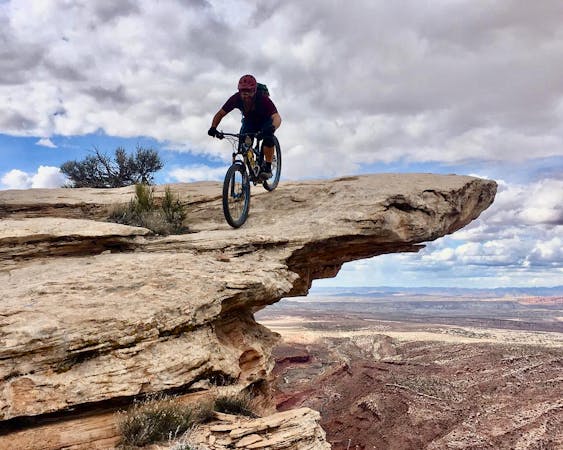
The riding here is new school in that it incorporates some sweet singletrack and creative line choices as the trail snakes through the rocks and along slickrock shelves. But it’s still classic Moab: the newer-style singletrack sections lead to slabby slickrock with ledges and drops, with Moab's iconic spray painted dots guiding your way.
Most of Navajo Rocks should be rideable by a confident intermediate rider, although some sections exceed. As with most of Moab’s slickrock riding, in many ways the ride is as difficult as you make it. Air off the ledge, or roll it? It’s your choice. Straight line, or switchback down the rock? Again, it’s up to you.
No matter which loop you choose, or even if you decide to ride both, you’ll be treated to a combination of flowy singletrack, challenging rocks, and scenic views in every direction!
Difficult
Mostly stable trail tread with some variability featuring larger and more unavoidable obstacles that may include, but not be limited to: bigger stones, roots, steps, and narrow curves. Compared to lower intermediate, technical difficulty is more advanced and grades of slopes are steeper. Ideal for upper intermediate riders.

Some trail sections are extremely exposed where falling will almost certainly result in serious injury or death.

Little chance of being seen or helped in case of an accident.
3 km away
New school Moab singletrack offering superb cross country riding, Moab style.
Moderate Mountain Biking
6.2 km away
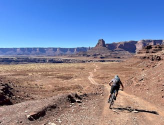
Pedal through the visually-stunning depths of Canyonlands National Park.
Moderate Mountain Biking
6.2 km away
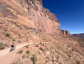
Day 1 of the epic White Rim Trip: running from either Mineral Bottom THD or the beginning of the Shafer Trail to Airport Tower.
Easy Mountain Biking
7.1 km away
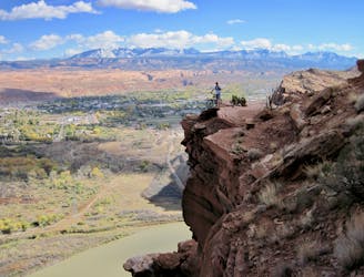
Ride some of the most technical and dangerous mountain bike trails in the world in one massive shuttle route!
Extreme Mountain Biking
7.1 km away
A shorter, more accessible version of the full Mag 7 shuttle.
Severe Mountain Biking
8.9 km away
Prepare to have a blast playing on Bartlett's undulating slickrock terrain.
Difficult Mountain Biking
5 routes · Mountain Biking
20 routes · Mountain Biking

37 routes · Mountain Biking
4 routes · Mountain Biking

25 routes · Mountain Biking
4 routes · Mountain Biking