High Bridge Trail
A beautiful rails-to-trails route crossing the longest recreational bridge in Virginia.
Trail Running Easy
- Distance
- 52 km
- Ascent
- 449 m
- Descent
- 500 m
- Duration
- 7-8 hrs
- Low Point
- 80 m
- High Point
- 220 m
- Gradient
- 3˚

The High Bridge Trail is a long-distance rails-to-trails route located between Lynchburg and Richmond, Virginia—although it doesn't reach either city. (The trail does run through the smaller town of Farmville.)
- •
- •
Description
This trail is popular with cyclists, but walkers/hikers, runners, and equestrians all use this trail. Due to the crushed limestone surface, a gravel bike is the ideal tool for this ride, although some road cyclists and mountain bikers will undoubtedly give the trail a shot.
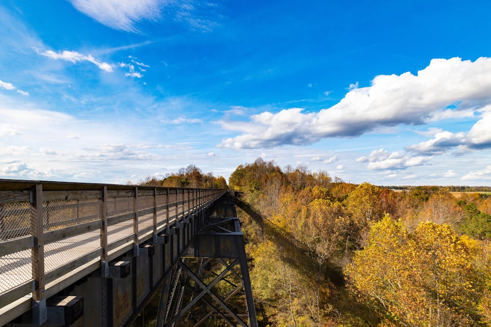
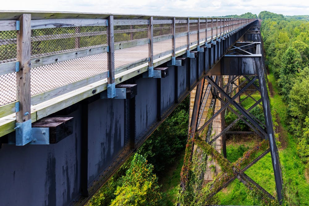
The most notable feature along this 32-mile trail is the eponymous "High Bridge," which "is more than 2,400 feet long and 125 feet above the Appomattox River," according to Virginia.gov. "It is the longest recreational bridge in Virginia and among the longest in the United States," they continue.
While the route shown here measures 32.6 miles one-way, you can tailor this distance as you see fit. If you ride an out-and-back, you can easily get to 65 miles. Or, if you want to hike a short way, you can do that too, beginning from any number of parks and access points along the trail.
Sources: https://www.dcr.virginia.gov/state-parks/high-bridge-trail
Difficulty
Easy
Low Exposure

The path is on completely flat land and potential injury is limited to falling over.
Remoteness

Away from help but easily accessed.