11 routes · Hiking
One of Washington’s premier backpacking routes, to alpine lakes and along a mountain crest in Olympic National Park.
Hiking Difficult

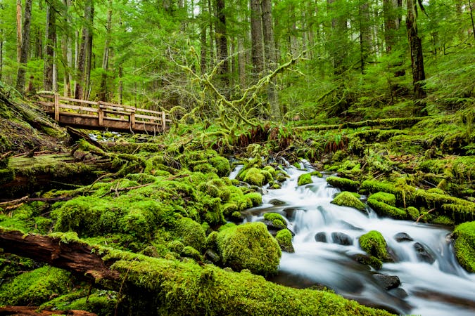
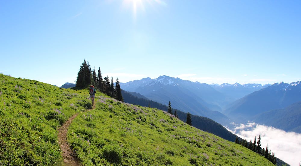
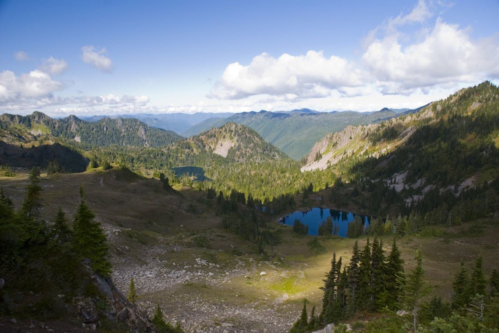
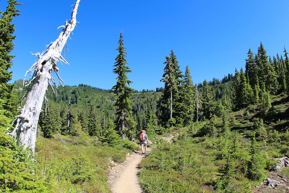
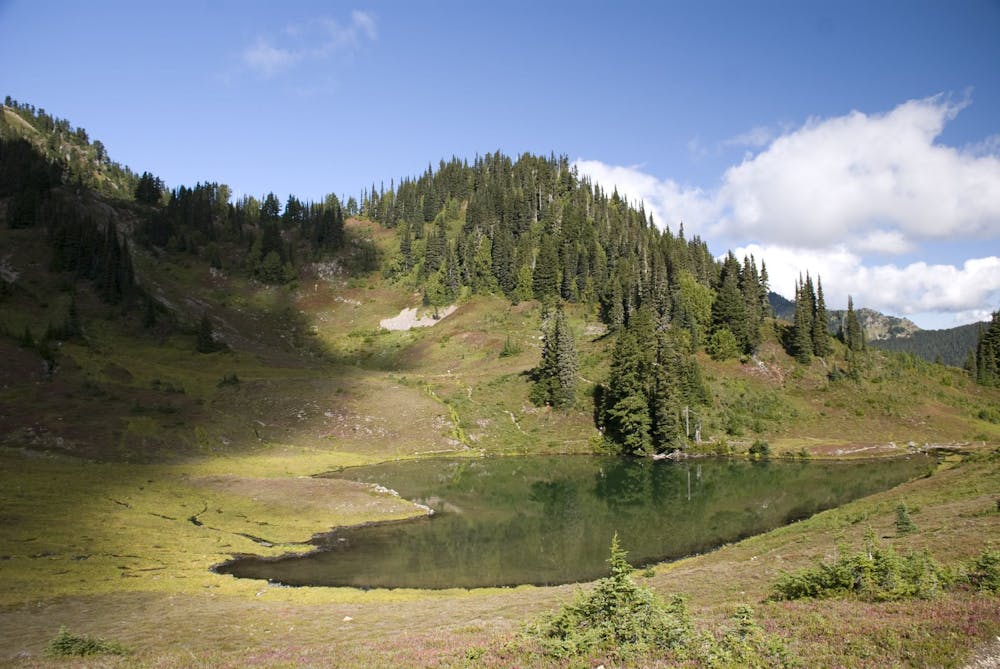
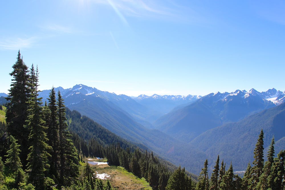
The hike begins at the ever-popular Sol Duc Falls trailhead, but continues past the crowds into a mountainous wilderness, reaching a highpoint of 5,474 feet on Bogachiel Peak. The lower elevations are lush with evergreens and ferns, and watered with tumbling creeks. The mid elevations have a patchwork of flowery meadows, with blue lakes and mountain backdrops. The highest elevations are atop those mountains, on bare ridgelines with the Olympic Range unfolding in every direction. Mountain goats are commonly seen along this trail, and black bears sometimes make an appearance. The bears don’t generally bother people, but proper food storage is required for backpackers. Idyllic campsites sit beside lakes in mountain meadows, and alongside creeks in the forest. The scenery is unparalleled in a loop of this distance in Olympic National Park, making this one of the best backpacking routes in Washington.
Permits are needed for camping, and they are often hard to get. Because the distance is moderate, however, many people choose to day hike or trail run the loop instead of camp. Backpacking is of course the best way to slow down and enjoy this wilderness though, so those with camping permits are the most fortunate. You can reserve far in advance, up to 6 months ahead on Recreation.gov. Note: Prior to the 2020 season, half of all campsites were available first-come-first-served rather than by reservation. It is unknown when and if this policy will resume. Check the park’s wilderness reservations page for updates.
The most coveted campsites are at Lunch Lake and Heart Lake, due to their scenery and their locations midway through the loop. Other campsites are scattered throughout, and what you get will depend on what’s available when you book your permit. Whether camping at one of the lakes or not, you can stop at these clear water sources to cool off, filter water, or go fishing.
Between Deer Lake and Heart Lake is where the trail traces the divide on a high ridge. Water is not generally available up there, so you may want to take the spur (as mapped) to Lunch Lake to fill up, and maybe even have lunch. On the ridge the views are phenomenal, and if the weather is clear you can see Mount Olympus and its cloak of glaciers. You can also peer down into the Seven Lakes Basin and count the pools of water nestled within. Come well prepared for bad weather though, because any amount of wind or rain can be brutal at this elevation. Be sure to check the forecast before you begin, and consider alternate plans if it looks bleak.
Early season (June and first half of July) makes it easier to get permits, but that’s because the hike is harder. Snow lingers on the high ridges through June, so hikers often carry trail crampons and some even bring an ice axe for safety. Late July through early September is the best season, when the snow is melted and days in a row of good weather are common.
Sources: https://www.nps.gov/olym/planyourvisit/high-divide-loop.htm https://www.wta.org/go-hiking/hikes/seven-lakes-basin https://besthike.com/n-america/pacific-n-w/high-divide-loop/
Difficult
Hiking trails where obstacles such as rocks or roots are prevalent. Some obstacles can require care to step over or around. At times, the trail can be worn and eroded. The grade of the trail is generally quite steep, and can often lead to strenuous hiking.

Some trail sections have exposed ledges or steep ascents/descents where falling could cause serious injury.
Little chance of being seen or helped in case of an accident.
11 routes · Hiking

19 routes · Hiking