146 m away
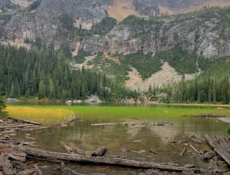
Maple Pass Loop
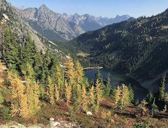
Walk a high ridgeline among wildflowers and larch trees, encircling an alpine lake with mountain views in all directions.
Difficult Hiking
- Distance
- 12 km
- Ascent
- 688 m
- Descent
- 687 m
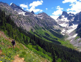
Miles 2591.1-2622 of the northbound PCT: The last of the big elevation swings in the North Cascades, featuring high ridges with larch trees and a sheltered valley with abundant creeks.
Hiking Moderate

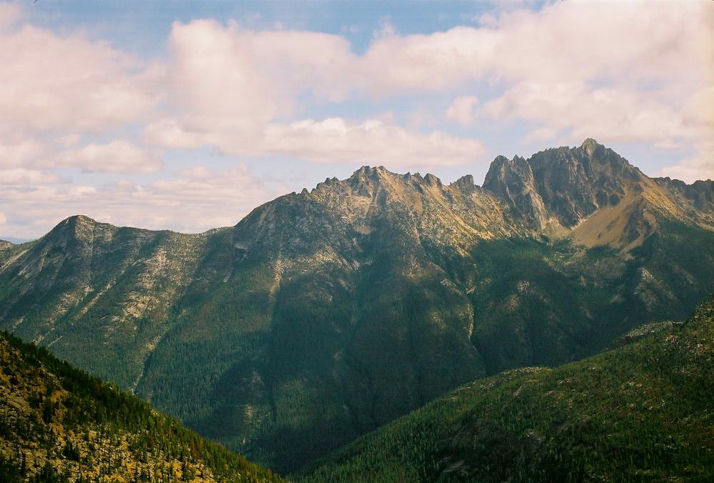
Despite the utter magnificence of sections to the south, this segment of the PCT remains a highlight for many hikers in the North Cascades. Jagged peaks crane far above the timberline, and the uppermost trees are often the famous larches that turn golden in the fall. The high ridges are gorgeous but susceptible to bad weather, sometimes receiving snowstorms before the end of summer. Rainy Pass is the last easy access before the Canada border, so hikers must be prepared for the rugged mountains plus the logistics of exiting the trail.
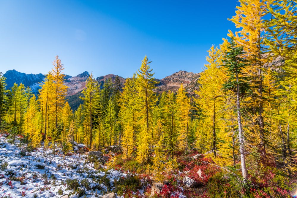
From Rainy Pass, the PCT gains elevation steadily, rising among thick forest on the slope above the road. It soon veers into a valley and later fords Porcupine Creek (NB mile 2593.1), where campsites are found nearby. A steep climb leads farther up this valley and out of the trees, soon cresting Cutthroat Pass (NB mile 2596.4) for an incredible view of spire-studded horizons. The views remain spectacular as long as the weather is clear, but even in shrouded conditions, there’s beauty in heather meadows and stands of larch all around. The trail next contours beneath vertical cliffs to cross over another ridge, then drops quickly to Granite Pass (NB mile 2598.7) where some shelter can be found among scattered pines.
Next, the trail begins a bold traverse on the face of Tower Mountain, crossing numerous avalanche gullies full of rocky debris. After that, it hooks into a little basin with campsites set beside small streams and springs (NB mile 2601). A bit more uphill through sparse conifers leads to Methow Pass (NB mile 2601.8), a beautiful saddle with meadows and larches overlooking peaks and valleys.
From there, the trail descends rapidly, back into thick forest in the valley of the West Fork Methow River. It crosses some seasonal streams and small camps before meeting the river and crossing on a bridge (NB mile 2606.6), where there’s an established campsite nearby. Next, the trail trends uphill again, crossing a series of avalanche clearings and turning into an adjacent valley. This one is particularly narrow, walled tightly by towering peaks that are striped with green and gray. Small camps and streams are scattered along as the trail rises toward Glacier Pass.
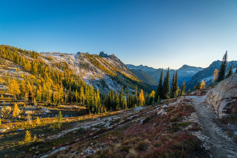
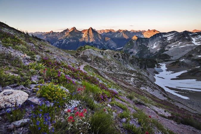
This forested pass (NB mile 2612.1) is merely a step along the way, however, as the trail zigzags higher to a mountain crest. Grassy slopes with epic views lead to a prolonged contour above the timberline, and finally to a short but head-spinning ridge walk near Tatie Peak (NB mile 2618). U-shaped valleys fall away to either side, with craggy summits rising ahead and behind.
Next, the trail curves along another ridge to Harts Pass, but passes a junction to a road and a Forest Service campground along the way (NB mile 2619.8). At Harts Pass (NB mile 2622) there is a dirt road and the Harts Pass campground which has picnic tables and toilets. There is also a guard station that is often staffed during the hiking season.
Permits: This segment through Okanogan-Wenatchee National Forest does not require any permits for hiking or camping. However, hikers planning on continuing north to Canada will need to have a plan. A Canada PCT Entry Permit is required for crossing the border. Without one, you must turn around and exit the trail elsewhere.
Sources: https://www.wta.org/go-hiking/hikes/cutthroat-pass-via-pacific-crest-trail https://www.pcta.org/discover-the-trail/maps/ https://pctmap.net/trail-notes/
Moderate
Hiking along trails with some uneven terrain and small hills. Small rocks and roots may be present.

The trail contains some obstacles such as outcroppings and rock which could cause injury.
Away from help but easily accessed.
146 m away
Walk a high ridgeline among wildflowers and larch trees, encircling an alpine lake with mountain views in all directions.
Difficult Hiking
7.5 km away
One of Washington Pass' best day hikes, taking in everything from dense forests to desolate high mountains.
Moderate Hiking
9.6 km away
A not-so-easy hike to Easy Pass, then an extended trek through deep wilderness of the North Cascades.
Difficult Hiking
7 routes · Hiking

72 routes · Hiking

19 routes · Hiking