1 m away
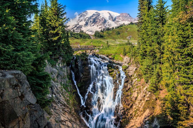
Myrtle Falls
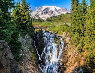
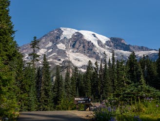
Reach a stunning view of Myrtle Falls framed by Mount Rainier.
Easy Hiking
- Distance
- 1.5 km
- Ascent
- 51 m
- Descent
- 51 m
One of the most beautiful hikes in Washington State!
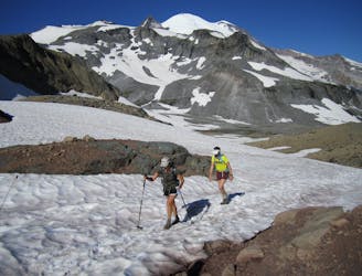
Hiking Moderate

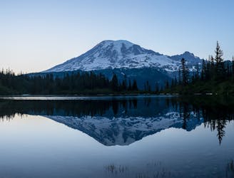
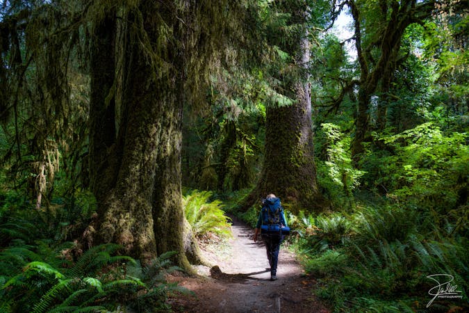
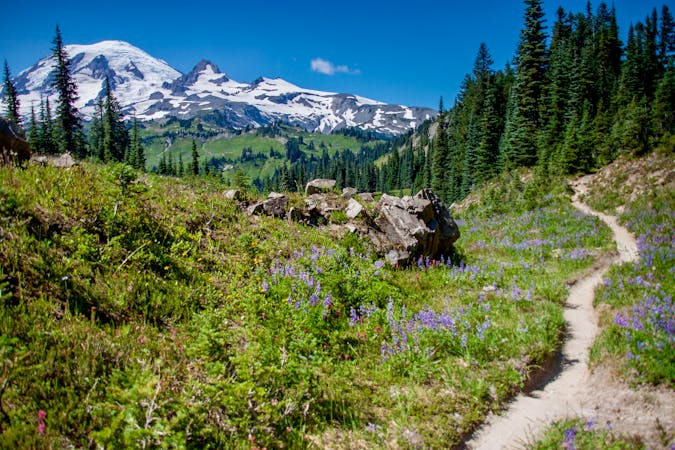
The Skyline Loop Trail in Mount Rainier National Park circumnavigates the Paradise area. With fantastic views throughout this entire hike, Skyline is renowned as one of the most beautiful trails in Washington State!
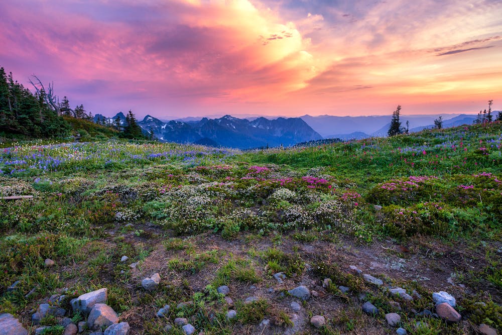
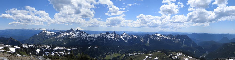
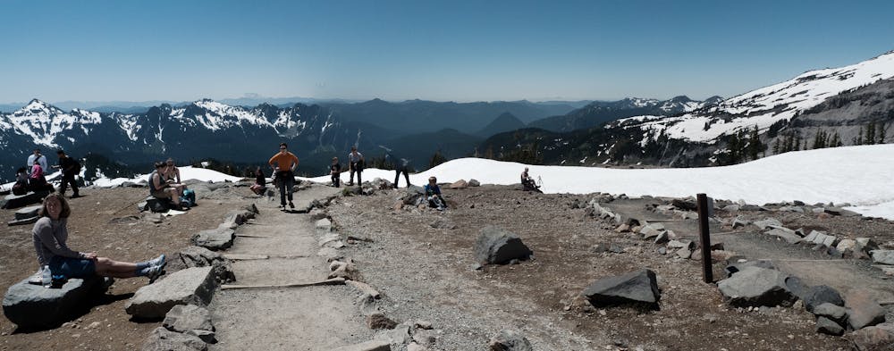
While you’ll enjoy stunning views the entire time, two of the highest-acclaimed sites along this loop route include Panorama Point and the view of Nisqually Glacier. Some hikers choose to simple hike out-and-back to one of these two viewpoints, with Panorama Point being the most popular. From Panorama Point, you can see "the neighboring Mount Saint Helens, Mount Adams, and Mount Hood on clear days,” according to Brad Lane of PlanetWare.com. While you could choose to hike a short out-and-back, completing this entire loop hike is a much more rewarding experience!
You can hike this loop in either direction, but the clockwise route mapped here takes the quickest route to Panorama Point. If you reach the point and are already tired out, it’s probably best to turn around and retrace your steps to the parking lot. But if you want to head higher up the mountain and return on a different trail, carry on and follow the loop!
This 5.6-mile loop does climb over 1,700 feet of elevation, but all things considered, the hike is relatively moderate. The extreme popularity of this hike has lead to the trail becoming quite manicured over the years, with very few difficult or technical portions to challenge hikers. In fact, stairs and water bars have been installed on most of the steep pitches to minimize erosion and aid in your ascent.
Sources: https://www.planetware.com/washington/top-rated-hikes-in-mount-rainier-national-park-us-wa-114.htm https://www.nomadswithapurpose.com/best-hikes-mount-rainier-national-park/ https://www.gaiagps.com/hike/18057/panorama-point-loop-via-skyline-trail/
Moderate
Hiking along trails with some uneven terrain and small hills. Small rocks and roots may be present.

The path is on completely flat land and potential injury is limited to falling over.

Away from help but easily accessed.
1 m away
Reach a stunning view of Myrtle Falls framed by Mount Rainier.
Easy Hiking
459 m away
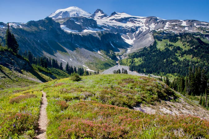
An easy paved hike to a stunning overlook of a glacier-carved valley.
Easy Hiking
1.4 km away
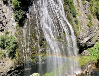
Hike down to a beautiful vista of this 168-foot waterfall.
Moderate Hiking
2 km away
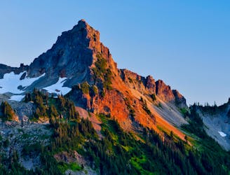
A steep hike and scramble to the summit of Pinnacle Peak.
Extreme Hiking
3 km away
Enjoy a high effort-to-view ratio on this beautiful hike to two alpine lakes.
Moderate Hiking
7.1 km away
A 93 mile (150 kilometer) hiking trail that circumnavigates Mount Rainier, one of North America's most iconic peaks.
Difficult Hiking
8 km away
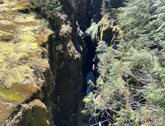
This narrow slot canyon is 180 feet deep, with a rushing river at the bottom!
Easy Hiking

6 routes · Hiking
10 routes · Hiking
5 routes · Hiking
5 routes · Hiking
3 routes · Hiking
8 routes · Hiking

19 routes · Hiking