Ampriu - Tuca de Castanesa
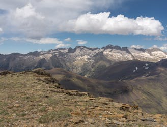
Awesome 360º views including the highest peak of the Pyrenees
Moderate Hiking
- Distance
- 14 km
- Ascent
- 1 km
- Descent
- 1 km

Go hiking in Estación de Esquí de Aramón Cerler with curated guides of the best hikes across the region. With over 1 3D trail maps in FATMAP, you can easily discover and navigate the best trails in Estación de Esquí de Aramón Cerler.
No matter what your next adventure has in store, you can find a guide on FATMAP to help you plan your next epic trip.
Get a top hiking trail recommendation in Estación de Esquí de Aramón Cerler, or get inspired by the 1 local adventures uploaded by the FATMAP community. Start exploring now!

Awesome 360º views including the highest peak of the Pyrenees
Moderate Hiking