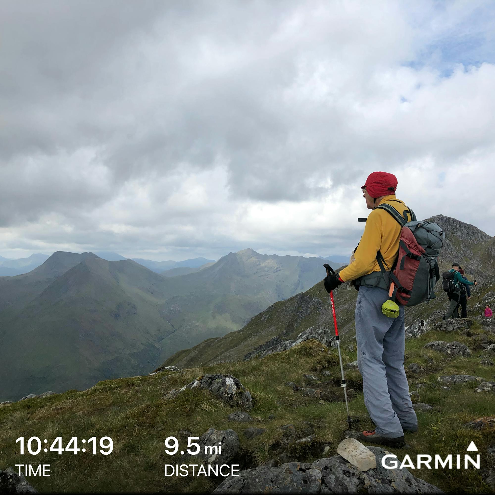
Sgurr na Ciste Duibhe, Sgurr na Carnach and Sgurr Fhuaran
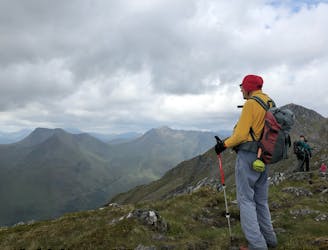
A classic ridgewalk taking in three Munros, the Five Sisters give a wonderful days excursion with magnificent views.
Severe Hiking
- Distance
- 15 km
- Ascent
- 1.4 km
- Descent
- 1.5 km
Go hiking in Highland with curated guides of the best hikes across the region. With over 163 3D trail maps in FATMAP, you can easily discover and navigate the best trails in Highland.
No matter what your next adventure has in store, you can find a guide on FATMAP to help you plan your next epic trip.
Get a top hiking trail recommendation in Highland from one of our 13 guidebooks, or get inspired by the 163 local adventures uploaded by the FATMAP community. Start exploring now!
A classic ridgewalk taking in three Munros, the Five Sisters give a wonderful days excursion with magnificent views.
Severe Hiking

The walk begins on the well-traveled path to Falls of Glomach, but descending past the falls requires steep scrambling through the gorge. Easier walking follows, on a primitive road through an inhabited glen, then a rugged footpath leads over another pass and down to the remote Maol-bhuidhe bothy.
Severe Hiking

Leave the busy road for seclusion in the An Caorann Mor, crossing a boggy pass then descending to River Affric and a remote hostel. After continuing over another pass, the path traces a waterfall gorge then proceeds down a treeless glen between particularly steep ranges.
Difficult Hiking

Heading deeper into the Highlands, a footpath goes over hilly moorland and across small burns, meets the River Loyne at a difficult crossing, then climbs again to traverse the flanks of the Shiel Ridge Munros, and finishes at the A87.
Difficult Hiking

A minor road leads through quiet woods to the farm town of Greenfield, where the trail turns into an off-road route across boggy ground. An alternative is to take the road north of Loch Garry through Tomdoun.
Difficult Hiking

Proceeding through the Great Glen, the first half of the walk is on a towpath; the rest circles the shore of Loch Oich before climbing a forested hill and descending to Mandally, with a hostel and more accommodations nearby at Invergarry.
Moderate Hiking

The stage takes a minor road for quite some time, then follows a wide track and power line through otherwise wild, high moorlands, and descends to finish on the shore of Loch Ness.
Difficult Hiking

A highly varied section that travels rural areas of moorlands, pastures, plantations, and sometimes pathless wildlands with impressive views of mountains all the while.
Difficult Hiking

On this stage the trail returns to civilization, but only after crossing more wild lands, fording a burn, and climbing through pinewoods to views above the Uath Lochans.
Moderate Hiking

In a very remote setting, wade or paddle three river crossings, then follow a very green glen which is rocky in places and boggy in others, finishing at a wild-camp spot near an old stone bothy.
Difficult Hiking

Climb away from the beach, then navigate a series of hills and gullies near the coast, boggy with no obvious path, and requiring water crossings, before concluding the Scottish National Trail at Cape Wrath Lighthouse.
Difficult Hiking

After days of hard walking, this comparatively easy stretch is well deserved, along rural roads and tracks leading to the picture-perfect beach at Sandwood Bay––an enviable spot to wild camp.
Moderate Hiking

This segment crosses the proud summit of Ben Dreavie––notable less for its elevation (501m) and more for its relief of at least 150m on every side. It’s a long trek on barren and often boggy moorland over this summit, along the flanks of Ben Stack, then returning to sea level at A838, before another long slog on partially pathless moorland alongside remote lochs and crossing a wide river.
Difficult Hiking

A true highlight stage of the Scottish National Trail, this rugged walk includes crossing a 620m col, passing Britain’s highest waterfall, and tracing a steeply bound sea loch––all with great difficulty, but with unforgettable bothy and wild-camp locations to segment the distance.
Severe Hiking

Enjoy a prolonged, scenic traverse above the rushing River Oykel, mostly on vehicle track but sometimes on grassy footpath, often on open hillside and sometimes at forest edge. After passing the small settlement at Loch Ailsh, the path begins an arduous climb to Bealach Trallgill over progressively rougher terrain, but gets easier on the other side going down to Inchnadamph.
Difficult Hiking

An easy but uphill path through a plantation leads to rugged and remote walking with mountain views, waterfalls, and river crossings, eventually reaching easier tracks and passing two bothies en route to the road at River Oykel.
Difficult Hiking