Proceeding through the Great Glen, the first half of the walk is on a towpath; the rest circles the shore of Loch Oich before climbing a forested hill and descending to Mandally, with a hostel and more accommodations nearby at Invergarry.
Moderate Hiking
- Distance
- 19 km
- Ascent
- 233 m
- Descent
- 185 m

The stage takes a minor road for quite some time, then follows a wide track and power line through otherwise wild, high moorlands, and descends to finish on the shore of Loch Ness.
Difficult Hiking
- Distance
- 40 km
- Ascent
- 846 m
- Descent
- 1.1 km

A highly varied section that travels rural areas of moorlands, pastures, plantations, and sometimes pathless wildlands with impressive views of mountains all the while.
Difficult Hiking
- Distance
- 23 km
- Ascent
- 409 m
- Descent
- 384 m

On this stage the trail returns to civilization, but only after crossing more wild lands, fording a burn, and climbing through pinewoods to views above the Uath Lochans.
Moderate Hiking
- Distance
- 20 km
- Ascent
- 226 m
- Descent
- 359 m

In a very remote setting, wade or paddle three river crossings, then follow a very green glen which is rocky in places and boggy in others, finishing at a wild-camp spot near an old stone bothy.
Difficult Hiking
- Distance
- 21 km
- Ascent
- 248 m
- Descent
- 340 m

Climb away from the beach, then navigate a series of hills and gullies near the coast, boggy with no obvious path, and requiring water crossings, before concluding the Scottish National Trail at Cape Wrath Lighthouse.
Difficult Hiking
- Distance
- 12 km
- Ascent
- 463 m
- Descent
- 432 m

After days of hard walking, this comparatively easy stretch is well deserved, along rural roads and tracks leading to the picture-perfect beach at Sandwood Bay––an enviable spot to wild camp.
Moderate Hiking
- Distance
- 19 km
- Ascent
- 365 m
- Descent
- 384 m

This segment crosses the proud summit of Ben Dreavie––notable less for its elevation (501m) and more for its relief of at least 150m on every side. It’s a long trek on barren and often boggy moorland over this summit, along the flanks of Ben Stack, then returning to sea level at A838, before another long slog on partially pathless moorland alongside remote lochs and crossing a wide river.
Difficult Hiking
- Distance
- 30 km
- Ascent
- 884 m
- Descent
- 906 m

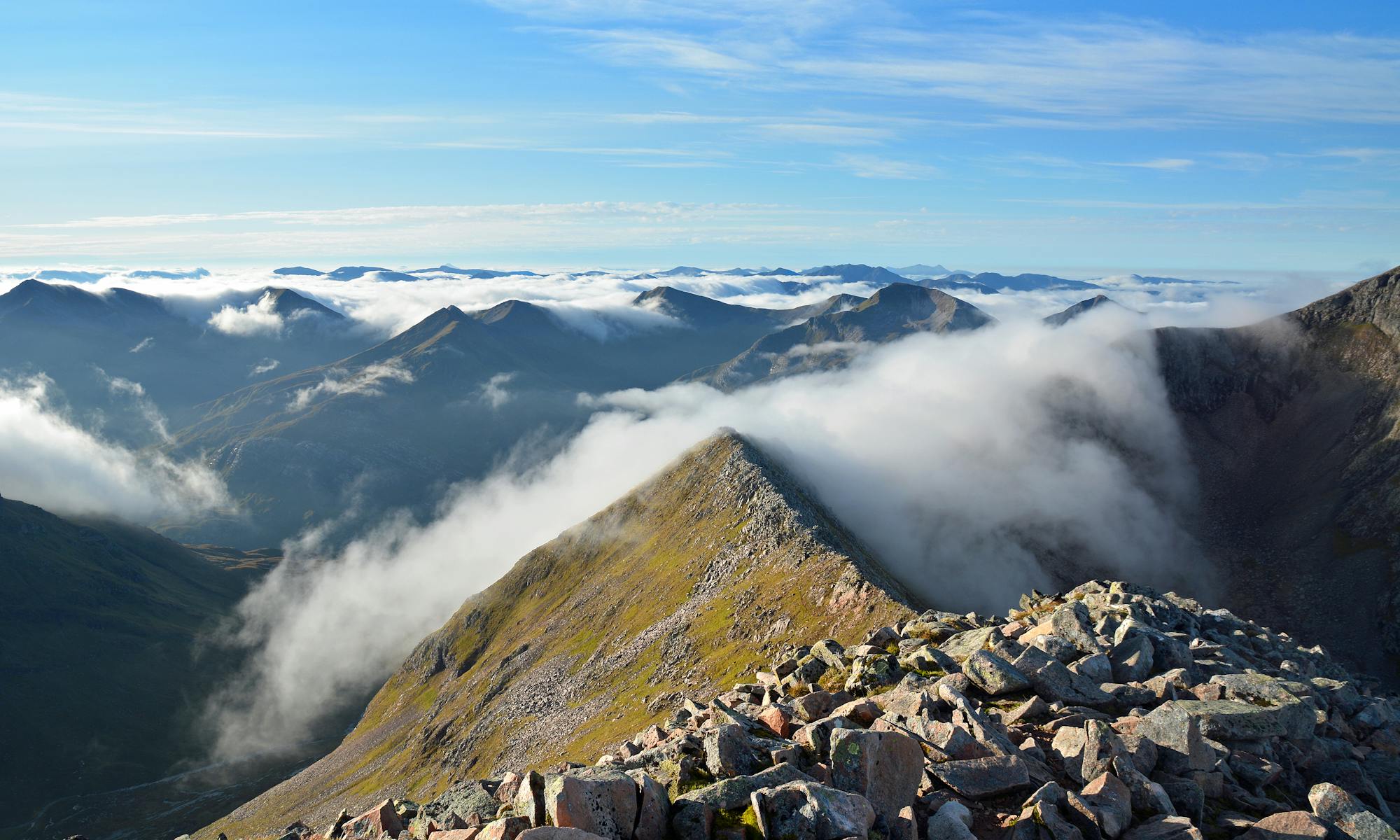
A true highlight stage of the Scottish National Trail, this rugged walk includes crossing a 620m col, passing Britain’s highest waterfall, and tracing a steeply bound sea loch––all with great difficulty, but with unforgettable bothy and wild-camp locations to segment the distance.
Severe Hiking
- Distance
- 28 km
- Ascent
- 1.1 km
- Descent
- 1.1 km

Enjoy a prolonged, scenic traverse above the rushing River Oykel, mostly on vehicle track but sometimes on grassy footpath, often on open hillside and sometimes at forest edge. After passing the small settlement at Loch Ailsh, the path begins an arduous climb to Bealach Trallgill over progressively rougher terrain, but gets easier on the other side going down to Inchnadamph.
Difficult Hiking
- Distance
- 31 km
- Ascent
- 663 m
- Descent
- 622 m

An easy but uphill path through a plantation leads to rugged and remote walking with mountain views, waterfalls, and river crossings, eventually reaching easier tracks and passing two bothies en route to the road at River Oykel.
Difficult Hiking
- Distance
- 34 km
- Ascent
- 847 m
- Descent
- 825 m

A steep climb reaches high, barren, and boggy moorland which must be crossed before an estate track leads down to the A832. From there, footpaths and minor roads lead over high moorland again, passing a few small lochs, and descending once more to A832 near the sea.
Difficult Hiking
- Distance
- 19 km
- Ascent
- 786 m
- Descent
- 884 m

Crossing the Great Wilderness, tracing rivers and lochs on mostly good tracks but some pathless travel, with abundant views from comfortable wild-camp spots.
Difficult Hiking
- Distance
- 28 km
- Ascent
- 742 m
- Descent
- 663 m

This exceptionally beautiful stage begins by climbing steeply through forestry to Coulin Pass, then gently down an open valley with Beinn Eighe in view ahead. Continuing through a rural setting along the River Coulin, the path becomes more difficult as it enters a felled forest and regenerating growth before emerging at Kinlochewe.
Difficult Hiking
- Distance
- 16 km
- Ascent
- 462 m
- Descent
- 501 m

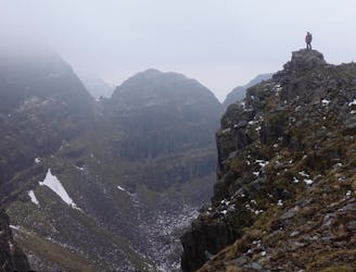
Continuing through very remote and rugged territory, this section occasionally follows vehicle tracks but otherwise rough trail, pathless sections, boggy ground, and water crossings.
Difficult Hiking
- Distance
- 24 km
- Ascent
- 674 m
- Descent
- 863 m
Standard Life Mountain Club
Extreme Hiking
- Distance
- 16 km
- Ascent
- 1.3 km
- Descent
- 1.3 km