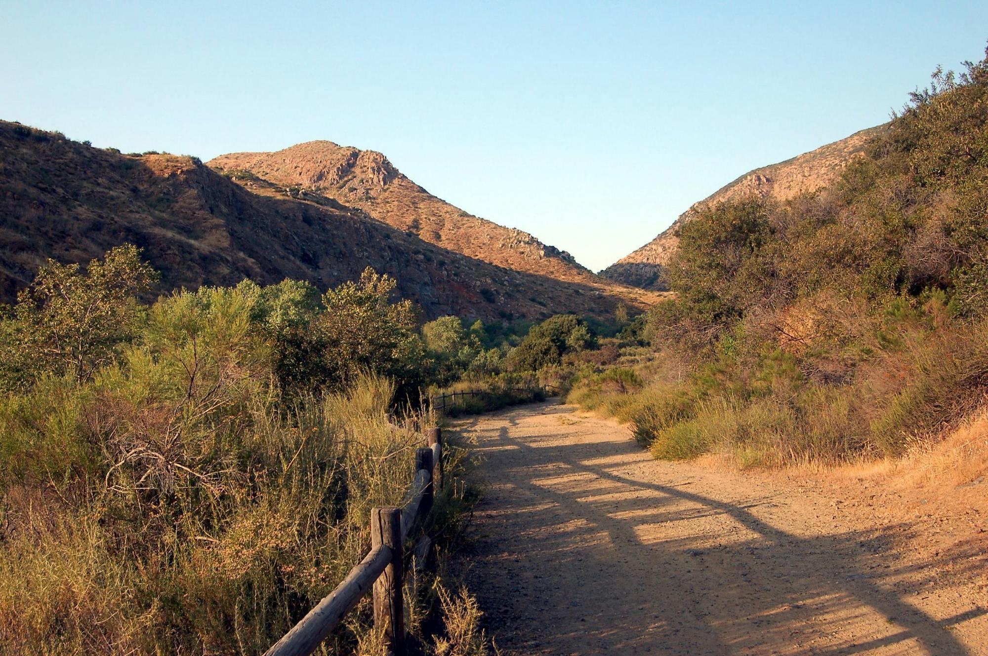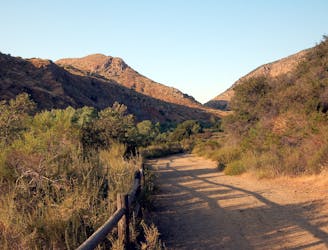
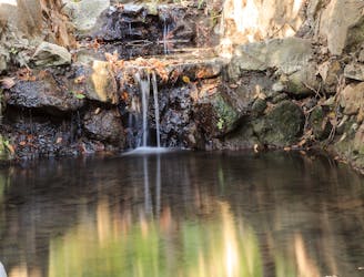
Experience the natural and cultural wonders of Mission Trails Regional Park on the Visitor Center Loop Trail, an easy and scenic hike that starts and ends at the park’s visitor center.
Easy Hiking
- Distance
- 2.4 km
- Ascent
- 59 m
- Descent
- 59 m
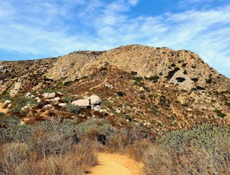
A steep hike to the summit of Kwaay Paay Peak yields a rewarding view.
Difficult Hiking
- Distance
- 3.4 km
- Ascent
- 264 m
- Descent
- 265 m
Hike to a stunning 360-degree panorama from the top of North Fortuna Mountain.
Difficult Hiking
- Distance
- 6.9 km
- Ascent
- 314 m
- Descent
- 314 m
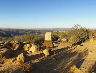
Gain incredible views from one of Mission Trails Regional Park's beautiful mountains.
Difficult Hiking
- Distance
- 8.5 km
- Ascent
- 441 m
- Descent
- 441 m
A beautiful but non-technical hike to the summit of Mount Hollywood.
Easy Hiking
- Distance
- 8.5 km
- Ascent
- 340 m
- Descent
- 340 m

"One of the few coastal wilderness hiking experiences in the United States."
Difficult Hiking
- Distance
- 41 km
- Ascent
- 405 m
- Descent
- 381 m
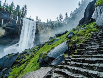
A stunning hike up steep climbs, passing close to Vernal and Nevada Falls.
Difficult Hiking
- Distance
- 11 km
- Ascent
- 753 m
- Descent
- 752 m
Miles 1655.9-1718.9 of the northbound PCT: The final big climb from a Northern California valley, then along a panoramic ridge to cross into Oregon.
Difficult Hiking
- Distance
- 99 km
- Ascent
- 4.1 km
- Descent
- 3.2 km
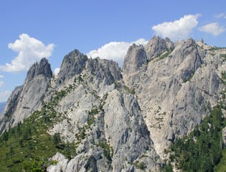
Miles 1599.7-1655.9 of the northbound PCT: Through the stunningly colorful landscape of the Marble Mountains Wilderness.
Difficult Hiking
- Distance
- 88 km
- Ascent
- 2.4 km
- Descent
- 3.8 km
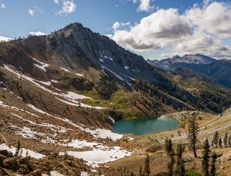
Miles 1560.2-1599.7 of the northbound PCT: Through the rugged expanse of two wilderness areas, each studded with granite peaks and sparkling lakes.
Moderate Hiking
- Distance
- 63 km
- Ascent
- 2.7 km
- Descent
- 2.5 km
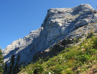
Miles 1501.2-1560.2 of the northbound PCT: A stunning hike beneath granite spires of the Castle Crags, then along miles of panoramic ridge within view of Mount Shasta.
Moderate Hiking
- Distance
- 93 km
- Ascent
- 2.9 km
- Descent
- 1.9 km
Rolling ridges and deep forest between the McCloud and Sacramento Rivers in Shasta-Trinity National Forest.
Moderate Hiking
- Distance
- 48 km
- Ascent
- 2.3 km
- Descent
- 2.4 km
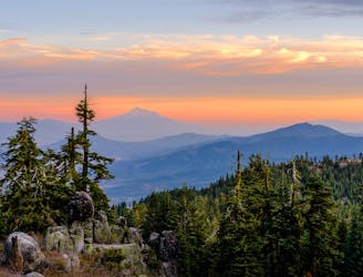
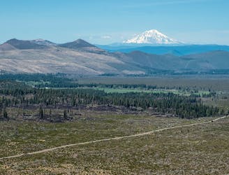
Enjoy frequent views from an undulating ridge, with lush valleys below and the white cap of Mount of Shasta on the horizon.
Moderate Hiking
- Distance
- 81 km
- Ascent
- 2.6 km
- Descent
- 2.8 km
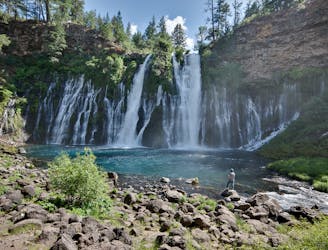
Miles 1377.4-1419 of the PCT: Along a panoramic rim with views to Mount Shasta, then down into a broad valley with entrenched creeks and the spectacle of Burney Falls.
Easy Hiking
- Distance
- 67 km
- Ascent
- 830 m
- Descent
- 1.3 km
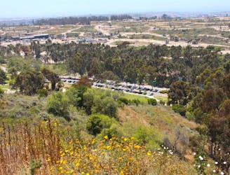
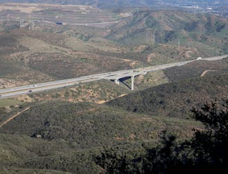
Hike to the crest of a ridge for some of the finest views in the urban area.
Moderate Hiking
- Distance
- 2.4 km
- Ascent
- 77 m
- Descent
- 77 m
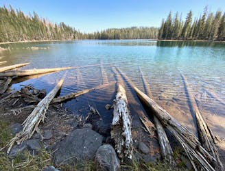
Miles 1350.1-1377.4 of the northbound PCT: Continuing through Lassen National Park, past backcountry lakes and views of volcanic peaks.
Moderate Hiking
- Distance
- 43 km
- Ascent
- 658 m
- Descent
- 1.1 km