Sawtooth Ridge
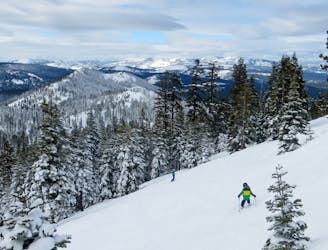
The best hike-to terrain at Northstar when conditions permit
Difficult Freeride Skiing
- Distance
- 1.7 km
- Ascent
- 41 m
- Descent
- 266 m
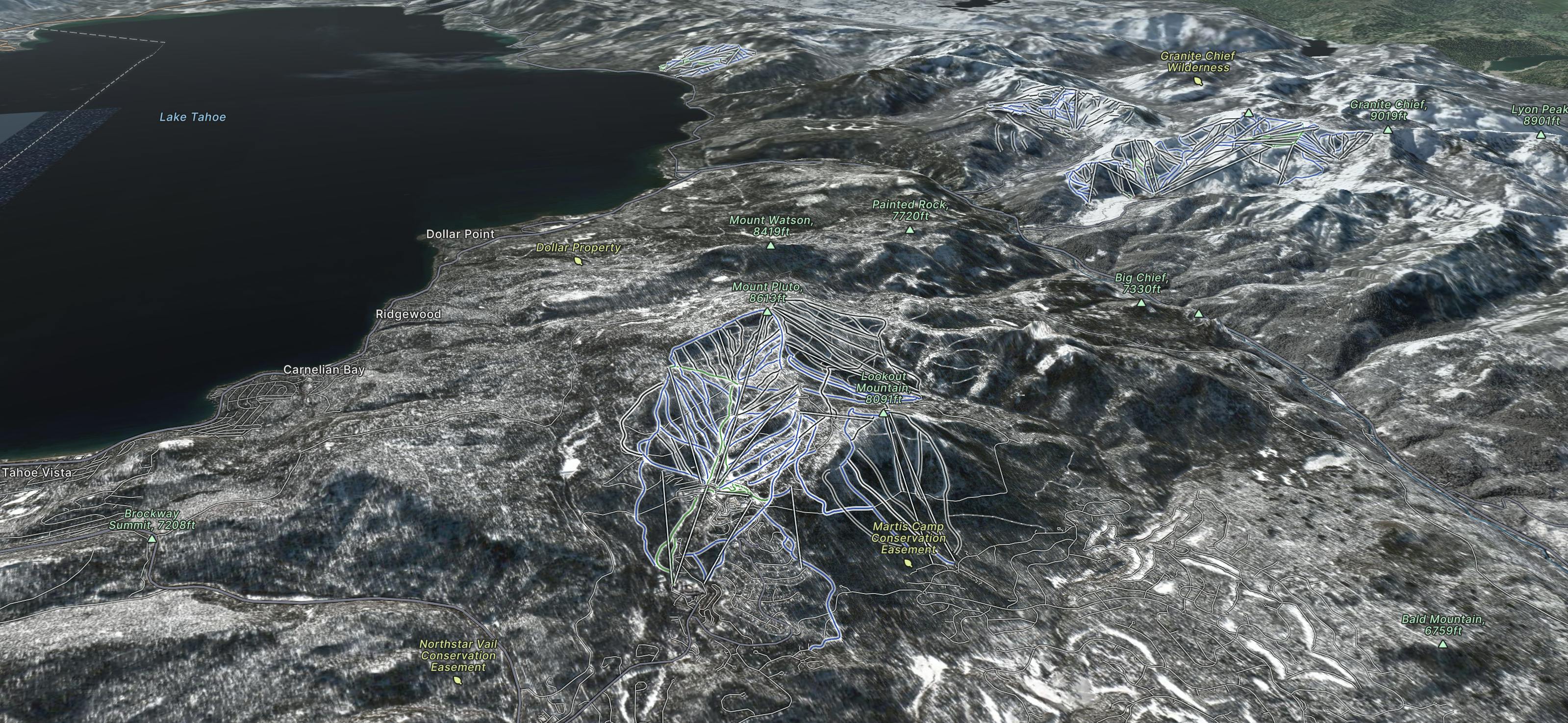
Northstar California is a mountain resort in the western United States, approximately 200 miles (320 km) from the San Francisco Bay Area, alpine terrain accessed by 19 lifts, a snowmaking system, a cross-country center, a village, on-site lodging and summer activities including an 18-hole golf course and a lift-served mountain bike park.
Go Freeride in Northstar California with curated guides of the best routes across the region. With over 34 3D trail maps in FATMAP, you can easily discover and navigate the best routes in Northstar California.
No matter what your next adventure has in store, you can find a guide on FATMAP to help you plan your next epic trip.
Get a top Freeride recommendation in Northstar California from one of our 1 guidebooks, or get inspired by the 34 local adventures uploaded by the FATMAP community. Start exploring now!
The best hike-to terrain at Northstar when conditions permit
Difficult Freeride Skiing

Great Views of Lake Tahoe Basin on the Mountain
Difficult Freeride Skiing

A perfect spot for powder photoshoots
Severe Freeride Skiing

Large boulder/cliff drop area
Difficult Freeride Skiing

Great views of Lake Tahoe and large boulders to drop off of.
Difficult Freeride Skiing

Drop after drop after drop
Difficult Freeride Skiing

A popular locals spot on Sawtooth Ridge
Severe Freeride Skiing

A large Cornice atop Sawtooth Ridge
Severe Freeride Skiing

One of the most challenging Lift Lines at Northstar
Difficult Freeride Skiing

Run that goes directly under Tahoe Zephyr Express
Difficult Freeride Skiing

One of the more challenging runs off Rendezvous
Difficult Freeride Skiing

Largest Cliffs at Northstar
Severe Freeride Skiing

Some of the biggest cliff drops at Northstar
Severe Freeride Skiing

A set of chutes far beyond the backside of northstar
Severe Freeride Skiing