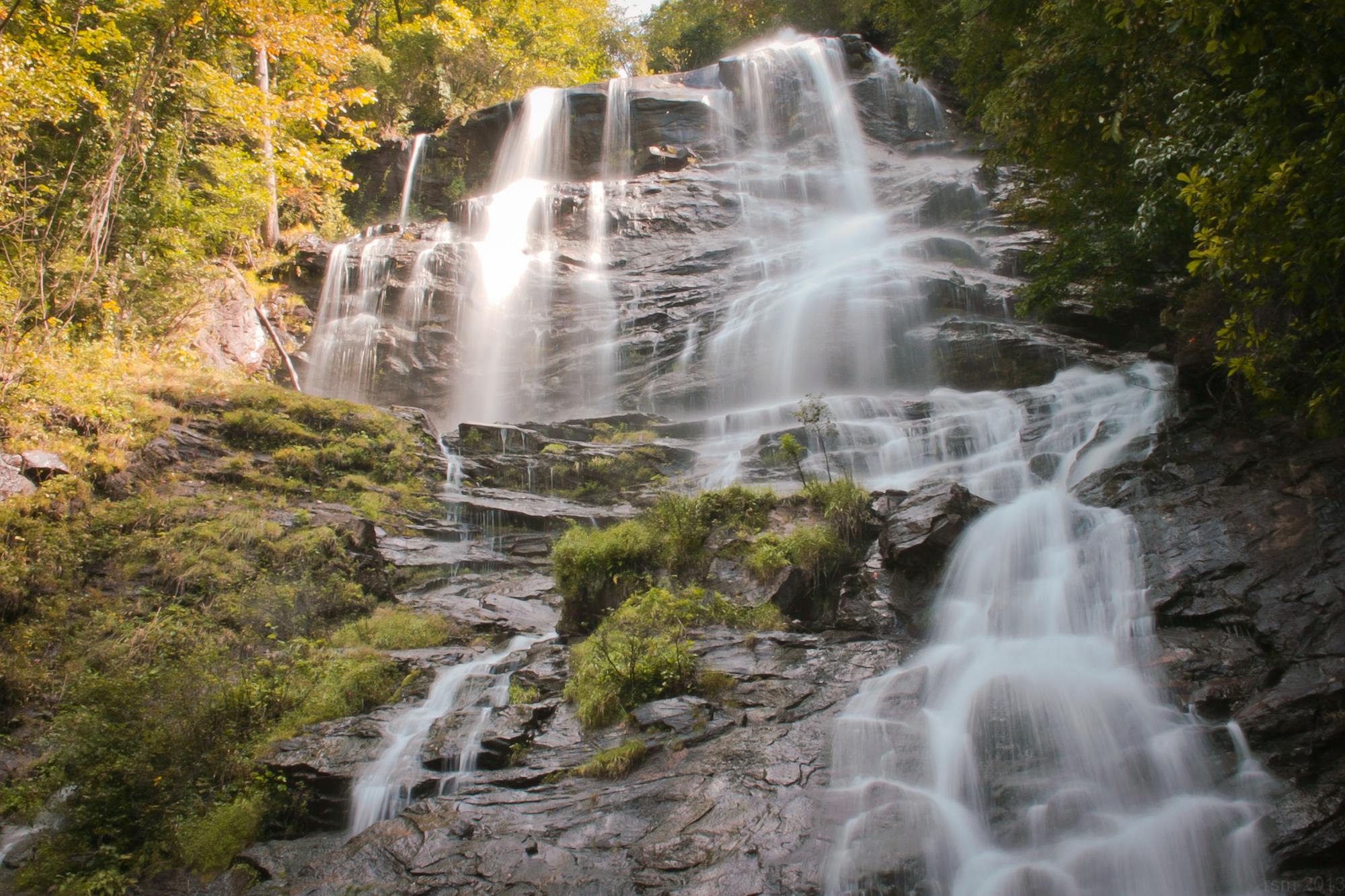
Amicalola Falls: AT Approach Trail

The 8-mile approach to the southern terminus of the Appalachian Trail.
Difficult Hiking
- Distance
- 13 km
- Ascent
- 959 m
- Descent
- 358 m
Go hiking in Georgia with curated guides of the best hikes across the region. With over 82 3D trail maps in FATMAP, you can easily discover and navigate the best trails in Georgia.
No matter what your next adventure has in store, you can find a guide on FATMAP to help you plan your next epic trip.
Get a top hiking trail recommendation in Georgia from one of our 11 guidebooks, or get inspired by the 82 local adventures uploaded by the FATMAP community. Start exploring now!
The 8-mile approach to the southern terminus of the Appalachian Trail.
Difficult Hiking

Named for the creator of the Appalachian Trail, this lesser-known alternative route through the Southern Appalachians links scenery that's just as wild.
Difficult Hiking

The Appalachian Trail crosses into North Carolina and summits the first peaks over 5,000 feet.
Difficult Hiking

An AT segment through remote North Georgia Wilderness.
Difficult Hiking

The southern terminus for the world-renowned Appalachian Trail.
Difficult Hiking

A varied and scenic hike to a stunning waterfall
Moderate Hiking

Hike a section of the S River Path Trail named after the former First Lady
Moderate Hiking

An easy hike with a strange, macabre artistic flair.
Easy Hiking

A classic Georgia trail system.
Easy Hiking

One of the most beautiful hikes ITP.
Moderate Hiking

A beautiful hike near the Chattahoochee River.
Moderate Hiking

An epic long-distance hike through the Appalachian Mountains in North Georgia and North Carolina.
Difficult Hiking