
The Best Hiking Trails in Mount Rainier National Park
Explore Hiking TrailsTop 20 hiking trails in Mount Rainier National Park
Page 1 of 1
1

Grove of the Patriarchs
The Grove of the Patriarchs is the best spot in Mount Rainier National Park to see giant trees. This short, easy hike quickly drops into a grove of ancient trees that soar hundreds of feet into the air....
2


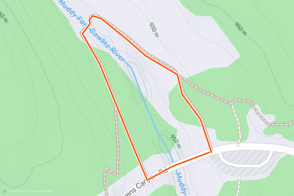
Box Canyon
At just 0.3 miles, many hikers might skip over this short paved loop to Box Canyon. That would be a mistake, though, because this quick roadside stop in Mount Rainier National Park is absolutely jaw-dropping!
"Box Canyon is a narrow slot canyon carved by the Muddy Fork of the Cowlitz River," writes the [NPS](https://www....
3


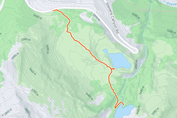
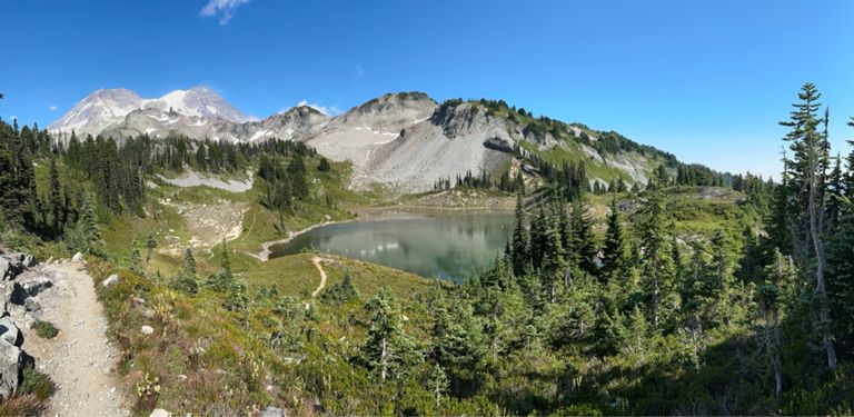
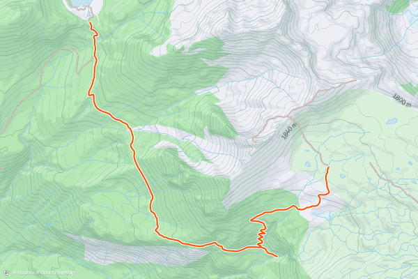
Frozen Lake via Sourdough Ridge
This blue droplet of water resting in a small depression high above treeline is known as "Frozen Lake." Even late in the year, the lake usually retains a frozen snowdrift along one shore that feeds it with snowmelt....
4


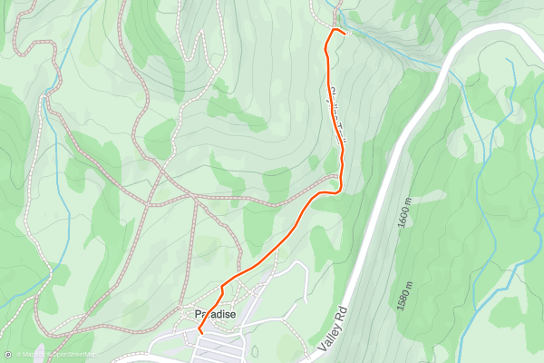
Nisqually Vista
This short hike to Nisqually Vista is one of the most popular sightseeing hikes in the Paradise area of Mount Rainier National Park. This easy 1.1-mile loop trail follows a paved path to a stunning overview of the rocky Nisqually River Valley and the Nisqually Glacier....
5


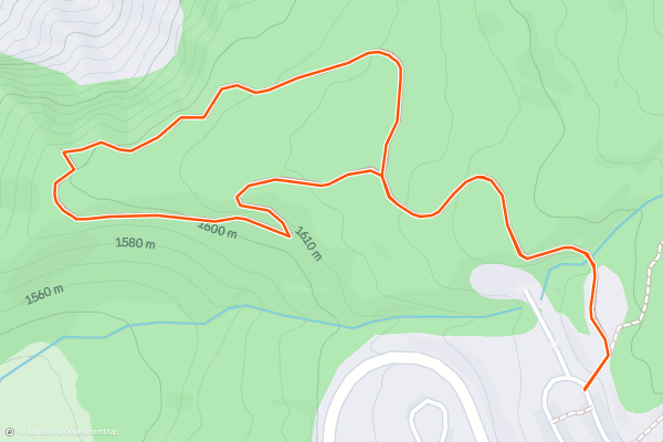
Myrtle Falls
This short hike along the Skyline Trail to the Myrtle Falls overlook is one of the most popular easy hikes in Mount Rainier's Paradise area. The trailhead for this hike is directly accessible from the main Paradise Visitor Center parking lot....
6


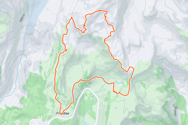
Skyline Loop Trail and Panorama Point
The Skyline Loop Trail in Mount Rainier National Park circumnavigates the Paradise area. With fantastic views throughout this entire hike, Skyline is renowned as one of the most beautiful trails in Washington State!
While you’ll enjoy stunning views the entire time, two of the highest-acclaimed sites along this loop route include Panorama Point and the view of Nisqually Glacier....
7


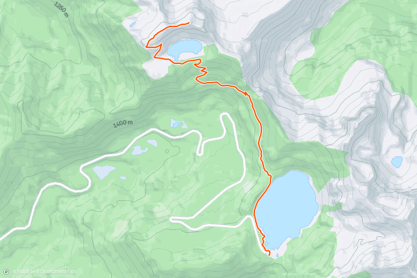
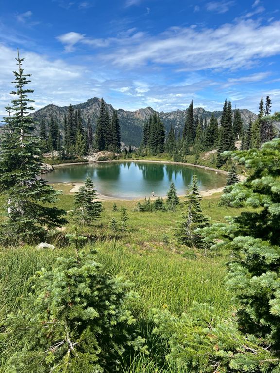
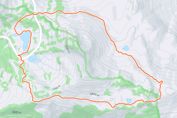
Tolmie Peak
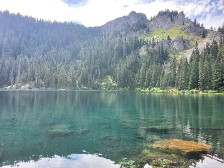
The 6.3-mile round-trip hike to Tolmie Peak Lookout packs a “one-two punch when it comes to scenery,” according to Anna Roth of [WTA.org](https://www.wta.org/go-hiking/hikes/tolmie-peak), thanks to passing by the stunning sapphire blue waters of Eunice Lake on the way to the jaw-dropping vistas from the peak itself....
8


Naches Peak Loop
This popular, family-friendly hike circumnavigates Naches Peak, providing stunning views the entire way! The loop begins at beautiful Tipsoo Lake, and whichever you way you hike the trail, you’ll enjoy "big views of Dewey Lake at the trail's middle point,” according to Brad Lane of [PlanetWare....
9


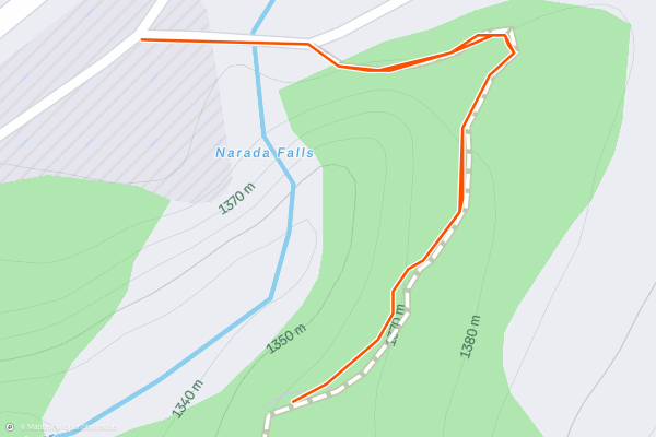
Narada Falls
This hike down to Narada Falls might be short, but the view is definitely worth the stop!
While you can see the waterfall from the observation point above, you can hike down the steep hillside to another viewpoint directly below the waterfall....
10

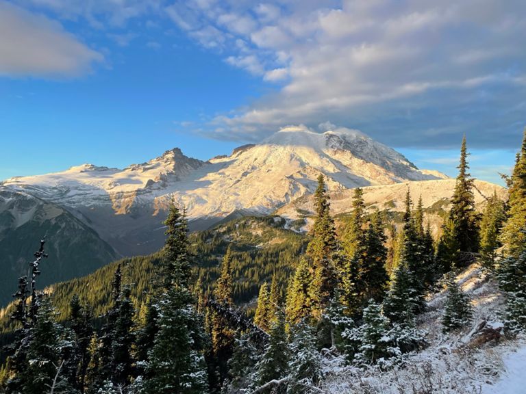


Burroughs Mountain Loop
This moderate hike combining the Burroughs Mountain Trail, Sourdough Ridge Trail, and the Wonderland Trail will take you high into the alpine, affording incredible views of Mount Rainier. Even though you'll reach such spectacular views of the towering, glaciated peak, this hike is relatively easy....
11


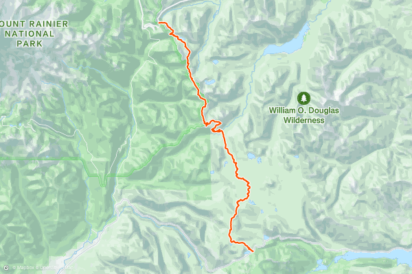
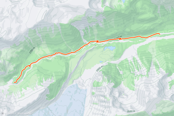
PCT: White Pass to Chinook Pass
Along this section, the PCT climbs gradually from White Pass and enters another wilderness area, passing several lakes surrounded by grass and forest. Eventually, the incline steepens dramatically, and the trail climbs to a subalpine crest where clearings reveal Mount Rainier plus other Cascade volcanoes on the horizon....
12


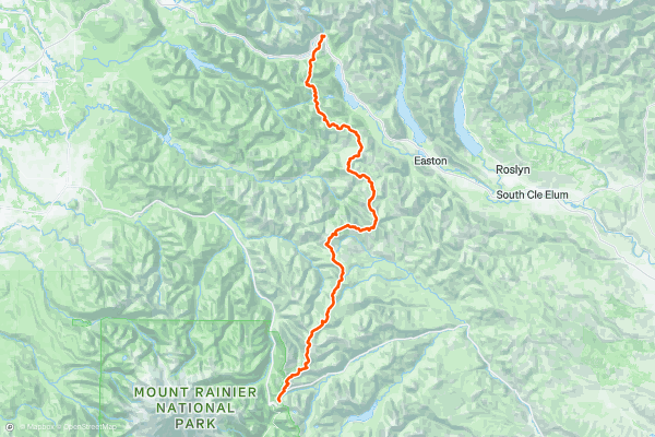
PCT: Chinook Pass to Snoqualmie Pass
Soon after leaving Mount Rainier National Park, the PCT enters the Norse Peak Wilderness to the north, following the elevated Cascade Crest. Clear days grant sweeping views over deep valleys and a perspective on Rainier’s north-side glaciers....
13
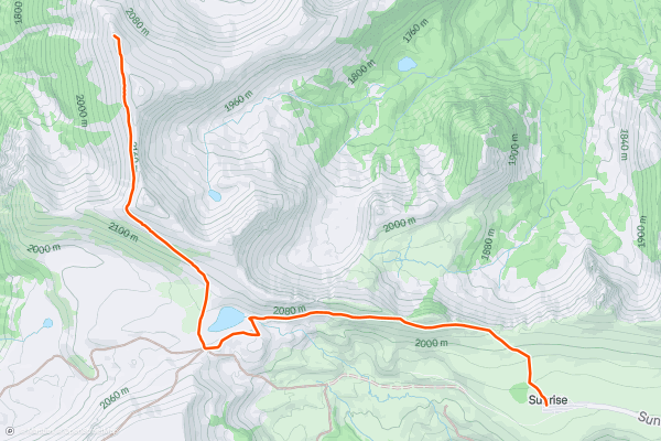
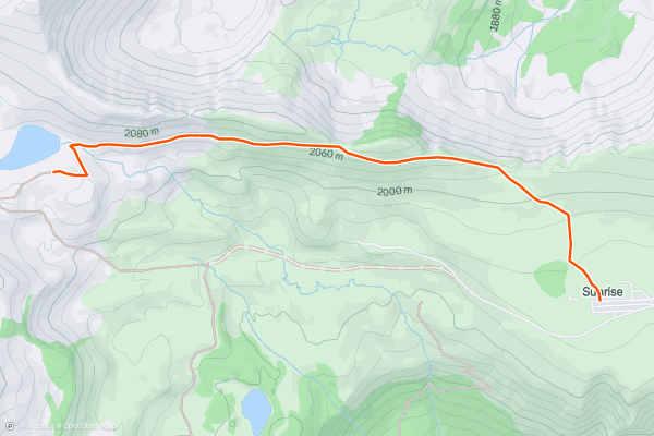
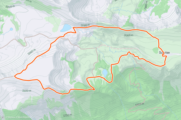
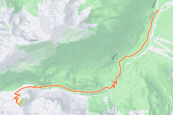
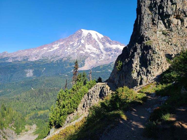
Mount Fremont Lookout Trail
If you are looking for a hike that offers stunning views of Mount Rainier, the Cascades, and the Olympic Mountains, as well as a chance to visit a historic fire lookout, then the Mount Fremont Lookout trail is for you....
14


Bench and Snow Lakes
If you are looking for a short and easy hike that offers stunning views of Mount Rainier and two beautiful alpine lakes, the Bench and Snow Lakes Trail is a perfect choice....
15


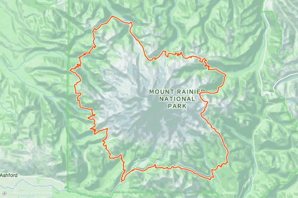
Wonderland Trail
Built back in 1915 and taking in 22,000 feet (6,700 metres) of elevation gain, this is a tough and historic journey that most hikers complete in 2 weeks-ish. Once underway the trail is rarely flat as it climbs and descends the various flanks of Rainier (including Panhandle Gap, which at 2600 metres is the highest altitude the trail reaches) but the constant effort is rewarded by a continual change of scenery, from deep forested valleys to sub-alpine meadows....
16


Summerland Trail
"If you can only do one summer full-day hike in Washington, the hike to Summerland in [Mount] Rainier National Park is your best bet,” writes [SwitchbackTravel.com](https://www.switchbacktravel.com/great-day-hikes-near-seattle). “Summerland,” the destination of your hike, is a beautiful alpine meadow filled with stunning wildflowers....
17


Spray Park and Spray Falls
"Found on the northwest side of Mount Rainier, Spray Park extends from the Mowich Lake walk-in campground and treats visitors to a dense collection of Pacific Northwest attractions and scenery, including the 350-foot Spray Falls waterfall,” writes Brad Lane on [PlanetWare....
18

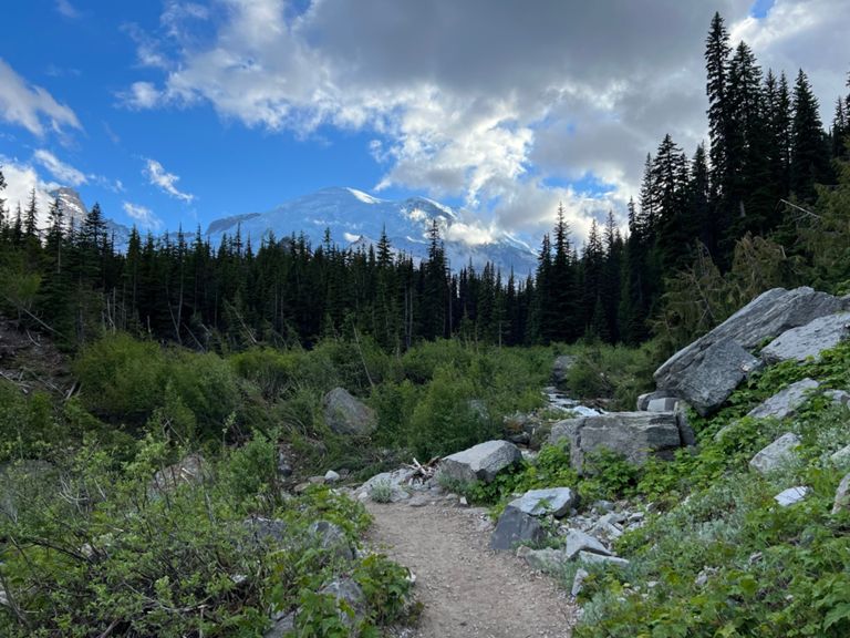


Glacier Basin Day Hike
The Glacier Basin Trail begins at the White River Campground and heads straight toward Mount Rainier. In fact, this trail forms one of the primary options for an attempt on the summit of Rainier....
19


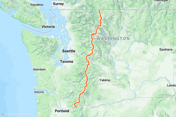
Pacific Crest Trail: Washington
"Stretching from dusty desert on the Mexican border, across snowy mountains in California, to chilly and rainy forests at the Canadian border, the Pacific Crest Trail travels through an overwhelming array of environments and covers a daunting distance of 2,650 miles," [writes](https://fatmap....
20


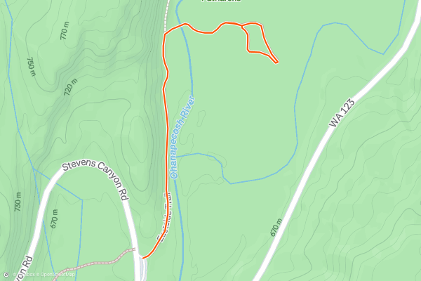
Pinnacle Peak
If you are looking for a short but challenging hike with stunning views of Mount Rainier and the surrounding peaks, the Pinnacle Peak hike is a great option. This 2.9-mile round-trip trail climbs over 1,600 feet to the summit of Tatoosh Range....
Page 1 of 1
Top regions for hiking trails on Strava
- Acadia National Park
- Alabama
- Alaska
- Albuquerque
- Alyeska
- Angeles National Forest
- Arizona
- Arkansas
- Austin, TX
- Bay Area
- Bend
- Big Sky
- Blue Mountain Ski Area
- Boston
- Boulder, CO
- Brevard
- Bridger Bowl
- Buena Vista
- California
- Cape Cod
- Colorado
- Connecticut
- Dahlonega
- Downieville
- Ellijay
- Flagstaff
- Florida
- Georgia
- Glacier National Park (USA)
- Grand Teton National Park
- Great Smoky Mountains National Park, TN
- Hawaii
- Hurricane
- Hyalite
- Idaho
- Illinois
- Indiana
- Kansas
- Kentucky
- Lake Tahoe
- Las Vegas, NV
- Los Angeles, CA
- Maine
- Mammoth Mountain
- Marin County
- Maryland
- Massachusetts
- Maui, HI
- Michigan
- Minnesota
- Missouri
- Moab
- Montana
- Mount Rainier National Park
- Mt. Rainier National Park, WA
- Nederland
- Nevada
- New Hampshire
- New Jersey
- New Mexico
- New York
- New York, NY
- North Bridgers
- North Carolina
- North Dakota
- Oakridge
- Ohio
- Oklahoma
- Oregon
- Park City and Deer Valley
- Pennsylvania
- Phoenix, AZ
- Placitas
- Portland, OR
- Roanoke
- Salida
- Salt Lake City, UT
- San Diego, CA
- San Francisco, CA
- Santa Fe, NM
- Santa Monica Mountains
- Seattle, WA
- Sedona, AZ
- Sisters
- South Carolina
- South Dakota
- South Lake Tahoe, CA
- Stowe
- Sugarbush
- Sun Valley
- Taos
- Telluride
- Tennessee
- Texas
- Timberline Lodge Summer
- Utah
- Vermont
- Virginia
- Washington
- West Virginia
- Wind River Range
- Winter Park
- Wisconsin
- Wyoming
- Yellowstone National Park
- Yosemite National Park, CA
- Zion National Park, UT