
The Best Hiking Trails in Wyoming
Explore Hiking TrailsTop 44 hiking trails in Wyoming
Page 1 of 3
1


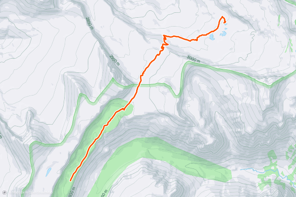
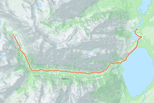
Teton Crest Trail: Death Canyon Shelf to Alaska Basin
If one chooses to camp at Alaska Basin, day two of the Teton Crest will be nice and relaxing! An allure of camping in Alaska Basin is that it's located in the Jedediah Smith Wilderness Area, meaning a backcountry permit is not required....
2


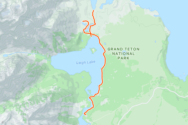
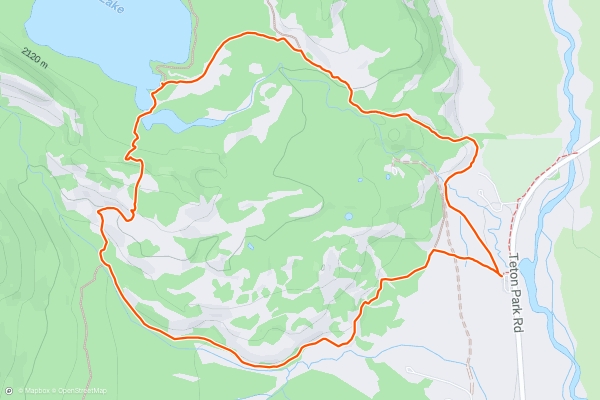
Leigh, Bearpaw, and Trapper Lakes
Pack your gear the night before, and get an early start on this hike along the shores of Leigh Lake, a glacial lake resting along the eastern slopes of Mount Moran....
3

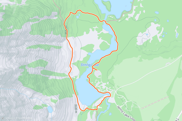
String Lake
String Lake is one of the best short hikes in Grand Teton National Park, and awards "outstanding views of the *Cathedral Group,* which includes 12,325-foot Teewinot Mountain, 13,770-foot Grand Teton and 12,928-foot Mt....
4


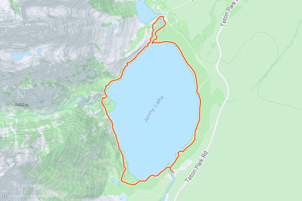
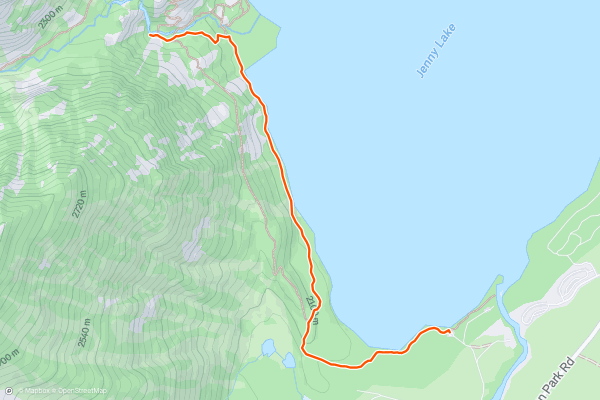
Jenny Lake Loop
Resting along the northeastern edge of the Grand Teton itself, Jenny Lake offers an easy lakeside hike with stunning mountain views. The loop is easy to follow, never steep, and great for anyone looking for some exercise on their visit to Jackson Hole or the National Park....
5


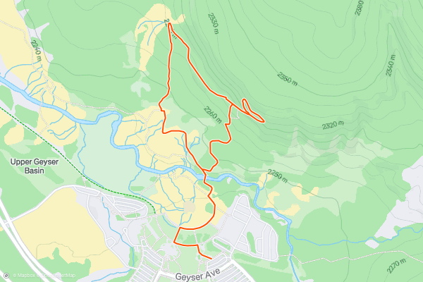
Observation Point to Geyser Hill
The trail takes you to a lookout over Upper Geyser Basin, which has incredible views of Old Faithful and many other impressive geysers.
**Directions**
Starting at the Visitor Center in Old Faithful Village, follow the signs for the Geyser Hill Trail, which begins as a walkway, passing Old Faithful Lodge on the right....
6

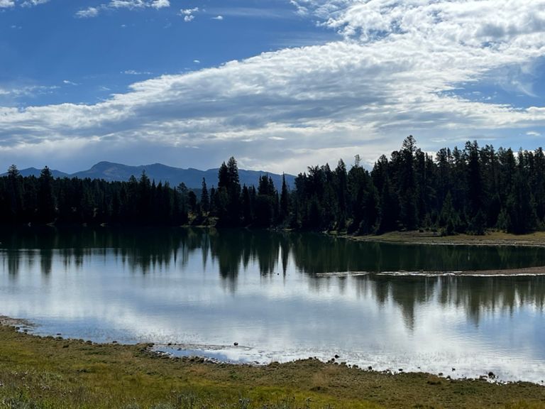


Storm Point
Storm Point is an easy, family-friendly loop, with many natural wonders and points of historical interest along the way.
The trail passes by the historic Indian Pond, where Native American artifacts were found in 1880, including corals and wickiups....
7


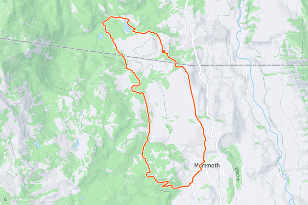
Beaver Ponds Loop
Choose this hike for scenic views and high chances of spotting various wildlife. You could come across: elk, waterfowl, bison, mule deer, moose, grizzly and black bears, and of course, beavers....
8


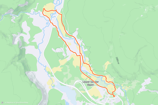
Upper Geyser Basin Trail
Starting at the Visitor Information Centre follow the signs to Old Faithful along the wooden boardwalks. You will soon enter the Upper Geyser Basin and Biscuit Basin which host the largest collection of geysers in the world, including the original geyser Old Faithful, made famous by its frequent, huge eruptions....
9
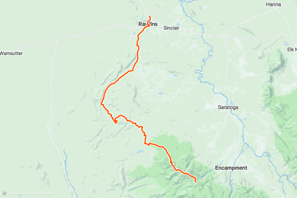
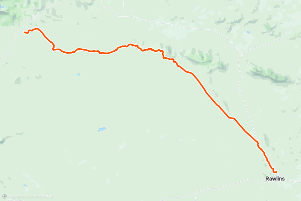
CDT: Red Mountain (WY-70) to Rawlins (US-287)
This segment of the Continental Divide Trail (CDT) begins at the Red Mountain Trailhead on State Route 70 through Wyoming. Closed during the winter, the area is susceptible to strong winter weather, making this much more of a summer hike....
10


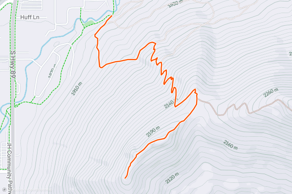
Josie's Ridge
Josie's Ridge is a trail in the national forest that starts right on the edge of Jackson. The trailhead is in fact nothing more than a kiosk along the community paved pathway....
11
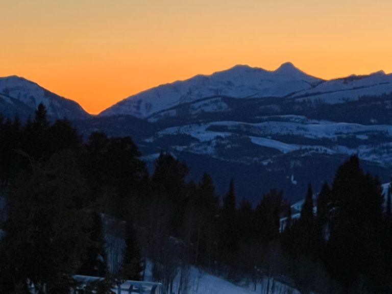


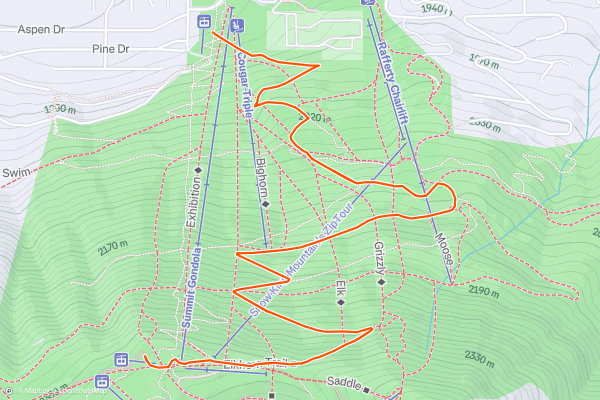
Snow King Summit Trail
Snow King is the ski resort in the town of Jackson, forming the immediate backdrop to the downtown. It's a recreation hotspot all year long, with loads of outdoor activities in every season....
12


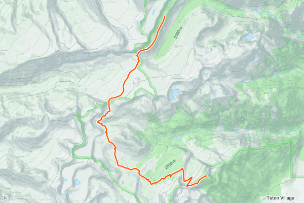
Teton Crest Trail: Rendezvous Mountain to Death Canyon Shelf
The Teton Crest Trail is one of the most spectacular trails in the world for a reason. The first day lives up to the hype as it features open views for most of the way....
13


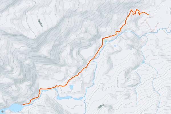
Teton Crest Trail: North Fork Cascade Canyon to Leigh Lake Trailhead (via Cascade Canyon)
There are two main exit points from the Teton Crest Trail: one exiting via Cascade Canyon and one exiting via Paintbrush Canyon. This route focuses on the former. Both are spectacular, so choose whichever option works best!
If you are camping in the North Fork Cascade Canyon camping zone you will be treated to spectacular morning views of the Grand....
14
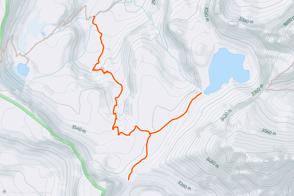
Icefloe Lake and Avalanche Divide
This route is a must-do if you are on the Teton Crest Trail. This route features two magnificent spots: Avalanche Divide and Icefloe Lake.
The views are incredible since the entire route is wide-open....
15


Hidden Falls
Jenny Lake is one of the most popular destinations in Grand Teton National Park, and it's not hard to understand why. Resting along the northeastern edge of the Grand Teton itself, Jenny Lake offers an easy [lakeside run](https://fatmap....
16


Taggart Lake Loop
If you are looking for a scenic and easy hike that showcases the beauty of the Teton Range and its glacial lakes, you should try the Taggart Lake Loop hike in Grand Teton National Park....
17


Lake Louise
Tucked away in Fitzpatrick Wilderness, Lake Louise offers an easy day hike to one of the Wind River's stunning glacial lakes. Along the way, you'll even pass a massive waterfall cascading through the canyon, runoff from the lake itself....
18


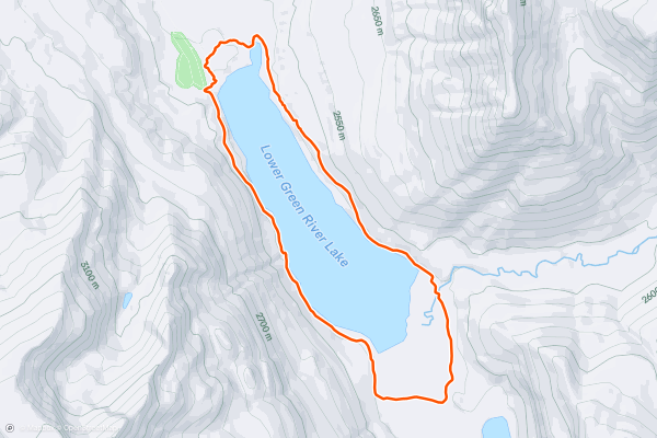
Lower Green River Lake Loop
Just 6 miles total, this easy day hike circumnavigates one of the Wind's many spectacular glacial lakes. In addition to an abundance of backcountry hikes in the area, canoeing, kayaking, and even paddleboarding are also popular on Lower Green River Lake....
19
CDT: Rawlins (US-287) to South Pass City (WY-28)
This section of the CDT begins at a small pull-out on US-287 north of Rawlins. Neither water nor restrooms are immediately available, though the small town is noted as a key resupply point for thru-hikers....
20
The Thorofare
The Thorofare is perhaps the most remote place in the contiguous United States--farther from a road than anywhere else, at 25 miles or more. That means that a backpacking here puts you among the country’s most vast wilderness outside of Alaska, but only by putting in your dues....
Page 1 of 3
Top regions for hiking trails on Strava
- Acadia National Park
- Alabama
- Alaska
- Albuquerque
- Alyeska
- Angeles National Forest
- Arizona
- Arkansas
- Austin, TX
- Bay Area
- Bend
- Big Sky
- Blue Mountain Ski Area
- Boston
- Boulder, CO
- Brevard
- Bridger Bowl
- Buena Vista
- California
- Cape Cod
- Colorado
- Connecticut
- Dahlonega
- Downieville
- Ellijay
- Flagstaff
- Florida
- Georgia
- Glacier National Park (USA)
- Grand Teton National Park
- Great Smoky Mountains National Park, TN
- Hawaii
- Hurricane
- Hyalite
- Idaho
- Illinois
- Indiana
- Kansas
- Kentucky
- Lake Tahoe
- Las Vegas, NV
- Los Angeles, CA
- Maine
- Mammoth Mountain
- Marin County
- Maryland
- Massachusetts
- Maui, HI
- Michigan
- Minnesota
- Missouri
- Moab
- Montana
- Mount Rainier National Park
- Mt. Rainier National Park, WA
- Nederland
- Nevada
- New Hampshire
- New Jersey
- New Mexico
- New York
- New York, NY
- North Bridgers
- North Carolina
- North Dakota
- Oakridge
- Ohio
- Oklahoma
- Oregon
- Park City and Deer Valley
- Pennsylvania
- Phoenix, AZ
- Placitas
- Portland, OR
- Roanoke
- Salida
- Salt Lake City, UT
- San Diego, CA
- San Francisco, CA
- Santa Fe, NM
- Santa Monica Mountains
- Seattle, WA
- Sedona, AZ
- Sisters
- South Carolina
- South Dakota
- South Lake Tahoe, CA
- Stowe
- Sugarbush
- Sun Valley
- Taos
- Telluride
- Tennessee
- Texas
- Timberline Lodge Summer
- Utah
- Vermont
- Virginia
- Washington
- West Virginia
- Wind River Range
- Winter Park
- Wisconsin
- Wyoming
- Yellowstone National Park
- Yosemite National Park, CA
- Zion National Park, UT