Anello della Val Gargassa - Sentiero Natura
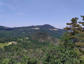
Escursione all'interno del Parco del Beigua lungo il torrente Gargassa
Moderate Hiking
- Distance
- 7.3 km
- Ascent
- 276 m
- Descent
- 276 m
Explore Genova with curated guides of the best hiking trails, and more. With over 20 3D trail maps in FATMAP, you can easily discover and navigate the best trails in Genova.
No matter what your next adventure has in store, you can find a guide on FATMAP to help you plan your next epic trip.
Get a top trail recommendation in Genova from one of our 1 guidebooks, or get inspired by the 20 local adventures uploaded by the FATMAP community. Start exploring now!
Escursione all'interno del Parco del Beigua lungo il torrente Gargassa
Moderate Hiking
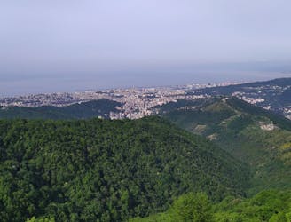
Percorso lungo forti di Quezzi, Forte dei Ratti, cava abbandonata e Forte Richelieu
Difficult Hiking

Anello ai bunker, al ristorante abbandonato e alla cresta di Monte Moro
Moderate Hiking

A easy track that passes through the fortresses built on the hills over Genova.
Easy Hiking