Alta Via dell'Adamello
Trentino-Alto Adige
An epic 8 day hike through the Adamello mountains in the Italian Alps
Also in Brescia, Italy
Hiking Difficult
- Distance
- 59 km
- Ascent
- 5 km
- Descent
- 5 km
- Duration
- 1 day +
- Low Point
- 1.5 km
- High Point
- 2.9 km
- Gradient
- 23˚

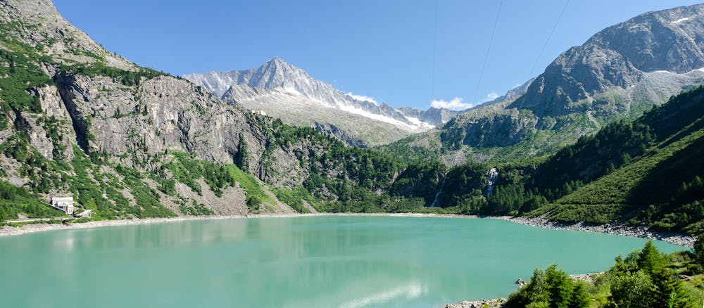
Cross the Adamello Nature Park in the heart of the Rhaetian Alps on this high alpine trail. From start to finish you barely brush past signs of modern civilisation, hopping from remote mountain hut to remote mountain hut where you can enjoy traditional hearty Italian alpine cuisine at the end of each day’s long hike. You will be completely immersed in the high alpine world surrounded by many 2500er peaks and passing multiple alpine lakes with the distinctive and enticing bright turquoise water. The route takes you between Lombardy and Trentino and is well signed throughout.
Description
Difficulty
Difficult
Hiking trails where obstacles such as rocks or roots are prevalent. Some obstacles can require care to step over or around. At times, the trail can be worn and eroded. The grade of the trail is generally quite steep, and can often lead to strenuous hiking.
High Exposure

Some trail sections have exposed ledges or steep ascents/descents where falling could cause serious injury.
Remoteness
Little chance of being seen or helped in case of an accident.
Best time to visit
Features
- Alpine
- Wildlife
- Picturesque
- Wild flowers
- Water features