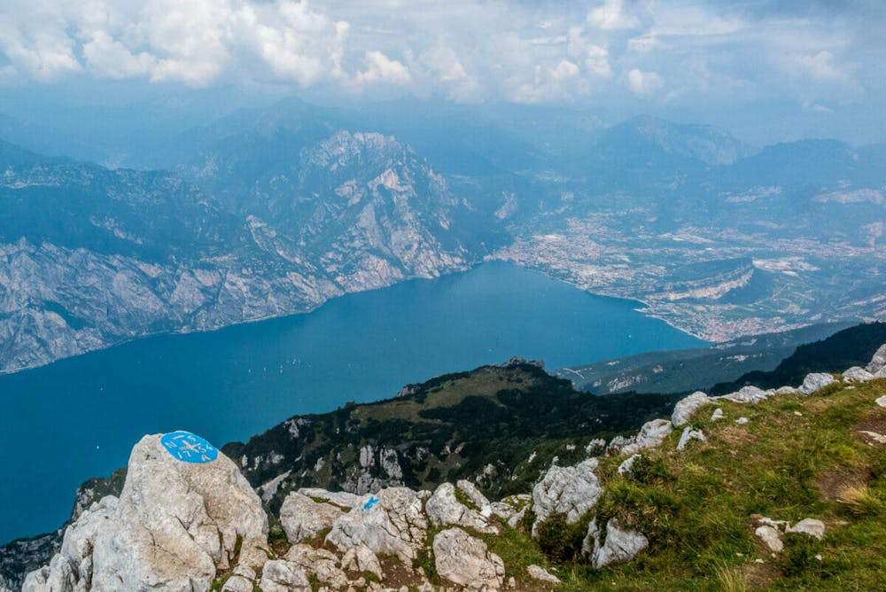
Prati di Nago -> Monte Nago l'Altissimo
Trentino-Alto Adige
NB il parcheggio ai prati di Nago non è raggiungibile in periodo invernale causa interruzione della strada predisposta dal sindaco.
Also in Verona, Italy
Hiking Moderate
- Distance
- 4.3 km
- Ascent
- 766 m
- Descent
- 5 m
- Duration
- 2-3 hrs
- Low Point
- 1.3 km
- High Point
- 2.1 km
- Gradient
- 15˚

This is a popular hiking route which is generally considered to be moderate. It's not remote, it features medium exposure and is typically done between May and September. From a low point of 1.3 km to the maximum altitude of 2.1 km, the route covers 4.3 km, 766 vertical metres of ascent and 5 vertical metres of descent.
- •
- •
Description
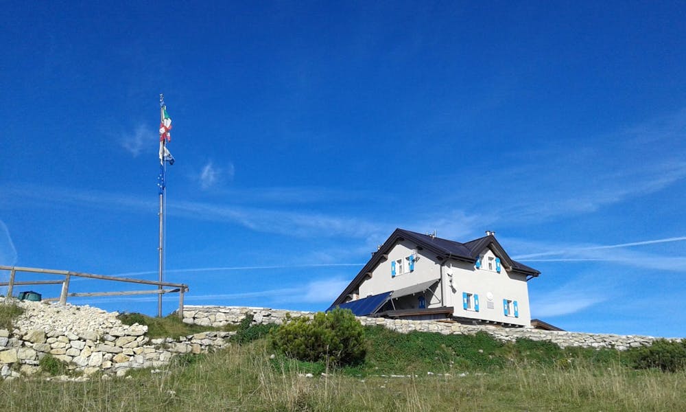
NB il parcheggio ai prati di Nago non è raggiungibile in periodo invernale causa interruzione della strada predisposta dal sindaco. Il rifugio in cima (Altissimo "Damiano Chiesa") apre in primavera.
Difficulty
Moderate
Hiking along trails with some uneven terrain and small hills. Small rocks and roots may be present.
Medium Exposure

The trail contains some obstacles such as outcroppings and rock which could cause injury.
Remoteness

Close to help in case of emergency.
Best time to visit
Features
- Picturesque
- Dog friendly
- Family friendly