48 m away
Urner Alps Traverse: Steingletscher to Sustli Hut
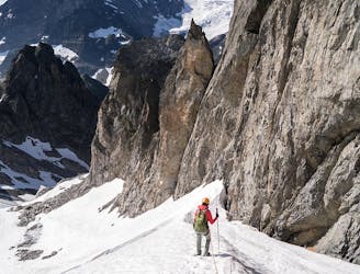
The traverse of the well named Füffingerstock and a long descent, before a short climb to the Sustli Hut.
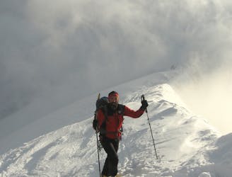
Difficult Ski Touring
- Distance
- 6.4 km
- Ascent
- 1.4 km
- Descent
- 1 km
Discover one of the most beautiful and steepest Haute Routes in Switzerland.
Also in Uri, Switzerland
Ski Touring Difficult

Day 4: 'We will make our way through the Obertal valley, past the striking Fünffinger peaks, and climb up to the Uratstock at 2,911 meters. Back in Uri, we can then enjoy a great descent down to Kleinsustli. There is just one more counter climb to tackle before the well-earned reward of a cool drink on the terrace of the relaxed Sustli Hut.' (https://www.mammutalpineschool.com/en/skihochtour-urner-haute-route/)
Difficult
Serious gradient of 30-38 degrees where a real risk of slipping exists.

In case of a fall, death is highly likely.

Away from help but easily accessed.
48 m away
The traverse of the well named Füffingerstock and a long descent, before a short climb to the Sustli Hut.
Difficult Ski Touring
4.1 km away
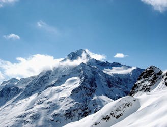
A great ski summit (Grassen, 2946m) followed by an 1800m N facing descent.
Difficult Ski Touring
6.6 km away
A magnificent long glacial descent, with an optional high summit, the Sustenhorn (3502m).
Difficult Ski Touring
5 routes · Ski Touring