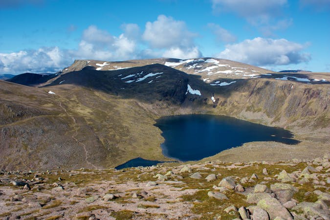
FATMAP by Strava

Scottish National Trail: Bynack Lodge to Glen Feshie

Cairngorms National Park

In a very remote setting, wade or paddle three river crossings, then follow a very green glen which is rocky in places and boggy in others, finishing at a wild-camp spot near an old stone bothy.

Also in Highland, United Kingdom

Hiking Difficult

Distance
21 km
Ascent
248 m
Descent
340 m
Duration
4-5 hrs
Low Point
364 m
High Point
568 m
Gradient
Scottish National Trail: Bynack Lodge to Glen Feshie Map

This is a popular hiking route which is generally considered to be difficult. It's an unknown remoteness, it features unknown exposure and is typically done in an unknown time of year. From a low point of 364 m to the maximum altitude of 568 m, the route covers 21 km, 248 vertical metres of ascent and 340 vertical metres of descent.

Description

Difficulty

Difficult

Hiking trails where obstacles such as rocks or roots are prevalent. Some obstacles can require care to step over or around. At times, the trail can be worn and eroded. The grade of the trail is generally quite steep, and can often lead to strenuous hiking.

Similar routes nearby

Guidebooks in this area