West Highland Way
Ben Nevis
Glencoe
Milngavie
The Loch Lomond and the Trossachs National Park
A wonderful journey through the rugged and wild mountains of the Scottish Highlands.
Also in Argyll and Bute, United Kingdom • East Dunbartonshire, United Kingdom • Stirling, United Kingdom
Hiking Difficult
- Distance
- 153 km
- Ascent
- 3.3 km
- Descent
- 3.3 km
- Duration
- 1 day +
- Low Point
- 5 m
- High Point
- 547 m
- Gradient
- 8˚

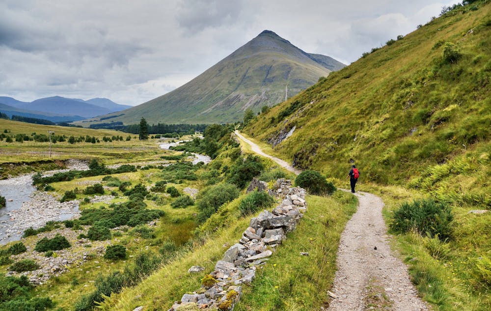
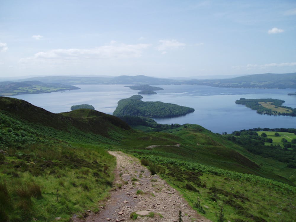
Starting out at a granite obelisk in the centre of Milngavie, a small town 7 miles north of Glasgow city centre, this 96 mile mountain adventure is generally completed over 5 - 7 days, depending on fitness and conditions. The path quickly leaves the urban area and enters pleasant countryside and follows gently rolling terrain to the village of Balmaha on the eastern shore of Loch Lomond.
- •
- •
- •
- •
Description
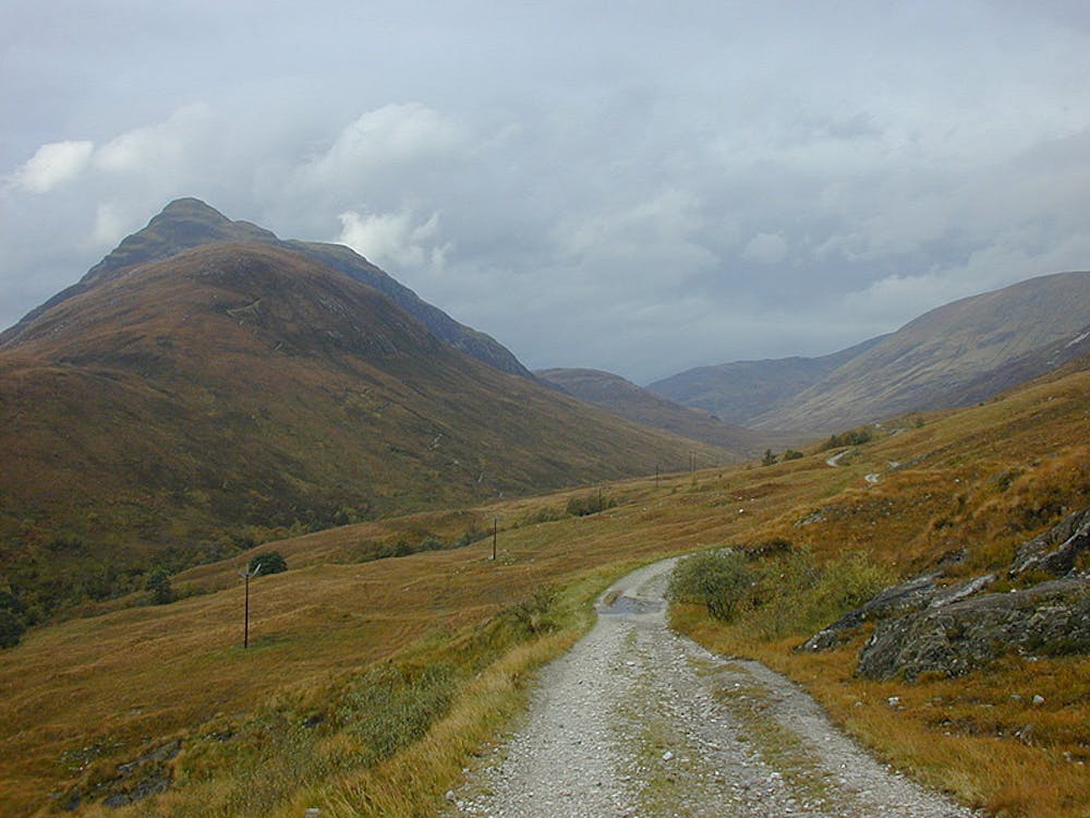
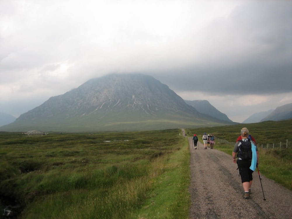
From Balmaha, the path follows the quiet and peaceful eastern shore of the lake all the way to Inverarnan. The trail then leads into the Glen Falloch valley and up to the village of Crianlarich and then on to Tyndrum, at the foot of Glen Orchy - a wild and rugged mountain valley. The trail goes up Glen Orchy and then crosses the desolate and atmospheric Rannoch Mor before dropping down into the valley of Glencoe.
Before reaching Glencoe village it climbs the famous "Devil's Staircase" path, which crosses the notorious Aonach Eagach ridge before dropping down to the town of Kinlochleven. From here, the path is large and leads without any major difficulties into Fort William - the capital of the Highlands and the end of this wonderful journey. The logistics of whether to stay in hotels or a tent, and managing how and when to resupply yourself en route can be quite complicated for the West Highland Way but the planning is all part of the fun!
Jane McGeary works in the West Highland Way Management Group and is one of the speakers at ‘Tales from the Trails’ at Fort William Mountain Festival 2023. Jane will be talking about the WHW and about preserving and maintaining the trail, to hear more about it make sure to come to her talk: https://mountainfestival.co.uk/ticket/events/ocuk-tales-from-the-trails/
Sources: https://www.walkingthewesthighlandway.co.uk/west-highland-way-interactive-map/
Difficulty
Difficult
Hiking trails where obstacles such as rocks or roots are prevalent. Some obstacles can require care to step over or around. At times, the trail can be worn and eroded. The grade of the trail is generally quite steep, and can often lead to strenuous hiking.
Medium Exposure

The trail contains some obstacles such as outcroppings and rock which could cause injury.
Remoteness

Little chance of being seen or helped in case of an accident.
Best time to visit
Features
- Wildlife
- Historical
- Picturesque
- Dog friendly